Gettysburg in Adams County, Pennsylvania — The American Northeast (Mid-Atlantic)
Second Brigade
Second Division - Eleventh Corps
— Army of the Potomac —
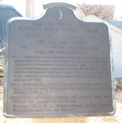
Inscription.
Eleventh Corps Second Brigade
Second Brigade
Col. Orland Smith
33d. Massachusetts 138th. New York
55th. 73. Ohio Infantry
July 1 Arrived 2 p.m. and went into position on Cemetery Hill in line behind stone walls along Emmitsburg and Taneytown Roads facing northwest and supporting Battery I 1st New York. The 33d Mass. was detached during the battle and placed on the right of the Corps under the command of Brig. Gen. A. Ames. The 136th New York was on the extreme left of the Corps connecting on its right with the 55th and 73d Ohio.
July 2 Sharpshooting was kept up all day by the Union troops from stone walls and by the Confederates from houses in the town with considerable loss.
July 3 Sharp skirmishing continued with Artillery firing from Confederate Batteries east of the town.
Casualties. Killed 51 men. Wounded 5 officers 273 men. Captured or missing 2 officers 17 men. Total 348.
Erected 1912 by Gettysburg National Military Park Commission.
Topics. This historical marker is listed in this topic list: War, US Civil.
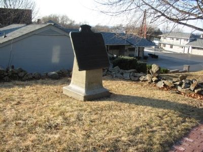
Location. 39° 49.196′ N, 77° 13.975′ W. Marker is in Gettysburg, Pennsylvania, in Adams County. Marker is on Taneytown Road / Washington Street (State Highway 134), on the right when traveling south. Located north of the old Gettysburg Battlefield Visitor Center parking area, and across the street from the Gettysburg National Cemetery. Touch for map. Marker is in this post office area: Gettysburg PA 17325, United States of America. Touch for directions.
Other nearby markers. At least 8 other markers are within walking distance of this marker. 73rd Ohio Infantry (within shouting distance of this marker); Bvt. Maj. Gen. Charles H.T. Collis Memorial (about 300 feet away, measured in a direct line); 136th New York Infantry (about 300 feet away); Better Than a Tent... (about 300 feet away); Gettysburg (about 300 feet away); First Minnesota Volunteers (about 300 feet away); A Tale of Two Brothers (about 400 feet away); Gold Star Mothers Memorial (about 400 feet away). Touch for a list and map of all markers in Gettysburg.
Also see . . . Report of Col. Orland Smith. In his official report, Col. Smith described the activities of his Brigade:
Our entire front was covered by a line of skirmishers thrown out toward the enemy's lines, the right resting near the town and the left connecting with a similar line of the Second Corps. These skirmishers were more or less engaged with those of the enemy during the whole period from the 1st to the night of July 3. This line was exposed not only to the fire of the enemy's front, but to a fire from the flanks and rear by the sharpshooters posted in the houses in the town. Indeed, the main line, though posted behind a stone wall, was constantly subjected to annoyances from the same source. (Submitted on March 9, 2009, by Craig Swain of Leesburg, Virginia.)

Photographed By Craig Swain, February 21, 2009
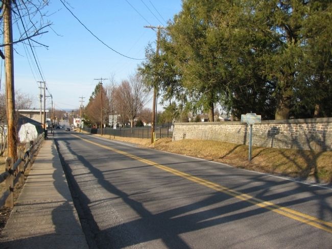
3. Smith's Line
Looking north down Taneytown Road into Gettysburg from near the tablet location. At the time of the battle, stone walls lined the road here, and the ground was open to the south edge of the city, Close to modern day High Street. The Brigade arrayed along the Taneytown Road with the 136 New York on the left (behind the camera); 73rd Ohio in the center (foreground here); and the 55th Ohio on the right (near the intersection seen in the distance). Skirmishers from the Brigade extended forward to the right toward the Emmitsburg Road.

Photographed By Craig Swain, February 21, 2009
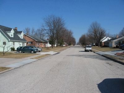
4. Smith's Brigade Skirmish Line
Looking north down Fairview Avenue, about 700 yards west of the tablet location. At the time of the battle the ground now occupied by houses was open field. A fence ran approximately to the right of the present day road. Skirmishers from Smith's Brigade held the fence line under pressure from Confederate skirmishers from Perrin's Brigade. The intense skirmishing raged from the morning of July 2 until noon on July 3.
Credits. This page was last revised on July 25, 2020. It was originally submitted on March 9, 2009, by Craig Swain of Leesburg, Virginia. This page has been viewed 929 times since then and 21 times this year. Photos: 1, 2, 3, 4. submitted on March 9, 2009, by Craig Swain of Leesburg, Virginia.

