
Palacios in Matagorda County, Texas — The American South (West South Central)
History of the Palacios Pavilion

Photographed by James Hulse, March 11, 2021
1. History of the Palacios Pavilion Marker
In 1904 the Palacois City Townsite Company erected the first pavilion. Jules Leffland of Victoria was the architect, and the pavilion was constructed under the supervision of contractors Hatchett and White of Bay City. A roof covered the open air pavilion, which had a double deck. A walkway enciried the dance floor. A pier led to the pavilion. Dressing rooms were erected east and west from the pier, and there was a catwalk on each end of the south side of the pavilion for mooring boats. In 1932 local businessmen purchased the pavilion from Mayhew Lumber Company, the mortgage holder on the property. The pavilion was remodeled, and the bathing booths were removed from the west wing to make room for a restaurant and fountain. In 1934 a hurricane destroyed the back pier, diving chute, and a few feet of the pier near the shore. A Seawall Commission was formed to supervise the building of both a seawall and a new pavilion. The seawall, bay front, pier and pavilion were deeded to the City of Palacios. The new pavilion was dedicated on November 1935. The pavilion was 300 feet from the shoreline on the east side of the pier. Construction
this page online
In September 1961, Hurricane Carla destroyed the pavillon. In January 1962 the floor was replaced on the round area and the pier received new wooden planking. In July 1988 the City of Palacios completed the project of constructing a roof over the existing Roundhouse dance floor. A massive center column supported the roof. For stability, it was anchored with new columns attached to the perimeter columns. Extra supports were added to the existing floor supports. In July 2003 Hurricane Claudette caused enough damage to the supports of the pavilion to render it unsafe for the public's use. For over

Photographed by James Hulse, March 11, 2021
2. History of the Palacios Pavilion Marker with the pier
Erected 2005 by City of Palacios.
Topics. This historical marker is listed in these topic lists: Architecture • Entertainment • Sports. A significant historical month for this entry is July 1988.
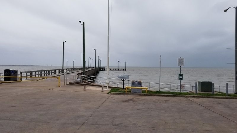
Location. 28° 41.909′ N, 96° 12.914′ W. Marker is in Palacios, Texas, in Matagorda County. It is at the intersection of South Bay Boulevard and 4th Street, on the left when traveling west on South Bay Boulevard. The marker is located in the South Bay Park at the entrance to the pier. Touch for map. Marker is in this post office area: Palacios TX 77465, United States of America. Touch for directions.

Regionally, this marker is in the American South and on the Gulf Coast. Globally, it is in North America, a Gulf of Mexico state, the Western Hemisphere, the Western World, and the Anglosphere. Historically, it finds itself in what was once New Spain, the Republic of Texas, one of the Confederate States of America, and the Antebellum South.
Other nearby markers. At
Photographed by James Hulse, March 11, 2021
3. The view of the History of the Palacios Pavilion Marker
The History of the Palacios Pavilion marker is the first marker on the left of the two markers.
Also see . . . Palacios, TX.
The town is also on Tres Palacios Bay (after which it is named), an inlet of Matagorda Bay off the Gulf of Mexico. The name of the bay is Spanish for "Three Palaces." An apocryphal story has it that sailors from a Spanish ship that wrecked in Matagorda Bay thought they saw palaces on the shoreline. As they neared the shore, however, the palaces disappeared. It is thought that the bay and the Tres Palacios River were actually named for José Félix Trespalacios. Source: The Handbook of Texas(Submitted on March 19, 2021, by James Hulse of Medina, Texas.)

Photographed by James Hulse, March 11, 2021
4. The pier where the Pavilion was originally located near the left side of the T-head.

Photographed by James Hulse, March 11, 2021
5. The Palacios Pavilion as seen on the marker
Credits. This page was last revised on March 19, 2021. It was originally submitted on March 19, 2021, by James Hulse of Medina, Texas. This page has been viewed 799 times since then and 124 times this year. Photos: 1, 2, 3, 4, 5. submitted on March 19, 2021, by James Hulse of Medina, Texas.
