Wrightsville in York County, Pennsylvania — The American Northeast (Mid-Atlantic)
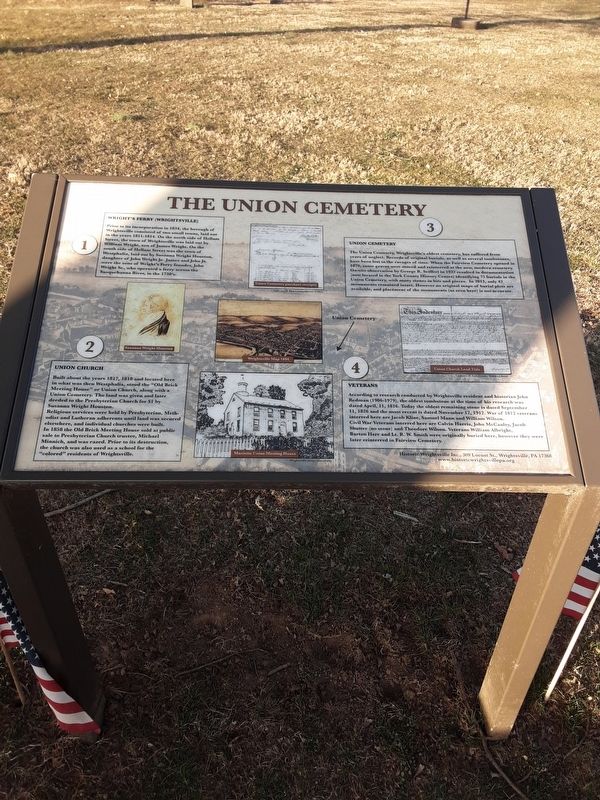
The Union Cemetery
(1) Wright's Ferry (Wrightsville)
Prior to its incorporation in 1834, the borough of Wrightsville consisted of two small towns, laid out in the years 1811-1814. On the north side of Hellam Street, the town of Wrightsville was laid out by William Wright, son of James Wright. On the south side of Hellam Street was the town of Westphalia, laid out by Susanna Wright Houston, daughter of John Wright Jr. James and John Jr. were the sons of Wright's Ferry founder, John Wright Sr., who operated a ferry across the Susquehanna River, in the 1730's.
Susanna Wright Houston
Drawing by J.H. Mifflin
(2) Union Church
Built about the years 1817, 1818 and located here in what was then Westphalia, stood the "Old Brick Meeting House” or Union Church, along with a Union Cemetery. The land was given and later deeded to the Presbyterian Church for $1 by Susanna Wright Houston.
Religious services were held by Presbyterian, Methodist and Lutheran adherents until land was secured elsewhere, and individual churches were built. In 1858 the Old Brick Meeting House sold at public sale to Presbyterian Church trustee, Michael Minnich, and was razed. Prior to its destruction, the church was also used as a school for the "colored” residents of Wrightsville.
Union Cemetery purchase receipts
Courtesy of York County History Center
Wrightsville Map 1894
Marietta Union Meeting House
Wrightsville image unavailable
(3) Union Cemetery
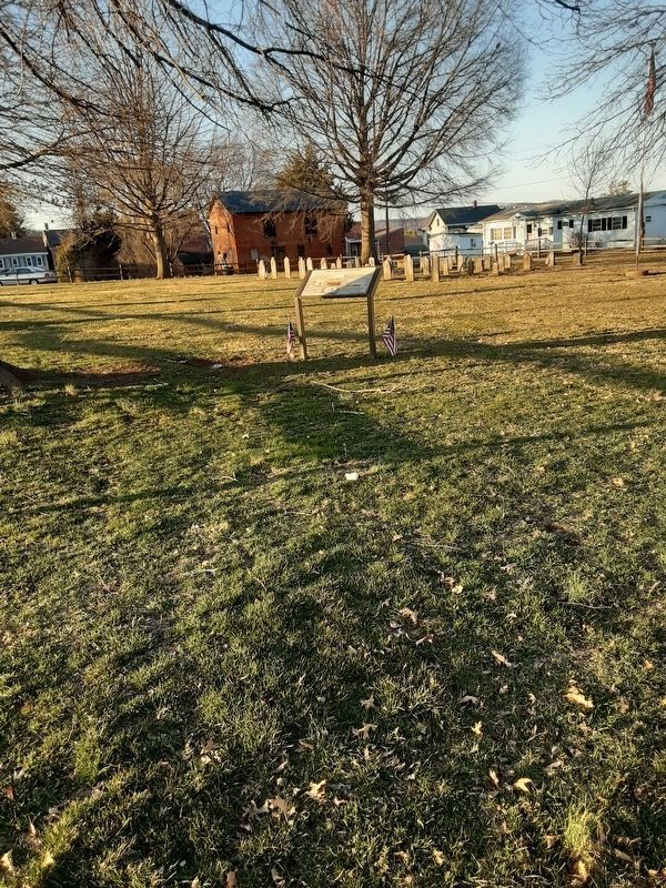
The Union Cemetery, Wrightsville's oldest cemetery, has suffered from years of neglect. Records of original burials, as well as several tombstones, have been lost to the ravages of time. When the Fairview Cemetery opened in 1870, some graves were moved and reinterred at the new, modern cemetery. On-site observation by George R. Seiffert in 1932 resulted in documentation (now located in the York County History Center) identifying 75 burials in the Union Cemetery, with many stones in bits and pieces, In 2013, only 42 monuments remained intact. However no original maps of burial plots are available, and placement of the monuments (as seen here) is not accurate.
Union Cemetery [this tag accompanied by arrow]
This Indenture ...
Union Church Land Title
Courtesy of York County History Center
(4) Veterans
According to research conducted by Wrightsville resident and historian John Redman (1906-1979), the oldest tombstone at the time of his research was dated April, 11, 1816. Today the oldest remaining stone is dated September 11, 1826 and the most recent is dated November 12, 1912. War of 1812 veterans interred
here are Jacob Kline, Samuel Mann and William Wilson.
Civil War Veterans interred here are Calvin Harris, John McCauley, Jacob Shutter (no stone) and Theodore Wilson. Veterans William Albright, Barton Herr and Lt. R. W. Smith were originally buried here, however they were later reinterred in Fairview Cemetery.
Historic Wrightsville Inc., 309 Locust St., Wrightsville, PA 17368
www.historicwrightsvillepa.org
Topics. This historical marker is listed in these topic lists: Cemeteries & Burial Sites • Churches & Religion. A significant historical date for this entry is April 11, 1816.
Location. 40° 1.487′ N, 76° 31.808′ W. Marker is in Wrightsville, Pennsylvania, in York County. Marker is on Chestnut Street, on the left when traveling east. The provided address is directly across the street. Touch for map. Marker is at or near this postal address: 235 Chestnut Street, Wrightsville PA 17368, United States of America. Touch for directions.
Other nearby markers. At least 8 other markers are within walking distance of this marker. American Legion Monument (about 400 feet away, measured in a direct line); Wrightsville (about 400 feet away); Gettysburg Campaign (about 400 feet away); The Old Post Office Building (about 500 feet away); Ham, Eggs, and Confederates (about 600 feet away); Veterans Memorial Bridge (approx. 0.2 miles away); Susquehanna Canal (approx. 0.2 miles away); Susquehanna and Tidewater Canal (approx. 0.2 miles away). Touch for a list and map of all markers in Wrightsville.
Credits. This page was last revised on March 23, 2021. It was originally submitted on March 20, 2021, by Carl Gordon Moore Jr. of North East, Maryland. This page has been viewed 281 times since then and 41 times this year. Photos: 1. submitted on March 20, 2021, by Carl Gordon Moore Jr. of North East, Maryland. 2. submitted on March 22, 2021, by Carl Gordon Moore Jr. of North East, Maryland. • Bill Pfingsten was the editor who published this page.

