Clarksville in Montgomery County, Tennessee — The American South (East South Central)
Nature's Fury / Water ... Always a Powerful Presence
Inscription.
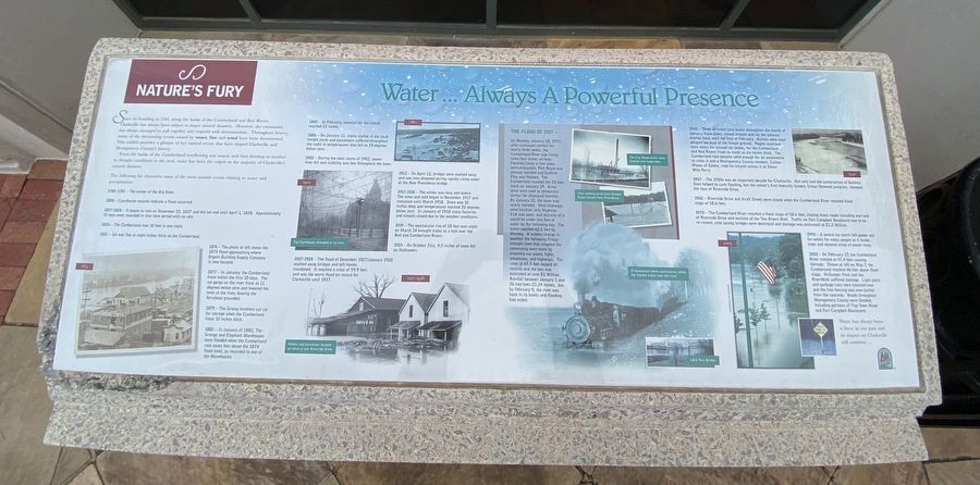
Since its founding in 1784, along the banks of the Cumberland and Red Rivers,
Clarksville has always been subject to major natural disasters. However, the community
has always managed to pull together and respond with determination. Throughout history,
many of the devastating events caused by water, fire and wind have been documented.
This exhibit provides a glimpse of key natural events that have shaped Clarksville and
Montgomery County's history.
From the banks of the Cumberland overflowing one season and then freezing in another to drought conditions in the next, water has been the culprit in the majority of Clarksville's natural disasters.
The following list chronicles some of the most notable events relating to water and precipitation:
1780-1781 The winter of the Big Sleet.
1808 Courthouse records indicate a flood occurred.
1827-1828 It began to rain on November 23, 1827 and did not end until April 1, l828. Approximately 10 days were recorded in that time period with no rain.
1836 The Cumberland rose 10 feet in one night.
1851 Ice was five to eight inches thick on the Cumberland.
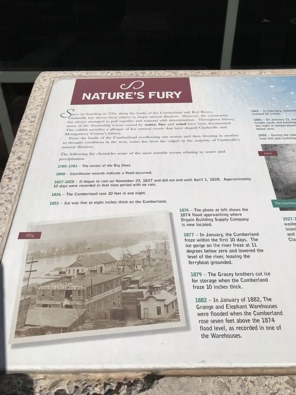
1874 The photo at left shows the 1874 flood approaching where Orgain Building Supply Company is now located.
1877 In January, the Cumberland froze within the first 10 days. The ice gorge on the river froze at 11 degrees below zero and lowered the level of the river, leaving the ferryboat grounded.
1879 The Gracey brothers cut ice for storage when the Cumberland froze 10 inches thick.
1882 In January of 1882, The Grange and Elephant Warehouses were flooded when the Cumberland rose seven feet above the 1874 flood level, as recorded in one of the Warehouses.
1885 In February, snowfall for the month reached 23 inches.
1886 On January 11, trains stalled in the local freight yards and passengers suffered throughout the night in temperatures that fell to 19 degrees below zero.
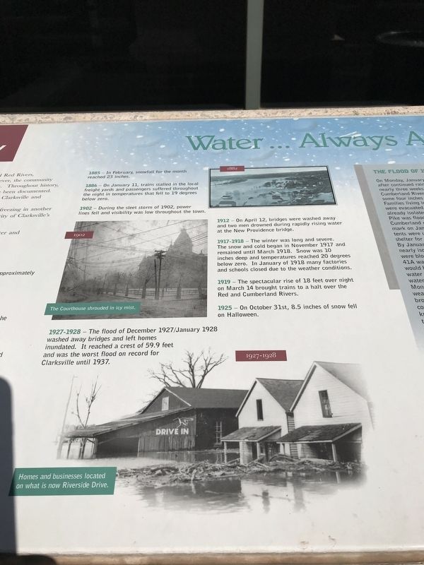
1902 During the sleet storm of 1902, power lines fell and visibility was low throughout the town.
1912 On April 12, bridges were washed away and two men drowned during rapidly rising water at the New Providence bridge.
1917-1918 The winter was long and severe. The snow and cold began in November 1917 and remained until March 1918. Snow was 10 inches deep and temperatures reached 20 degrees below zero. In January of 1918 many factories and schools closed due to the weather conditions.
1919 The spectacular rise of 18 feet over night on March 14 brought trains to a halt over the Red and Cumberland Rivers.
1925 On October 31st, 8.5
inches of snow fell on Halloween.
1927-1928 The flood of December 1927/January 1928 washed away bridges and left homes inundated. It reached a crest of 59.9 feet and was the worst flood on record for Clarksville until 1937.
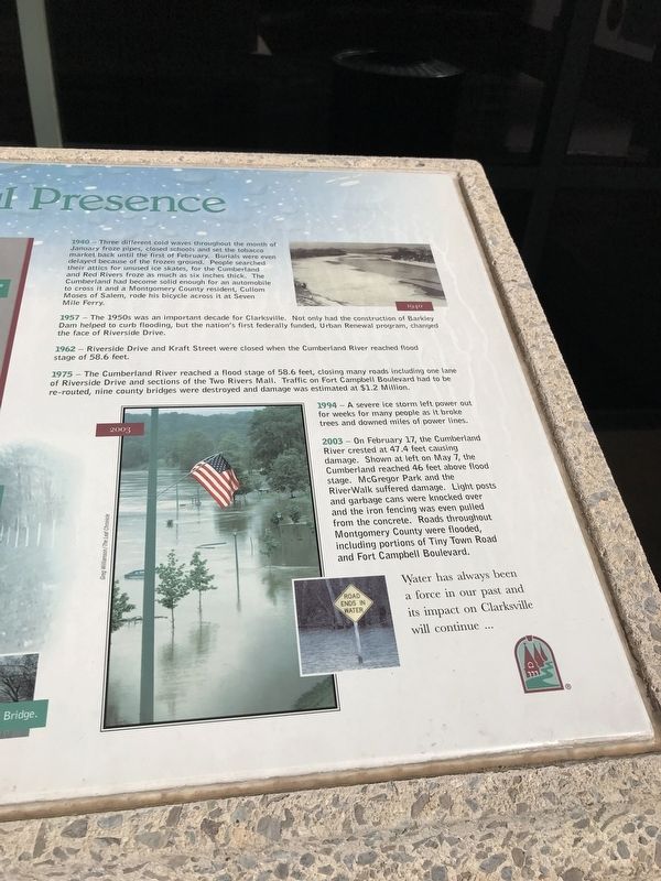
1940 Three different cold waves throughout the month of January froze pipes, closed schools and set the tobacco market back until the first of February. Burials were even delayed because of the frozen ground. People searched their attics for unused ice skates, for the Cumberland and Red Rivers froze as much as six inches thick. The Cumberland had become solid enough for an automobile to cross it and a Montgomery County resident, Cullom Moses of Salem, rode his bicycle across it at Seven Mile Ferry.
1957 The 1950s was an important decade for Clarksville. Not only had the construction of Barkley Dam helped to curb flooding, but the nation's first federally funded, Urban Renewal program, changed the face of Riverside Drive.
1962 Riverside Drive and Kraft Street were closed when the Cumberland River reached flood stage of 58.6 feet.
1975 The Cumberland River reached a flood stage of 58.6 feet, closing many roads including one lane of Riverside Drive and sections of the Two Rivers Mall. Traffic on Fort Campbell Boulevard had to be re-routed, nine county bridges were destroyed and damage was estimated
at $1.2 million.
1994 A severe ice storm left power out for weeks for many people as it broke trees and downed miles of power lines.
2003 On February 17, the Cumberland River crested at 47.4 feet causing damage. Shown at left on May 7, the Cumberland reached 46 feet above flood stage. McGregor Park and the RiverWalk suffered damage. Light posts and garbage cans were knocked over and the iron fencing was even pulled from the concrete. Roads throughout Montgomery County were flooded, including portions of Tiny Town Road and Fort Campbell Boulevard.
Water has always been a force in our past and its impact on Clarksville will continue
(Sidebar)
The Flood of 1937
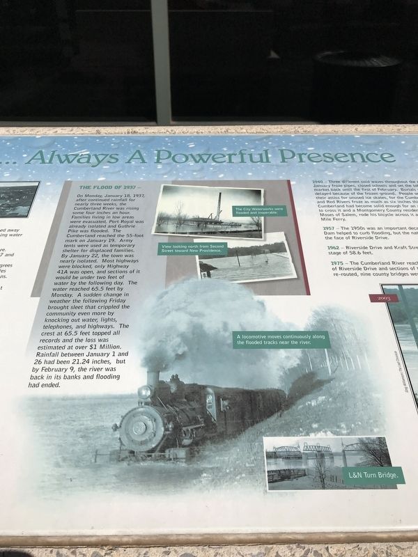
On Monday, January 18, 1937, after continued rainfall for nearly three weeks, the Cumberland River was rising some four inches an hour. Families living in low areas were evacuated, Port Royal was already isolated and Guthrie Pike was flooded. The Cumberland reached the 55-foot mark on January 19. Army tents were used as temporary shelter for displaced families. By January 22 the town was nearly isolated. Most highways were blocked, only Highway 41A was open, and sections of it would be under two feet of water by the following day. The water reached 65.5 feet by Monday. A sudden change in weather the following Friday brought sleet that crippled the community
even more by knocking out water, lights, telephones, and highways. The crest at 65.5 feet topped all records and the loss was estimated at over $1 Million. Rainfall between January 1 and 26 had been 21.24 inches, but by February 9, the river was back in its banks and flooding had ended.
Captions:
Bottom left: (1874)
Center, top: (1882)
Center, middle: (1902) The Courthouse shrouded in icy mist.
Center, bottom: (1927-1928) Homes and businesses located on what is now Riverside Drive.
The Flood of 1937 (top to bottom):
The City Waterworks were flooded and inoperable.
View looking north from Second Street toward New Providence.
A locomotive moves continuously along the flooded tracks near the river.
L&N Turn Bridge.
Right, top: (1940)
Right, bottom: (2003)
Erected by Clarksville Area Chamber of Commerce.
Topics. This historical marker is listed in these topic lists: Disasters • Waterways & Vessels.
Location. 36° 31.626′ N, 87° 21.487′ W. Marker is in Clarksville, Tennessee, in Montgomery County. Marker can be reached from South 2nd Street (Tennessee Route 76) south of Franklin Street, on the left when traveling south
.
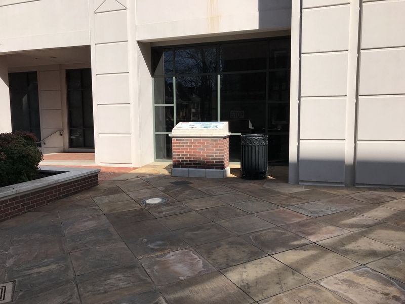
Located in the Millennium Plaza courtyard next to the Montgomery County Courthouse. Touch for map. Marker is at or near this postal address: 2 Millennium Plz, Clarksville TN 37040, United States of America. Touch for directions.
Other nearby markers. At least 8 other markers are within walking distance of this marker. Disaster Strikes Again ... Courthouse Rises from Ashes (here, next to this marker); Grand Judicial Building Constructed ... Citizens Celebrate (here, next to this marker); Nature's Fury / Fire & Wind A Terrible Threat & a Frightful Force (here, next to this marker); Blaze Consumes 15 Acres ... Downtown & Courthouse Destroyed (here, next to this marker); A Mighty Wind... Community Unites To Rebuild (a few steps from this marker); Town Population Increases ... Move Deemed Necessary (a few steps from this marker); First Courthouse Established ... Tennessee Awaits Statehood (a few steps from this marker); Nora (within shouting distance of this marker). Touch for a list and map of all markers in Clarksville.
More about this marker. Base is somewhat higher than is typical of panel markers. Reading it may be harder for those of shorter height or in a wheelchair.
Regarding Nature's Fury / Water ... Always a Powerful Presence. The Cumberland River flooded Clarksville again in May 2010, when the river crested at nearly 62.6 feet. It was the third-highest crest recorded in the city, behind
the 1937 flood's 65.5 feet and 62.7 feet in an 1882 flood.
Related markers. Click here for a list of markers that are related to this marker.
Credits. This page was last revised on February 28, 2022. It was originally submitted on March 21, 2021, by Duane and Tracy Marsteller of Murfreesboro, Tennessee. This page has been viewed 187 times since then and 14 times this year. Photos: 1. submitted on February 26, 2022, by Darren Jefferson Clay of Duluth, Georgia. 2, 3, 4, 5, 6. submitted on March 21, 2021, by Duane and Tracy Marsteller of Murfreesboro, Tennessee.
