Neversink in Sullivan County, New York — The American Northeast (Mid-Atlantic)
The New York City Water Supply System
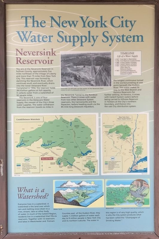
Neversink Reservoir
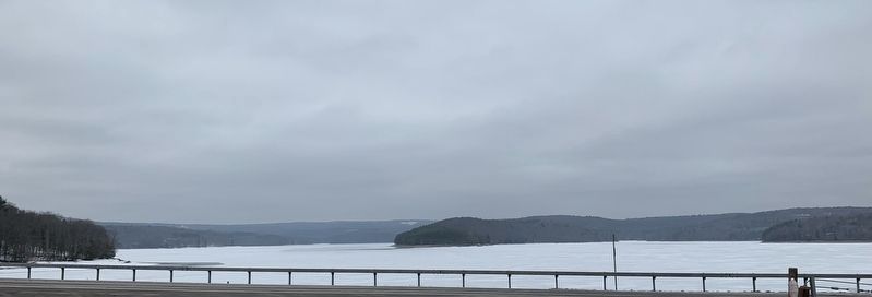
You are at the Neversink Reservoir in Sullivan County, approximately five miles northeast of the Village of Liberty and more than 75 miles from New York City. This reservoir was formed by damming the Neversink River, which continues south and eventually drains into the lower Delaware River. Completed in 1954, the reservoir holds 34.9 billion gallons at full capacity. It collects water from a watershed of 92 square miles.
The Neversink is one of four reservoirs in the Delaware Water Supply, the newest of the City's three water supplies. The water withdrawn from the reservoir travels six miles in the Neversink Tunnel to the Rondout Reservoir. There it mixes with water from two other Delaware System reservoirs, the Cannonsville and the Pepacton, before heading south via the 85-mile-long Delaware Aqueduct, the longest continuous tunnel in the world, tunneling at one point beneath the Hudson River. This water makes its way to the West Branch and Kensico Reservoirs for further settling. At Kensico, it mixes with Catskill System waters before being carried to Hillview Reservoir in Yonkers at the City's northern boundary, and thence into the vast City distribution system.
TIMELINE
Life of a Water Supply
• 1677 First Well in Manhattan
• 1776 First Reservoir (Lower B'way)
• 1842 Croton System Initiated
• 1915 Catskill System Initiated
• 1931 Supreme Court Decision Clears Way for Delaware System
• 1967 Cannonsville Reservoir Finished,Completing the Delaware System
What is a Watershed?
Everyone lives in a watershed. A watershed is the land over which rain and melting snow drain to a river, stream, lake or other body of water. In much of the Catskill Region, residents live in a watershed that fills six reservoirs. Together with 13 reservoirs and lakes in Westchester and Putnam Counties east of the Hudson River, they supply 1.3 billion gallons of water each day to 9 million people in New York City and its northern suburbs. The water in this region is of very high quality, which is why the City system produces what has been called the "Champagne of Drinking Water."
Topics. This historical marker is listed in this topic list: Man-Made Features. A significant historical year for this entry is 1954.
Location. 41° 49.19′ N, 74° 38.774′ W. Marker is in Neversink, New York, in Sullivan County. Marker is on Neversink Road (New York State Route 55) 0.1 miles east of Divine Corners Road, on the right when traveling east. Touch for map. Marker is in this post office area: Neversink NY 12765, United States of America. Touch for directions.
Other nearby markers. At least 8 other markers are within 9 miles of this marker, measured as the crow flies. Reflections on Two Hamlets (here, next to this marker); The Neversink Reservoir (here, next to this marker); a different marker also named Neversink Reservoir (a few steps from this marker); Hellers Triangle (approx. 4.8 miles away); Grahamsville War Memorial (approx. 5.4 miles away); Borscht Belt - Fallsburg (approx. 6˝ miles away); Borscht Belt - Swan Lake (approx. 8.4 miles away); Methodist Church (approx. 8.7 miles away). Touch for a list and map of all markers in Neversink.
Credits. This page was last revised on March 23, 2021. It was originally submitted on March 22, 2021, by Steve Stoessel of Niskayuna, New York. This page has been viewed 164 times since then and 24 times this year. Photos: 1, 2, 3. submitted on March 22, 2021, by Steve Stoessel of Niskayuna, New York. • Bill Pfingsten was the editor who published this page.


