Occupation of Mechanicsburg
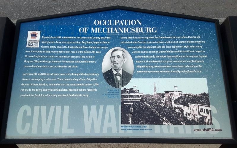
By mid-June 1863, communities in Cumberland County knew the Confederate Army was approaching. Residents began to flee to relative safety across the Susquehanna River. Freight cars came from Harrisburg to help move goods out of reach of the Rebels. On June 28, two Confederate scouts on horseback arrived at the home of Burgess (Mayor) George Hummel. Threatened with bombardment, Hummel had no choice but to surrender the town.
Between 700 and 800 cavalrymen soon rode through Mechanicsburg's streets, encamping a mile east. Their commanding officer, Brigadier General Albert Jenkins, demanded that the townspeople deliver 1,500 rations to the town hall within 90 minutes. Mechanicsburg residents provided the food, for which they received Confederate scrip.
During their two-day occupation, the Confederates tore up railroad tracks and skirmished with Federals just east of town. Jenkins had captured Mechanicsburg to reconnoiter the approaches to the state capital just eight miles away. Jenkins and his superior, Lieutenant General Richard Ewell, hoped to capture Harrisburg, but before they could act on those plans General Robert E. Lee ordered his troops to concentrate near Gettysburg. Mechanicsburg, free once more, went down in history as the northernmost town to surrender formally to the Confederacy.
[Photo captions read]
• Mechanicsburg Main Street c. 1860
Erected by Pennsylvania Civil War Trails.
Topics and series. This historical marker is listed in this topic list: War, US Civil. In addition, it is included in the Pennsylvania Civil War Trails series list. A significant historical date for this entry is June 28, 1863.
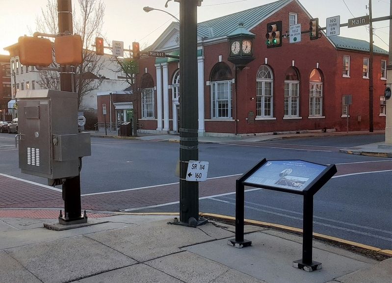
Location. 40° 12.796′ N, 77° 0.472′ W. Marker is in Mechanicsburg, Pennsylvania, in Cumberland County. Marker is at the intersection of Main Street (Pennsylvania Route 641) and Market Street (Pennsylvania Route 114), on the right when traveling east on Main Street. Touch for map. Marker is at or near this postal address: 2 East Main Street, Mechanicsburg PA 17055, United States of America. Touch for directions.
Other nearby markers. At least 8 other markers are within walking distance of this marker. Union Church (about 300 feet away, measured in a direct line); Cumberland Valley Railroad (about 300 feet away); Frankenberger Tavern (approx. 0.2 miles away); Simpson Ferry Road (approx. 0.3 miles away); Colestock Home for Old People (approx. 0.4 miles away); Civil War Memorial (approx. 0.4 miles away); Mechanicsburg Cemetery Civil War Memorial Plaza (approx. 0.4 miles away); Irving Female College (approx. half a mile away). Touch for a list and map of all markers in Mechanicsburg.
Also see . . .
1. Occupation of Mechanicsburg. PA
2. The Civil War on the West Shore. Cumberland Valley driving tour PDF (Submitted on March 23, 2021, by William Fischer, Jr. of Scranton, Pennsylvania.)
3. Highwater 1863: The Confederate Approach to Harrisburg (Crist, Pennsylvania History) .pdf. Unknown website PDF (Submitted on March 23, 2021, by William Fischer, Jr. of Scranton, Pennsylvania.)
4. The Gettysburg Campaign, Ch 1: The Confederates Invade Pennsylvania. Explore PA History website entry (Submitted on March 23, 2021, by William Fischer, Jr. of Scranton, Pennsylvania.)
Credits. This page was last revised on April 4, 2022. It was originally submitted on March 23, 2021, by William Fischer, Jr. of Scranton, Pennsylvania. This page has been viewed 468 times since then and 64 times this year. Photos: 1, 2. submitted on March 23, 2021, by William Fischer, Jr. of Scranton, Pennsylvania.

