
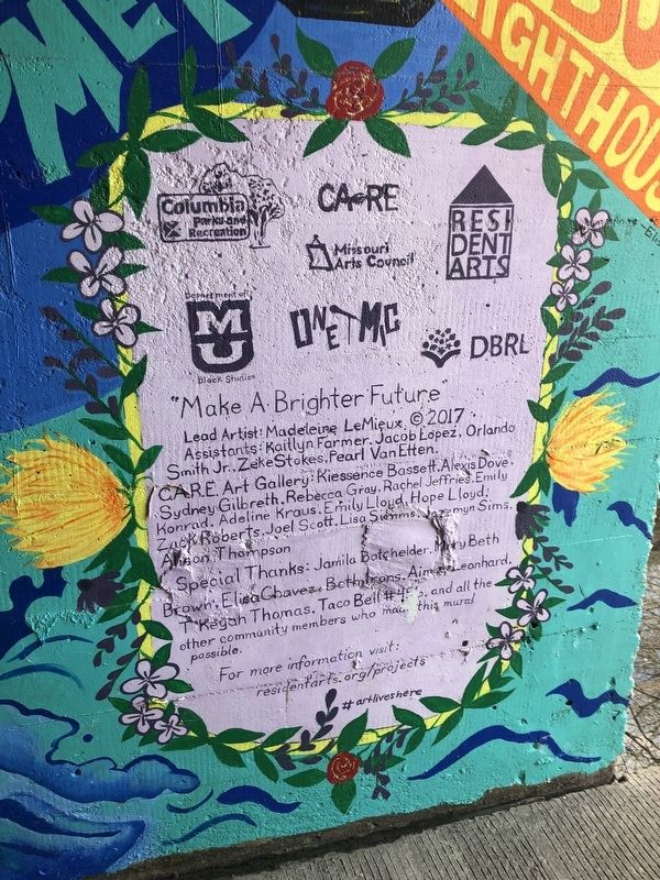
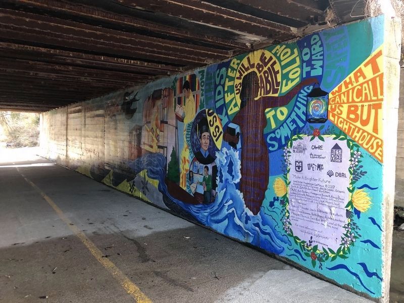
"Make A Brighter Future"
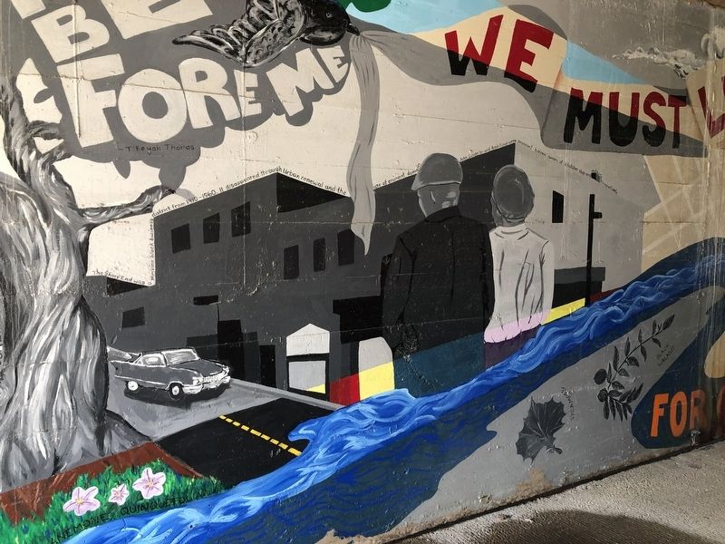
The Sharp End was a thriving business district from 1910 - 1960. It disappeared through urban renewal and the use of eminent domain. John Lange Sr. and Annie Fisher were prominent business owners of a butcher shop and restaurant, respectively.
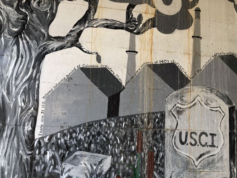
There are 31 U.S. Colored Infantry buried at Columbia cemetery. Many interred were members of MO's 62nd USCI Regiment. The regiment helped to establish The Lincoln Institute in Jeff City after the war.
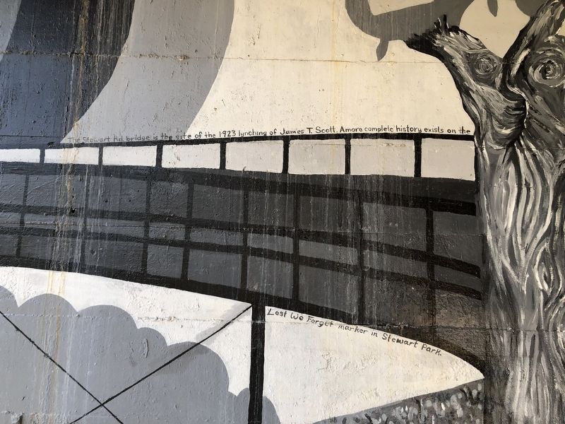
The Stewart Rd. bridge is the site of the 1923 lynching of James T. Scott. A more complete history exists on the Lest We Forget marker in Stewart Park.
Stewart Rd. is named after Judge John A. Stewart.
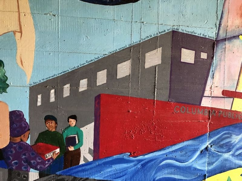
On Dec. 31 '70 community members lined up from Gentry Hall to the library's current location on Garth St in a book brigade to transfer all the books. The new library was designed by Malcolm Holzman architects and features two large sculptures by contemporary artist Albert Paley titled "Cypher."
Erected 2017 by Columbia Parks and Recreation; C.A.R.E.; Residentarts; Missouri Arts Council; MU Department of Black Studies; One Mic; DBRL.
Topics. This historical marker
this page online
Location. 38° 56.763′ N, 92° 20.094′ W. Marker is in Columbia, Missouri, in Boone County. It is on East Stewart Road just west of South Providence Road (State Highway 163), in the median. The marker is in a tunnel directly underneath East Stewart Road. Touch for map. Marker is at or near this postal address: 111 E Stewart Rd, Columbia MO 65203, United States of America. Touch for directions.

Regionally, this marker is in Little Dixie and in the Missouri River Corridor. It is also in the American Midwest, in the Lewis & Clark Corridor, and in the Corn Belt. Globally, it is in North America, the Western Hemisphere, the Western World, and the Anglosphere. Historically, it finds itself in what was once the territory of the Mississippian Culture, the Louisiana Purchase, and the Antebellum South.
Other nearby markers. At least 8 other markers are within walking distance of this marker: Lest We Forget: Lynching at the Stewart Road Bridge (within shouting distance
Additional keywords. Terrorism; Jim Crow era
Credits. This page was last revised on March 26, 2021. It was originally submitted on March 26, 2021, by Devry Becker Jones of Washington, District of Columbia. This page has been viewed 456 times since then and 21 times this year. Photos: 1, 2, 3, 4, 5, 6. submitted on March 26, 2021, by Devry Becker Jones of Washington, District of Columbia.
