Columbia in Boone County, Missouri — The American Midwest (Upper Plains)
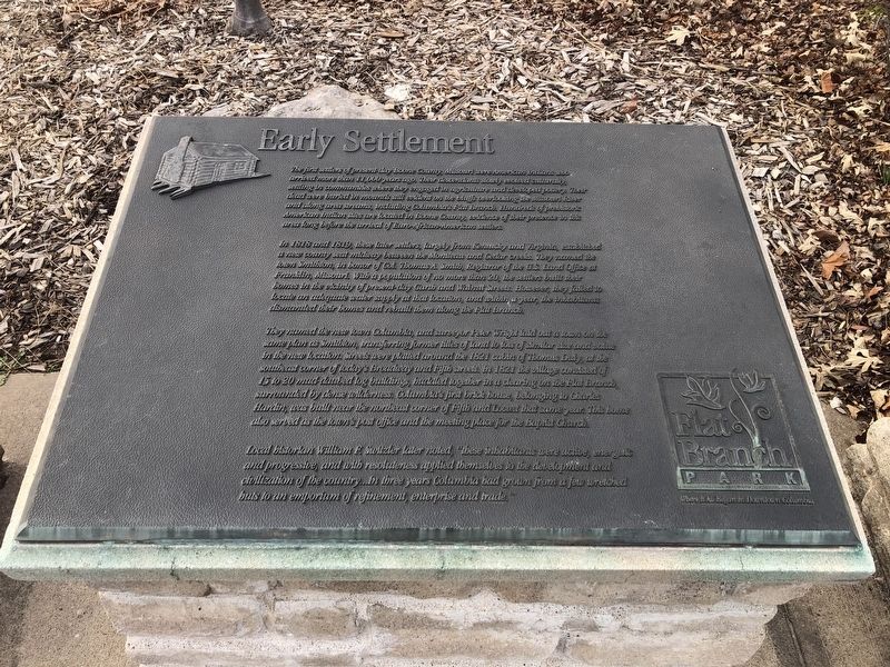
Early Settlement
Flat Branch Park
The first settlers of present-day Boone County, Missouri were American Indians who arrived more than 11,000 years ago. Their descendants slowly evolved culturally, settling in communities where they engaged in agriculture and developed pottery. Their dead were buried in mounds still evident on the bluffs overlooking the Missouri River and along area streams, including Columbia's Flat Branch. Hundreds of prehistoric American Indian sites are located in Boone County, evidence of their presence in this area long before the arrival of Euro-African-American settlers.
In 1818 and 1819, these later settlers, largely from Kentucky and Virginia, established a new county seat midway between the Montana and Cedar creeks. They named the town Smithton, in honor of Col. Thomas A. Smith, Registrar of the U.S. Land Office at Franklin, Missouri. With a population of no more than 20, the settlers built their homes in the vicinity of present-day Garth and Walnut Streets. However, they failed to locate an adequate water supply at that location, and within a year, the inhabitants dismantled their homes and rebuilt them along the Flat Branch.
They named the new town Columbia, and surveyor Peter Wright laid out a town on the same plan as Smithton, transferring former titles of land to lots of similar size and value in the new location. Streets were platted around the 1821 cabin of Thomas Duly, at the southeast corner of today's Broadway and Fifth streets. In 1821 the village consisted of 15 to 20 mud-daubed log buildings, huddled together in a clearing in the Flat Branch, surrounded by dense wilderness. Columbia's first brick house, belonging to Charles Hardin, was built near the northeast corner of Fifth and Locust that same year. This home also served as the town's post office and the meeting place for the Baptist Church.
Local historian William F. Switzler later noted, "these inhabitants were active, energetic and progressive, and with resoluteness applied themselves to the development and civilization of the country…In three years Columbia had grown from a few wretched huts to an emporium of refinement, enterprise and trade."
Erected by Flat Branch Park.
Topics. This historical marker is listed in these topic lists: Native Americans • Settlements & Settlers. A significant historical year for this entry is 1818.
Location. 38° 57.035′ N, 92° 19.991′ W. Marker is in Columbia, Missouri, in Boone County. Marker is at the intersection of South 4th Street and Cherry Street, on the right when traveling south on South 4th Street. Touch for map. Marker is at or near this postal address: 101 S 4th St, Columbia MO 65201, United States of America. Touch for directions.
Other nearby markers. At least 8 other markers are within walking distance
Credits. This page was last revised on August 8, 2023. It was originally submitted on March 26, 2021, by Devry Becker Jones of Washington, District of Columbia. This page has been viewed 492 times since then and 115 times this year. Photos: 1, 2. submitted on March 26, 2021, by Devry Becker Jones of Washington, District of Columbia.

