Missouri-Kansas-Texas Railroad Yard
Downtown Columbia, MO
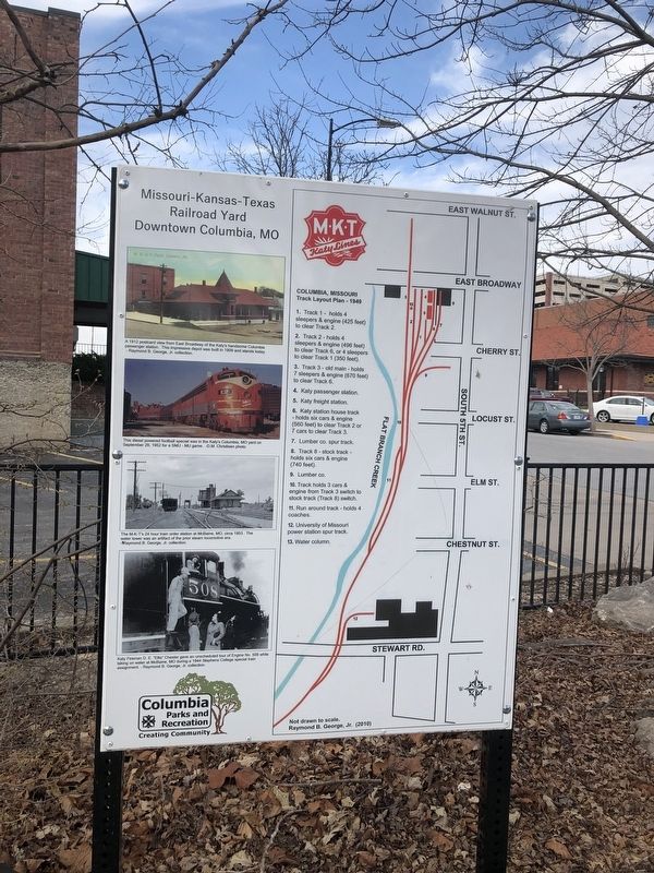
[The marker features images from the MKT's history, as well as a map:] A 1912 postcard view from East Broadway of the Katy's handsome Columbia passenger station. The impressive depot was built in 1909 and stands today. - Raymond B. George, Jr. collection.
This diesel powered football special was in the Katy's Columbia, MO yard on September 29, 1952 for a SMU - MU game. -D.M. Christisen photo.
The M-K-T's 24 hour train order station at McBaine, MO, circa 1953. The water tower was an artifact of the prior steam locomotive era. - Raymond B. George, Jr. collection
Katy Fireman D.E. "Ellis" Chester gave an unscheduled tour of Engine No. 508 while taking on water at McBaine, MO during a 1944 Stephens College special train assignment. - Raymond B. George, Jr. collection.
Columbia, Missouri
Track Layout Plan - 1949
1. Track 1 - holds 4 sleepers & engine (425 feet) to clear Track 2.
2. Track 2 - holds 4 sleepers & engine (496 feet) to clear Track 6, or 4 sleepers to clear Track 1 (350 feet)
3. Track 3 - old main - holds 7 sleepers & engine (670 feet) to clear Track 6.
4. Katy passenger station.
5.
this page online
6. Katy station house track - holds six cars & engine (560 feet) to clear Track 2 or 7 cars to clear Track 3.
7. Lumber co. spur track.
8. Track 8 - stock track - hold six cars & engine (740 feet).
9. Lumber co.
10. Track holds 3 cars & engine from Track 3 switch to stock track (Track 8) switch.
11. Run around track - holds 4 coaches.
12. University of Missouri power station spur track.
13. Water column.
Not drawn to scale.
Raymond B. George, Jr. (2020)
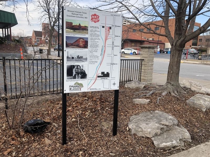
Erected 2010 by Columbia Parks and Recreation.
Topics. This historical marker is listed in these topic lists: Education • Railroads & Streetcars. A significant historical date for this entry is September 29, 1952.
Location. 38° 57.046′ N, 92° 19.991′ W. Marker is in Columbia, Missouri, in Boone County. It is at the intersection of South 4th Street and Cherry Street, on the right when traveling south on South 4th Street. Touch for map. Marker is at or near this postal address: 29 S 4th St, Columbia MO 65201, United States of America. Touch for directions.
Regionally, this marker is in Little Dixie and in the Missouri River Corridor. It
Other nearby markers. At least 8 other markers are within walking distance of this marker: Transportation (a few steps from this marker); Early Settlement (a few steps from this marker); Commerce (a few steps from this marker); African-American Heritage (within shouting distance of this marker); African-American Heritage Trailhead (within shouting distance of this marker); Missouri, Kansas & Texas Railroad Depot (about 300 feet away, measured in a direct line); African-American Heritage Trail (about 400 feet away); The John William "Blind" Boone Home and the Second Missionary Baptist Church (about 500 feet away). Touch for a list and map of all markers in Columbia.
Credits. This page was last revised on March 26, 2021. It was originally submitted on March 26, 2021, by Devry Becker Jones of Washington, District of Columbia. This page has been viewed 625 times since then and 65 times this year. Photos: 1, 2. submitted on March 26, 2021, by Devry Becker Jones of Washington, District of Columbia.
