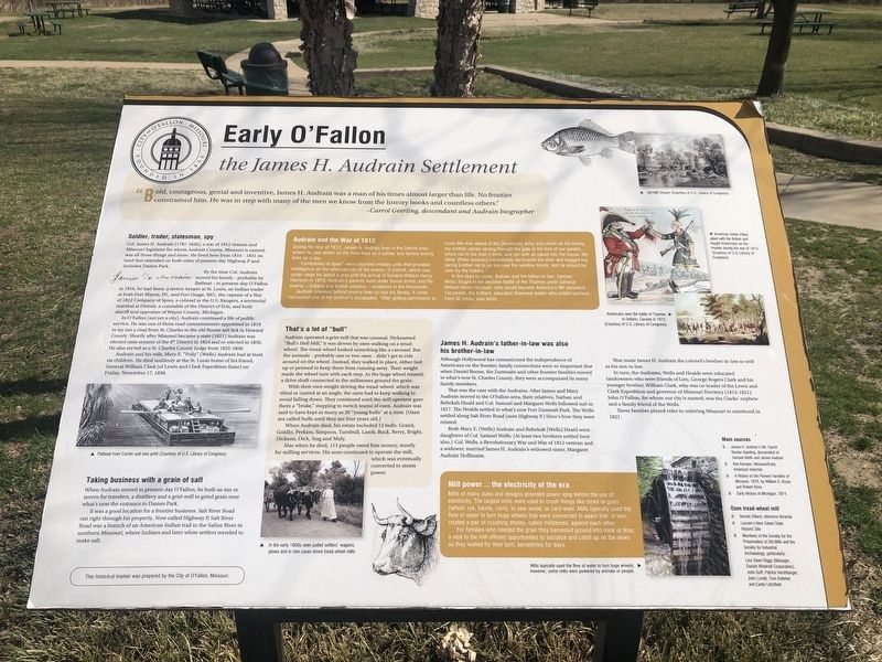
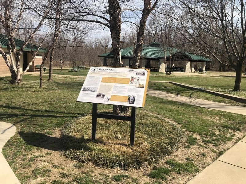
Early O'Fallon
the James H. Audrain Settlement
— City of O'Fallon, Missouri: Founded in 1856 —
"Bold, courageous, genial and inventive, James H. Audrain was a man in his times almost larger than life. No frontier constrained him. He was in step with many of the men we know from the history books and countless others."
Carrol Geerling, descendant and Audrain biographer
Soldier, trader, statesman, spy
Col. James H. Audrain (1781-1830), a war of 1812 veteran and Missouri legislator for whom Audrain County, Missouri is named, was all those things and more. He lived here from 1816 - 1831 on land that extended on both sides of present-day Highway P and includes Dames Park.
By the time Col. Audrain moved his family — probably by flatboat — to present-day O'Fallon in 1816, he had been: a tavern-keeper at St. Louis, an Indian trader at both Fort Wayne, In., and Fort Osage, MO., the captain of a War of 1812 Company of Spies, a colonel in the U.S. Rangers, a territorial marshal at Detroit, a constable of the District of Erie, and both sheriff and appraiser of Wayne County, Michigan.
In O'Fallon (not yet a city), Audrain continued a life of public service. He was one of three road commissioners appointed in 1819 to lay out a road from St. Charles to the old Boone salt lick in Howard County. Shortly after Missouri became a state (1821) Audrain was elected state
senator of the 8th District in 1824 and re-elected in 1830. He also served as a St. Charles County Judge from 1825-1826.Audrain and his wife, Mary E. "Polly" (Wells) Audrain had at least six children. He died suddenly at the St. Louis home of his friend, General William Clark (of Lewis and Clark Expedition fame) on Friday, November 17, 1830.
Taking business with a grain of salt
When Audrain moved to present-day O'Fallon, he built an inn or tavern for travelers, a distillery and a grist-mill to grind grain near what's now the entrance to Dames Park.
It was a good location for a frontier business. Salt River Road ran right through his property. Now called Highway P, Salt River Road was a branch of an American Indian trail to the Saline River in northern Missouri, where Indians and later white settlers traveled to make salt.
Audrain and the War of 1812
During the War of 1812, James H. Audrain lived in the Detroit area, where he saw action on the front lines as a soldier and behind enemy lines as a spy.
"Companies of spies" were mounted military units that provided intelligence on the whereabouts of the enemy. In Detroit, which was under siege for about a year until the arrival of General William Henry Harrison in 1813, Audrain's parents lived under house arrest, and the enemy — Indians and British soldiers — numbered
Audrain sneaked behind enemy lines to visit his family. A sister recounted one of her brother's escapades: "After getting permission to cross the river ahead of the [American] army and check on his family, my brother James sprang through the gate at the foot of our garden which ran to the river's brink, and ran with all speed into the house. My father [Peter Audrain] immediately barricaded the door and begged my daring brother not to go too near the window blinds, lest he should be seen by the Indians."
In the days to come, Audrain and his father-in-law, Samuel Wells, fought in the decisive Battle of the Thames under General William Henry Harrison, who would become America's 9th president. Tecumseh, the brilliant, educated Shawnee leader who united warriors from 30 tribes, was killed.
That's a lot of "bull"
Audrain operated a grist mill that was unusual. Nicknamed "Bull's Hell Mill," it was driven by oxen walking on a tread-wheel. The tread-wheel looked something like a carousel. But the animals — probably one or two oxen — didn't get to ride around on the wheel. Instead, they walked in place, either tied up or penned to keep them from running away. Their weight made the wheel turn with each step. As the huge wheel rotated, a drive shaft connected to the millstones ground the grain.
With their own weight driving
the tread-wheel, which was tilted or canted at an angle, the oxen had to keep walking to avoid falling down. They continued until the mill operator gave them a "brake," stopping to switch teams of oxen. Audrain was said to have kept as many as 20 "young bulls" at a time. (Oxen are called bulls until they are four years old.)When Audrain died, his estate included 13 bulls: Grand, Goldin, Perkins, Simpson, Turnbull, lamb, Buck, Berry, Bright, Dickson, Dick, Stag and Muly.
Also when he died, 113 people owed him money, mostly for milling services. His sons continued to operate this mill, which was eventually converted to steam power.
James H. Audrain's father-in-law was also his brother-in-law
Although Hollywood has romanticized the independence of Americans on the frontier, family connections were so important that when Daniel Boone, the Zumwalts and other frontier families moved to what's now St. Charles County, they were accompanied by many family members.
That was the case with the Audrains. After James and Mary Audrain moved to the O'Fallon area, their relatives, Nathan and Rebekah Heald and Col. Samuel and Margaret Wells followed suit in 1817. The Healds settled in what's now Fort Zumwalt Park. The Wells settled along Salt River Road (now Highway P.) Here's how they were related:
Both Mary E. (Wells) Audrain and Rebekah (Wells) Heald were daughters of Col. Samuel Wells. (At least two brothers settled here also.) Col. Wells, a revolutionary War and War of 1812 veteran and a widower, married James H. Audrain's widowed sister, Margaret Audrain Hoffman.
That made James H. Audrain the colonel's brother-in-law as well as his son-in-law.
In turn, the Audrains, Wells and Healds were educated landowners who were friends of Gen. George Rogers Clark and his younger brother, William Clark, who was co-leader of the Lewis and Clark Expedition and governor of Missouri Territory (1813-1821). John O'Fallon, for whom our city is named, was the Clarks' nephew and family friend of the Wells.
These families played roles in ushering Missouri to statehood in 1821.
Mill power … the electricity of the era
Mills of many sizes and designs provided power long before the use of electricity. The largest mills were used to crush things like rocks or grain (wheat, rye, barely, corn), to saw wood, or card wool. Mills typically used the flow of water to turn huge wheels that were connected to gears that, in turn, rotated a pair of crushing stones, called millstones, against each other.
For families who needed the grain they harvested ground into meal or flour, a visit to the mill offered opportunities to socialize and catch up on the news as they waited for their turn, sometimes for days.
Erected by the City of O'Fallon, Missouri.
Topics. This historical marker is listed in these topic lists: Agriculture • Industry & Commerce • Settlements & Settlers • War of 1812. A significant historical date for this entry is November 17, 1830.
Location. 38° 49.661′ N, 90° 42.399′ W. Marker is in O'Fallon, Missouri, in St. Charles County. Marker is at the intersection of Dames Park Drive and State Highway P, on the right when traveling north on Dames Park Drive. Touch for map. Marker is at or near this postal address: 400 Hwy P, O Fallon MO 63366, United States of America. Touch for directions.
Other nearby markers. At least 8 other markers are within 2 miles of this marker, measured as the crow flies. O'Fallon's 2,000-year-old Civilization (approx. 0.2 miles away); Veterans Memorial (approx. 0.2 miles away); Omer J. Dames War Memorial (approx. 0.2 miles away); The Ancient Cities and Earthen Mounds of O'Fallon (approx. 0.2 miles away); O'Fallon During Ancient Times (approx. 0.2 miles away); The Ancient Earthen Burial Mounds of O'Fallon (approx. 0.2 miles away); Alien Designs or Native Handiwork? (approx. ¼ mile away); Fort Zumwalt (approx. 2 miles away). Touch for a list and map of all markers in O'Fallon.
Credits. This page was last revised on March 27, 2021. It was originally submitted on March 27, 2021, by Devry Becker Jones of Washington, District of Columbia. This page has been viewed 526 times since then and 47 times this year. Photos: 1, 2. submitted on March 27, 2021, by Devry Becker Jones of Washington, District of Columbia.

