Silver City in Grant County, New Mexico — The American Mountains (Southwest)
Destroyed by Floods
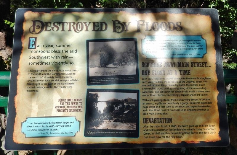
This valley drains the Pinos Altos Mountains to the north and the Continental Divide to the west. Unfortunately, town founders — unfamiliar with local conditions — placed Main Street right in the path of the watershed's natural drainage route. The results were disastrous.
Floods have always had the power to attract, astound and fascinate onlookers.
"...an immense wave twelve feet in height and three hundred feet in width, carrying with it everything movable in its path..."
— Silver City Enterprise, July 22, 1895
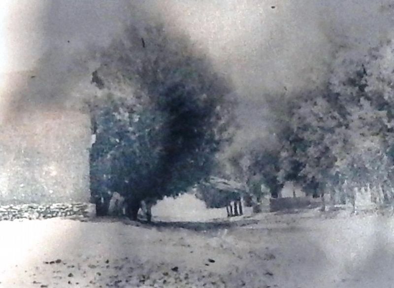
”A raging torrent came boiling through the deep ditch which used to be Main Street. The angry waters cut under the bank and undermined six or seven of the big trees. The front wall [of the Enterprise building] fell and later a considerable part of the side wall fell…”— Silver City Enterprise, July 22, 1895
Scouring away Main Street… one flood at a time
Each year, rainstorms caused damage to the main thoroughfare; each year, residents made repairs to the unpaved street. No one realized that the problem lay not in the rainfall, but in uncontrolled wood cutting and grazing of the surrounding watershed. Soil collection for adobe bricks made matters even worse. Floods became increasingly regular and more severe.
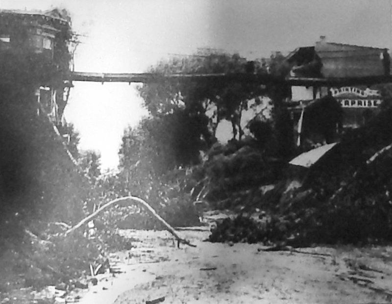
With each passing storm, Main Street wore deeper. It became an arroyo, a gully, and eventually a gorge. Residents expended huge effort and vast sums to construct and repair breakwaters and other flood control structures in an ongoing attempt to keep Main Street alive.
Devastation
After the major flood of 1895, the town gave up on Main Street and built a pedestrian footbridge over what is today San Vicente Creek. In 1902 another devastating flood carved the deep gulch that locals now call the "Big Ditch."
Topics. This historical marker is listed in these topic lists: Disasters • Settlements & Settlers • Waterways & Vessels. A significant historical date for this entry is July 22, 1895.
Location. 32° 46.222′ N, 108° 16.526′ W. Marker is in Silver City, New Mexico, in Grant County. Marker can be reached from the intersection of North Hudson Street (New Mexico Route 90) and East Yankie Street, on the left when traveling north. Marker is located along the San Vicente Trail, overlooking the "Big Ditch," near the Murray Ryan Visitor Center. Touch for map. Marker is at or near this postal address: 201 North Hudson Street, Silver City NM 88061, United States of America. Touch for directions.
Other nearby markers. At least 8 other markers are within walking distance of this marker. An Oasis in the Desert (here, next to this marker); Protecting our Watershed (here, next to
this marker); 1870's Log Cabin (within shouting distance of this marker); Anita Scott Coleman (within shouting distance of this marker); Changing Values (within shouting distance of this marker); O.B. McClintock Bank Clock (about 500 feet away, measured in a direct line); Municipal Museum (approx. 0.2 miles away); Silver City Centennial (approx. 0.3 miles away). Touch for a list and map of all markers in Silver City.
Related markers. Click here for a list of markers that are related to this marker. Silver City Big Ditch Park
Also see . . . The Big Ditch. Not only did Main Street follow a natural drainage path from the Pinos Altos watershed and the Continental Divide, but it was developed at a time before there were restrictions on logging and grazing in what would become the Gila National Forest, or removal of brush from surrounding hillsides for firewood. By 1895, the hills around Silver City had been largely denuded. In July of that year a flood roared down Main Street, turning it into a deep arroyo and resulting in its abandonment for wagon traffic. (Submitted on March 30, 2021, by Cosmos Mariner of Cape Canaveral, Florida.)
Credits. This page was last revised on March 31, 2021. It was originally submitted on March 30, 2021, by Cosmos Mariner of Cape Canaveral, Florida. This page has been viewed 294 times since then and 43 times this year. Photos: 1, 2, 3, 4. submitted on March 30, 2021, by Cosmos Mariner of Cape Canaveral, Florida.


