
Bond Hill in Cincinnati in Hamilton County, Ohio — The American Midwest (Great Lakes)
St. Aloysius Orphanage
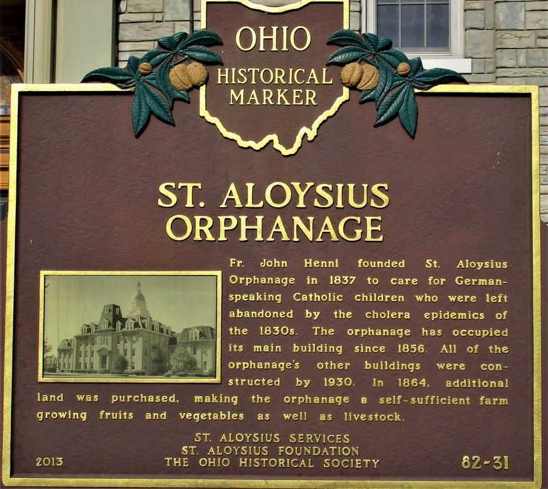
Photographed by Rev. Ronald Irick, March 30, 2021
1. St. Aloysius Orphanage Marker
Erected 2013 by St. Aloysius Services, St. Aloysius Foundation, and The Ohio Historical Society. (Marker Number 82-31.)
Topics and series. This historical marker is listed in these topic lists: Charity & Public Work • Religion & Religious Structures. In addition, it is included in the Ohio Historical Society / The Ohio History Connection series list. A significant historical year for this entry is 1837.
Location. 39° 10.289′ N, 84° 28.141′ W. Marker is in Cincinnati, Ohio, in Hamilton County. It is in Bond Hill. It is at the intersection of Reading Road (U.S. 42) and Berkley Avenue, on the left when traveling north on Reading Road. The marker is on the front lawn of the old St. Aloysius Orphanage. Touch for map.
this page online

Regionally, this marker is in the American Midwest and in the Ohio River Valley. Globally, it is in North America, the Western Hemisphere, the Western World, and the Anglosphere. Historically, it finds itself in what was once the Haudenosaunee (Iroquois) Confederacy, the territory of the Mississippian Culture, and the Northwest Territory.
Other nearby markers. At least 8 other markers are within 2 miles of this marker, measured as the crow flies: Norwood High School (approx. 0.9 miles away); Xavier University Armory (approx. 1½ miles away); Flagpole History (approx. 1.7 miles away); Evanston - World War One Honor Roll (approx. 1.8 miles away); Walter Scott, Christian Pioneer (approx. 1.8 miles away); King Records (approx. 1.9 miles away); James Warren Rankin / Ohio's Martin Luther King Jr. Holiday (approx. 2 miles away); Pleasant Ridge - World War One Marker (approx. 2.1 miles away). Touch for a list and map of all markers in Cincinnati.
Another marker is no longer nearby. White's Station
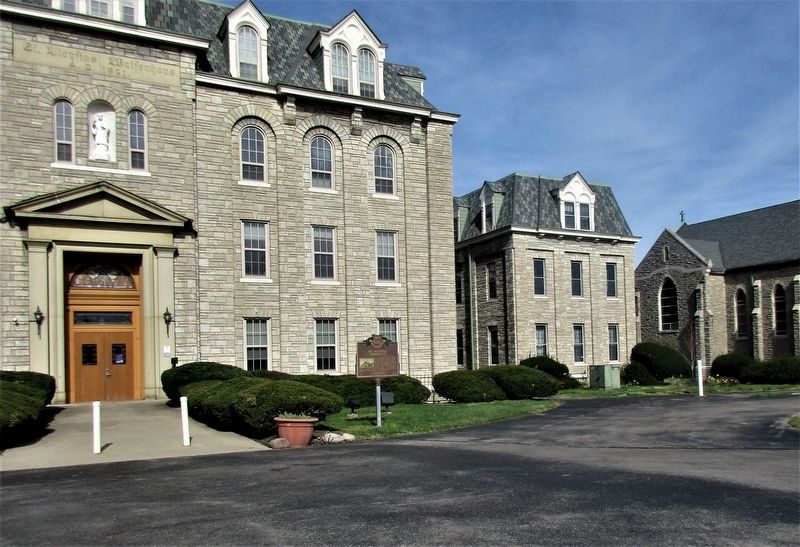
Photographed by Rev. Ronald Irick, March 23, 2021
2. St. Aloysius Orphanage Marker
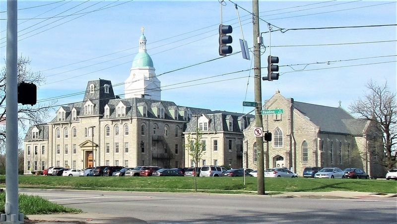
Photographed by Rev. Ronald Irick, March 30, 2021
3. St. Aloysius Orphanage Marker
The building as seen from Beckley Avenue

Photographed by Rev. Ronald Irick, March 30, 2021
4. St. Aloysius Waifenhaus
Inscription over the front door
Credits. This page was last revised on February 4, 2023. It was originally submitted on March 31, 2021, by Rev. Ronald Irick of West Liberty, Ohio. This page has been viewed 2,442 times since then and 185 times this year. Photos: 1, 2, 3, 4. submitted on March 31, 2021, by Rev. Ronald Irick of West Liberty, Ohio. • Devry Becker Jones was the editor who published this page.
