Near Dunbar in Georgetown County, South Carolina — The American South (South Atlantic)
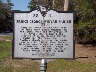
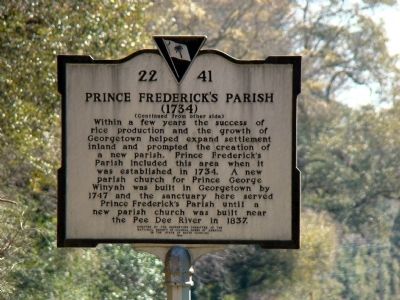
Prince George Winyah Parish / Prince Frederick’s Parish
(1721) / (1834)
Prince Frederick’s Parish (1734). Within a few years the success of rice production and growth of Georgetown helped expand settlement inland and prompted the creation of a new parish. Prince Frederick’s Parish included this area when it was established in 1734. A new parish church for Prince George Winyah was built in Georgetown by 1747 and the sanctuary here served Prince Frederick’s Parish until a new parish church was built near the Pee Dee River in 1837.
Erected 1996 by the Georgetown Committee of the National Society of Colonial Dames of America in the State of South Carolina. (Marker Number 22-41.)
Topics and series. This historical marker is listed in this topic list: Churches & Religion. In addition, it is included in the The Colonial Dames of America, National Society of series list. A significant historical year for this entry is 1721.
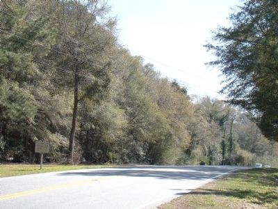
Location. 33° 32.083′ N, 79° 23.439′ W. Marker is near Dunbar, South Carolina, in Georgetown County. Marker is on Browns Ferry Road (State Highway 51), on the right when traveling north. Touch for map. Marker is in this post office area: Georgetown SC 29440, United States of America. Touch for directions.
Other nearby markers. At least 8 other markers are within 11 miles of this marker, measured as the crow flies. Black Mingo Presbyterian Meeting House (approx. 5˝ miles away); Birthplace of Jeremiah John Snow / China Grove Plantation (approx. 5.9 miles away); Black Mingo – Willtown / Black Mingo Baptist Church (approx. 6.2 miles away); Black Mingo Creek: (approx. 6˝ miles away); Skirmish At Black Mingo Creek (approx. 6˝ miles away); Early Settlers / Potatoe Ferry (approx. 9.1 miles away); Beneventum Plantation (approx. 9˝ miles away); Pleasant Hill Baptist Church (approx. 10.2 miles away).
Credits. This page was last revised on June 16, 2016. It was originally submitted on March 14, 2009, by J. J. Prats of Powell, Ohio. This page has been viewed 3,837 times since then and 68 times this year. Photos: 1, 2, 3, 4. submitted on March 14, 2009, by J. J. Prats of Powell, Ohio.


