Sampit in Georgetown County, South Carolina — The American South (South Atlantic)
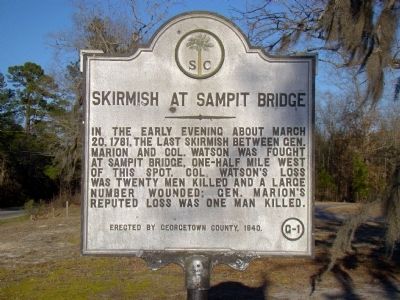
Skirmish at Sampit Bridge
Erected 1940 by Georgetown County. (Marker Number 22-7.)
Topics. This historical marker is listed in this topic list: War, US Revolutionary. A significant historical date for this entry is March 20, 1711.
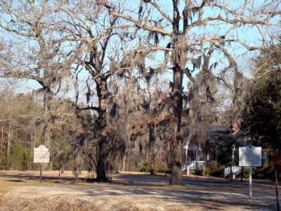
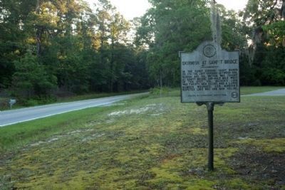
Location. 33° 21.866′ N, 79° 27.474′ W. Marker is in Sampit, South Carolina, in Georgetown County. Marker is on Saints Delight Road (Alternate U.S. 17) south of Highmarket Street / Georgetown Highway (U.S. 521), on the left when traveling south. Marker is at Sampit Methodist Church. Touch for map. Marker is at or near this postal address: 1125 Saints Delight Rd, Georgetown SC 29440, United States of America. Touch for directions.
Other nearby markers. At least 8 other markers are within 10 miles of this marker, measured as the crow flies. Sampit Methodist Church (a few steps from this marker); Oak Grove Methodist Church (approx. 1.6 miles away); General Arthur M. Manigault (approx. 8.3 miles away); 1st Battalion 178th Field Artillery (approx. 8˝ miles away); Gabriel Marion (approx. 8.6 miles away); Georgetown County National Guard Memorial (approx. 8.8 miles away); Friendly Aid Society / Rosemont School (approx. 9.8 miles away); Potter's Field (approx. 9.8 miles away).
Also see . . . Revolutionary War Raids & Skirmishes in 1781. “On March 28, Col. John Watson and his British force was still following Maj. Gen. Francis Marion’s Patriot force. Marion sent Peter Horry’s horsemen ahead of Watson, and they destroyed the Sampit Bridge in Watson’s path as he continued down the road toward Georgetown. Horry’s were then set to receive Watson, but he drove forward on them with the bayonet. At the same time, however, Marion attacked and badly cut up his rear guard as it forded the Sampit River, since the bridge had already been partially destroyed by the partisans to impede the British as they retired. His own horse shot out from under him, Watson then opened up his cannon on Marion and drove him back. Leaving twenty dead behind him, Watson then proceeded to Trapier’s Plantation where he camped. The next day, with a reported two wagon loads of wounded Watson made it to Georgetown. Although there is apparently no accurate count of Watson’s losses during his expedition against Marion during this month, the
total was reportedly not inconsiderable, 40 being both a reasonable and conservative estimate. Marion casualties, on the other hand, appear to have been negligible.” (Submitted on March 14, 2009.)
Additional keywords. Gen. Francis Marion, The Swamp Fox; Tory leader Col. John Watson
Credits. This page was last revised on June 16, 2016. It was originally submitted on March 14, 2009, by J. J. Prats of Powell, Ohio. This page has been viewed 1,447 times since then and 39 times this year. Photos: 1, 2. submitted on March 14, 2009, by J. J. Prats of Powell, Ohio. 3. submitted on May 26, 2013, by Mike Stroud of Bluffton, South Carolina.


