Culpeper in Culpeper County, Virginia — The American South (Mid-Atlantic)
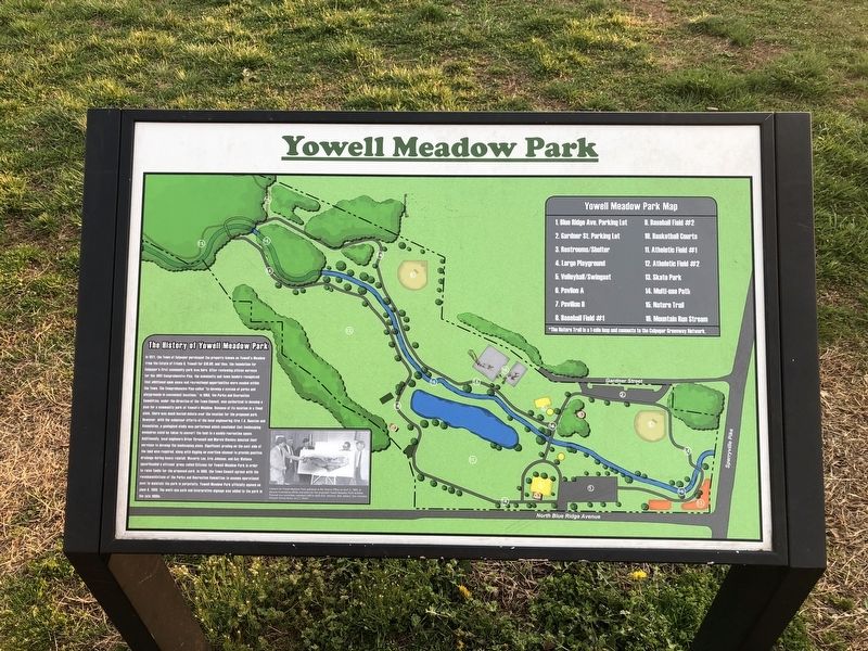
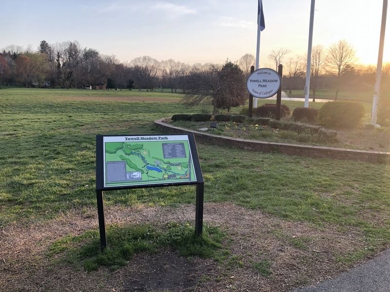
Yowell Meadow Park
The History of Yowell Meadow Park
In 1971, the Town of Culpeper purchased the property known as Yowell's Meadow from the Estate of Frieda Q. Yowell for $10.00, and thus, the foundation for Culpeper's first community park was born. After reviewing citizens surveys for the 1982 Comprehensive Plan, the community and town leaders recognized that additional open space and recreational opportunities were needed within the Town. The Comprehensive Plan called "to develop a system of parks and playgrounds in convenient locations." In 1984, the Parks and Recreation Committee, under the direction of the Town Council, was authorized to develop a plan for a community park at Yowell's Meadow. Because of its location in a flood plain, there was much heated debate over the location for the proposed park. However, with the volunteer efforts of the local engineering firm T.A. Houston and Associates, a geological study was performed which concluded that landscaping measures could be taken to convert the land to a usable recreation space. Additionally, local engineers Brian Thressell and Marvin Hinchey services to develop the landscaping plans. Significant grading on the east side of the land was required, along with digging an overflow channel to provide positive drainage during heavy rainfall. Waverly Lee, Eric Johnson, and Gay Wallace spearheaded a citizens' group called Citizens for Yowell Meadow Park in order to raise funds for the proposed park. In 1986, the Town Council agreed with the recommendation of the Parks and Recreation Committee to assume operational cost to maintain the park in perpetuity. Yowell Meadow Park officially opened on June 4, 1989. The multi-use path and interpretive signage was added to the park in the late 1990s.
Topics. This historical marker is listed in this topic list: Parks & Recreational Areas. A significant historical date for this entry is June 4, 1989.
Location. 38° 28.512′ N, 77° 59.952′ W. Marker is in Culpeper, Virginia, in Culpeper County. Marker is on North Blue Ridge Avenue, 0.1 miles south of West Edmondson Street, on the right when traveling south. Touch for map. Marker is at or near this postal address: 226 N Blue Ridge Ave, Culpeper VA 22701, United States of America. Touch for directions.
Other nearby markers. At least 8 other markers are within walking distance of this marker. Major Gabriel Long (a few steps from this marker); Mountain Run Watershed (about 600 feet away, measured in a direct line); Vietnam War Memorial (about 700 feet away); Confederate Memorial (approx. 0.2 miles away); Historic Antioch Baptist Church (approx. 0.2 miles away); The Blair Property and Sugar Bottom (approx. 0.2 miles away); The Revolutionary War (approx. 0.2 miles away); George Washington (approx. 0.2 miles away). Touch for a list and map of all markers in Culpeper.
Credits. This page was last revised on April 4, 2021. It was originally submitted on April 4, 2021, by Devry Becker Jones of Washington, District of Columbia. This page has been viewed 436 times since then and 58 times this year. Photos: 1, 2, 3. submitted on April 4, 2021, by Devry Becker Jones of Washington, District of Columbia.


