Downtown Los Angeles in Los Angeles County, California — The American West (Pacific Coastal)
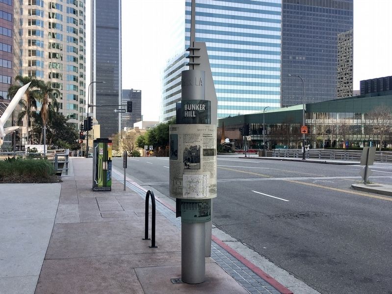
Bunker Hill
When Women Carried Parasols
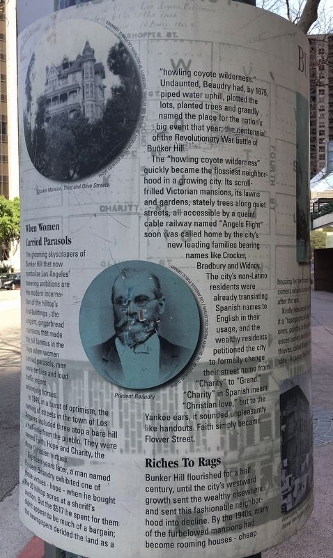
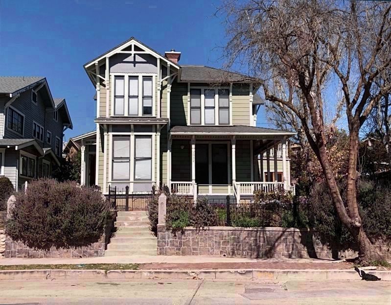
The gleaming skyscrapers of Bunker Hill that now symbolize Los Angeles' towering ambitions are the modern incarnation of the hilltop's first buildings - the elegant, gingerbread mansions that made the hill famous in the days when women carried parasols, men wore derbies and loud traffic meant whinnying horses.
In 1849, in a burst of optimism, the naming of streets in the town of Los Angeles included three atop a bare hill a half-mile from the pueblo. They were named Faith, Hope and Charity, the three Christian virtues.
Eighteen years later, a man named Prudent Beaudry exhibited one of those virtues - hope - when he bought the 20 hilltop acres at a sheriff's auction. But the $517 he spent for them didn't appear to be much of a bargain; the newspapers derided the land as a "howling coyote wilderness." Undaunted, Beaudry had by 1875, piped water uphill, plotted the lots, planted trees and grandly named the place for the nation's big event that year, the centennial of the Revolutionary War battle of Bunker Hill.
The "howling coyote wilderness" quickly became the glossiest neighborhood in a growing city. Its scroll-frilled Victorian mansions, its lawns and gardens, stately trees along quiet streets, all accessible by a quaint cable railway named "Angels Flight" soon was called home by the city's new leading families bearing names like Crocker, Bradbury and Widney.
The city's non-Latino residents were already translating Spanish names to English in their usage, and the wealthy residents petitioned the city to formally change their street name from "Charity" to "Grand." "Charity" in Spanish meant "Christian love," but to the Yankee ears, it sounded unpleasantly like handouts. Faith simply became Flower Street.
Riches To Rags
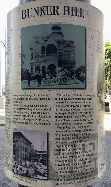
Bunker Hill flourished for a half-century, until the city's westward growth sent the wealthy elsewhere and sent this fashionable neighborhood into decline. By the 1940s, many of the furbelowed mansions had become rooming houses - cheap housing for the throngs of wartime new-comers whose numbers only increased after the war.
Kindly newspaper accounts called it a "topographical bulge"; more critical ones, pointing to the ramshackle residences turned dens for drug addicts and thieves, called Bunker Hill a "festering eyesore - a cancer that has to be wiped out. "
Yet Bunker Hill's dimly lit streets and dark alleys were perfectly suited to the new film noir sense of the city. In 1948, actor Edward G. Robinson hurried down the long stairs paralleling Angels Flight in "The Night Has A Thousand Eyes," and in 1954, actor Jimmy Stewart walked slowly up the same stairs in "The Glenn Miller Story."
Writer Raymond Chandler, who monitored the heartbeat of L.A. in his provocative detective stories, described Bunker Hill's eclectic demographics in his 1938 novella "The King in Yellow;" "you could find anything from down-at-heels ex-Greenwich-villagers to crooks on the lam, from ladies of anybody's evening to County Relief clients brawling with haggard landladies in grand old houses with scrolled porches. It had been a nice place once..."
Finally, the city had enough of fires and of crime - and of criticism for letting it go on. "Urban Renewal" was in vogue, so on a misty May morning in 1961, after the city had designated all 136 acres as blighted, and had bought out its last 9,000 residents, bulldozers toppled the haggard skeleton of the once-spectacular, five-story 1904 Hillcrest Hotel.
Preservation and Images Preserved
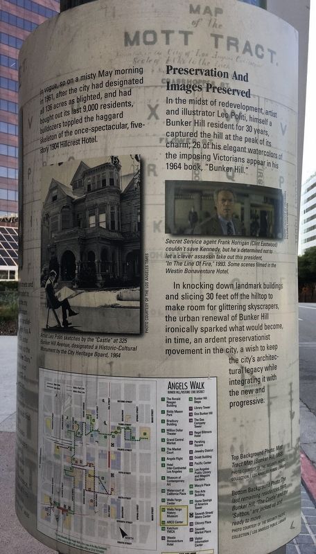
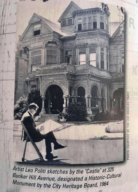
In the midst of redevelopment, artist and illustrator Leo Politi, himself a Bunker Hill resident for 30 years, captured the hill at the peak of its charm; 26 of his elegant watercolors of the imposing Victorians appear in his 1964 book, "Bunker Hill."
In knocking down landmark buildings and slicing 30 feet off the hilltop to make room for glittering skyscrapers, the urban renewal of Bunker Hill ironically sparked what would become, in time, an ardent preservationist movement in the city, a wish to keep the city's architectural legacy while integrating it with the new and progressive.
Erected 1997 by City of Los Angeles. (Marker Number 27.)
Topics and series. This historical marker is listed in these topic lists: Architecture • Industry & Commerce • Settlements & Settlers. In addition, it is included in the Los Angeles Historic-Cultural Monument series list. A significant historical year for this entry is 1849.
Location. 34° 3.151′ N, 118° 15.205′ W. Marker is in Los Angeles, California, in Los Angeles County. It is in Downtown Los Angeles. Marker is at the intersection of Hope Street and 4th Street, on the right when traveling north on Hope Street. Touch for map. Marker is at or near this postal address: 330 S Hope St, Los Angeles CA 90071, United States of America. Touch for directions.
Other nearby markers. At least 8 other markers are within walking distance of this marker. The Central Library (about 800 feet away, measured in a direct line); One Bunker Hill (approx. 0.2 miles away); Angels Flight (approx. 0.2 miles away); Los Angeles Central Library (approx. 0.2 miles away); The World Peace Bell (approx. 0.2 miles away); City National Plaza (approx. 0.2 miles away); Angels Flight Railway (approx. ¼ mile away); a different marker also named Angels Flight (approx. ¼ mile away). Touch for a list and map of all markers in Los Angeles.
Regarding Bunker Hill.
The marker is located on the highest point on Bunker Hill.
In 1964, the “Castle” was designated Los Angeles Historic-Cultural Monument No. 27. It was moved to Heritage Square Museum in 1969 and destroyed by arson fire the same year.
Also see . . . Angels Walk L.A. Self-guided walking tours of historic neighborhoods in Los Angeles. This marker is part of the Bunker Hill walk. (Submitted on March 11, 2021.)
Credits. This page was last revised on December 13, 2023. It was originally submitted on March 11, 2021, by Craig Baker of Sylmar, California. This page has been viewed 446 times since then and 40 times this year. Last updated on April 5, 2021, by Craig Baker of Sylmar, California. Photos: 1, 2, 3, 4, 5, 6. submitted on March 11, 2021, by Craig Baker of Sylmar, California. • J. Makali Bruton was the editor who published this page.
