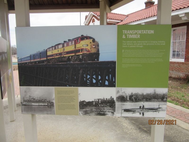
Transportation & Timber
Funding and construction of the first railroad, that today passes through Vivian, Oil City and other towns in the area proved problematic. Early resident and entrepreneur Arthur Stillwell travelled to Amsterdam Holland, and was successful in raising the funds needed to build the Kansas City, Pittsburg & Gulf Railway. It was later renamed the Kansas City Southern and still hauls coal through towns today.
Sawmills came to the area's because of the timber, while steamboats and railroads transported the lumber to factories in the Northeast. Cotton and timber remained as the areas greatest economic resources until the turn of the century.
[Photo captions]
Above: Kansas City Southern Train #2, the
northbound Southern Belle, travels across the
tranquil waters of Caddo Lake as it departs
Mooringsport, LA in June of 1969.
Left: Steamboats once were essential to travel
in northwest Louisiana. Lakes and bayous
served as alternatives to roads through dense
forests and thick underbrush. Even fully loaded
with cotton bales, steamboats could paddle
across shallow water, churning past stands of
cypress toward plantation landings.
Right: While there is little left of the
rugged
logging railroads that hauled timber from local
forests at the turn of the 20th century, those
railroads proved to be lifelines for many towns,
funneling passengers and cargoes through newly
constructed depots.
Topics. This historical marker is listed in these topic lists: Horticulture & Forestry • Industry & Commerce • Railroads & Streetcars.
Location. 32° 52.316′ N, 93° 59.127′ W. Marker is in Vivian, Louisiana, in Caddo Parish. Marker is on SW Front Street, half a mile north of East Arkansas Avenue, on the right when traveling north. Located under Gazebo outside of Chamber of Commerce building. Touch for map. Marker is at or near this postal address: 100 NW Front St, Vivian LA 71082, United States of America. Touch for directions.
Other nearby markers. At least 8 other markers are within 7 miles of this marker, measured as the crow flies. Agriculture (here, next to this marker); Roughnecks & Roustabouts (here, next to this marker); Vivian Railroad Station (within shouting distance of this marker); The Adams-Fuller House (approx. 6.3 miles away); Hosston Methodist Church (approx. 6.4 miles away); Hosston Post Office (approx. 6.4 miles away); Discovery-Rodessa Oil Field (approx. 6.9 miles away); Frog Level (approx. 7.1 miles away). Touch for a list and map of all markers in Vivian.
Credits. This page was last revised on April 9, 2021. It was originally submitted on April 8, 2021, by Jason Armstrong of Talihina, Oklahoma. This page has been viewed 97 times since then and 6 times this year. Photo 1. submitted on April 8, 2021, by Jason Armstrong of Talihina, Oklahoma. • Mark Hilton was the editor who published this page.
Editor’s want-list for this marker. A wide shot of the marker and its surroundings. • Can you help?
