Port Neches in Jefferson County, Texas — The American South (West South Central)
Grigsby's Bluff
(1834-1902)
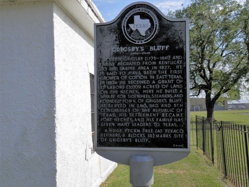
Photographed by Cajun Scrambler, April 5, 2021
1. Grigsby's Bluff Marker
Joseph Grigsby (1771-1841) and family migrated from Kentucky to the Sabine area in 1827. He is said to have been the first grower of cotton in East Texas. In 1834 he received a grant of 17 labors (3,009 acres) of land on the Neches. Here he built a wharf for sidewheel steamers and founded town of Grigsby's Bluff. He served in 2nd, 3rd and 5th congresses of the Republic of Texas. His settlement became Port Neches, and his family has given many leaders to Texas. A huge pecan tree (at Texaco Refinery, 6 blocks SE) marks site of Grigsby's Bluff.
Erected 1969 by Texas Historical Survey Committee. (Marker Number 10532.)
Topics. This historical marker is listed in this topic list: Settlements & Settlers. A significant historical year for this entry is 1827.
Location. 29° 59.6′ N, 93° 57.047′ W. Marker is in Port Neches, Texas, in Jefferson County. It is on Grigsby Avenue near Park Street, on the right when traveling east. Touch for map. Marker is in this post office area: Port Neches TX 77651, United States of America. Touch for directions.

Regionally, this marker is in the Golden Triangle. It is also in the American South,
this page online
Other nearby markers. At least 8 other markers are within 3 miles of this marker, measured as the crow flies: First United Methodist Church Of Port Neches (approx. ¾ mile away); Tex Ritter (approx. 0.9 miles away); St. Elizabeth Catholic Community (approx. 0.9 miles away); First Baptist Church of Port Neches (approx. 1.3 miles away); First Mercantile Building (approx. 2.7 miles away); City of Nederland (approx. 2.9 miles away); Interurban Rail Service (approx. 2.9 miles away); W.M. "Tex" Ritter (approx. 2.9 miles away). Touch for a list and map of all markers in Port Neches.
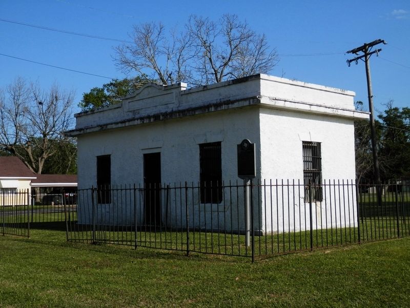
Photographed by Cajun Scrambler, April 5, 2021
2. Grigsby's Bluff Marker
Credits. This page was last revised on December 1, 2024. It was originally submitted on April 10, 2021, by Cajun Scrambler of Assumption, Louisiana. This page has been viewed 1,551 times since then and 146 times this year. Photos: 1, 2. submitted on April 10, 2021, by Cajun Scrambler of Assumption, Louisiana.
