Dover in Pope County, Arkansas — The American South (West South Central)
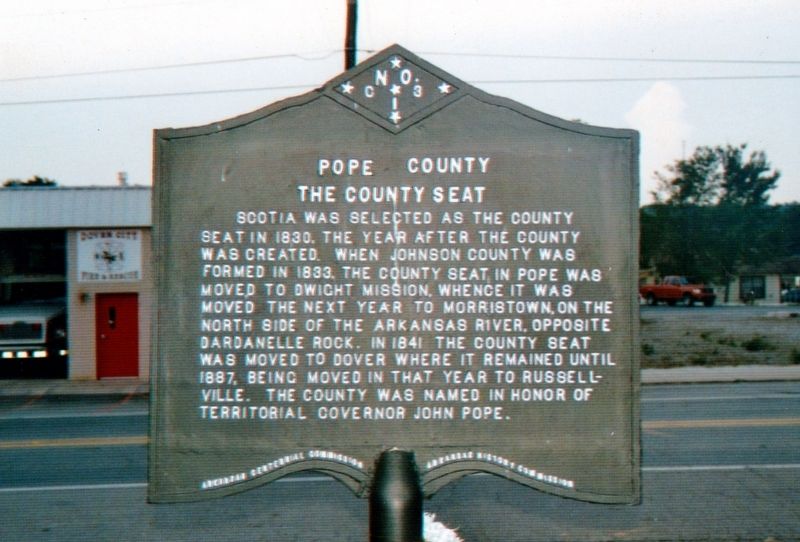
Pope County
The County Seat
Erected 1936 by Arkansas Centennial Commission Arkansas Historic Commission. (Marker Number C-13.)
Topics and series. This historical marker is listed in this topic list: Settlements & Settlers. In addition, it is included in the Arkansas Centennial Commission series list. A significant historical year for this entry is 1841.
Location. 35° 24.128′ N, 93° 6.863′ W. Marker is in Dover, Arkansas, in Pope County. Marker is at the intersection of State Highway 27 and West Water Street, on the left when traveling north on State Highway 27. Touch for map. Marker is at or near this postal address: 9720 AR 27, Dover AR 72837, United States of America. Touch for directions.
Other nearby markers. At least 8 other markers are within 11 miles of this marker, measured as the crow flies. Pope County in the Civil War / Pope County Militia War (approx. 6.9 miles away); J. Madison White (approx. 8˝ miles away); Fire of 1906 (approx. 8.6 miles away); J.L. Shinn Building (approx. 8.6 miles away); First Christian Church (approx. 8.7 miles away); Wilson House (approx. 8.9 miles away); William L. Lovely (approx. 9.2 miles away); Military Road Marker Stone (approx. 10.8 miles away).
Also see . . . Pope County, AR. (Submitted on April 11, 2021, by Tim Fillmon of Webster, Florida.)
Credits. This page was last revised on April 11, 2021. It was originally submitted on April 11, 2021, by Tim Fillmon of Webster, Florida. This page has been viewed 121 times since then and 13 times this year. Photo 1. submitted on April 11, 2021, by Tim Fillmon of Webster, Florida.
Editor’s want-list for this marker. A wide view photo of the marker and the surrounding area in context. • Can you help?
