Courthouse Square
| — | Davidsonville Historic State Park | — |
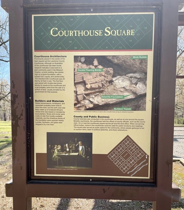
Courthouse Architecture
Prominently placed in the center of the town square sat the Lawrence County Courthouse. Although no illustration of the courthouse has been found, research indicates it was built on a plan commonly used in the Missouri Ozarks—a brick building, two stories high on a stone foundation, with a hipped roof, cupola, and central entry. The Davidsonville Courthouse was 24 feet by 32 feet in size. The first floor was paved with double-size bricks. Money to construct the courthouse and a jail probably came from the sale of a portion of land, usually donated by the government for that purpose.
Builders and Materials
Skilled stonemasons, bricklayers, and
carpenters probably were hired to
direct the work, but the work crew was
likely made up of enslaved Africans
whose time was leased or donated by
local planters. Bricks and mortar were
made on-site from locally available
materials, and the limestone blocks of
the foundation were quarried nearby.
Lumber, hardware, and glass were
shipped in by river boat.
County and Public Business
County business was conducted in the courthouse,
this page online
Photo captions:
Top right: Archeological excavations at the Courthouse revealed a floor of double bricks on top of a dolomite foundation.
Bottom left: The Puzzled Witness (Artist: George Caleb Bingham, 1874.
Erected by the State of Arkansas.
Topics. This historical marker is listed in this topic list: Notable Places. A significant historical year for this entry is 1874.
Location. 36° 9.271′ N, 91° 3.373′ W. Marker is near Black Rock, Arkansas, in Randolph County. It can be reached from Arkansas Route 166 0.6 miles south of Route 361 when traveling south. Touch for map. Marker is at or near this postal address: 8047 Hwy 166 S, Pocahontas AR 72455, United States

Regionally, this marker is in the American South, specifically in the Upper South, and in the Ozarks. Globally, it is in North America, the Western Hemisphere, the Western World, and the Anglosphere. Historically, it finds itself in what was once the territory of the Mississippian Culture, the Louisiana Purchase, one of the Confederate States of America, and the Antebellum South.
Other nearby markers. At least 8 other markers are within walking distance of this marker: Oldest Town Site in Arkansas (here, next to this marker); County Seat Town (here, next to this marker); Davidsonville's Courthouse (a few steps from this marker); Archeology Uncovers the Past (within shouting distance of this marker); Decline and Abandonment (within shouting distance of this marker); Public House (within shouting distance of this marker); County Jail (within shouting distance of this marker); House Lots (within shouting distance of this marker). Touch for a list and map of all markers in Black Rock.
Also see . . . Encyclopedia of Arkansas article about Davidsonville Historic State Park. (Submitted on April 12, 2021, by Mark Hilton of Montgomery, Alabama.)
Credits. This page was last revised on April 13, 2021. It was originally submitted on April 12, 2021, by Mark Hilton of Montgomery, Alabama. This page has been viewed 269 times since then and 20 times this year. Photos: 1, 2, 3, 4. submitted on April 12, 2021, by Mark Hilton of Montgomery, Alabama.
