House Lots
— Davidsonville Historic State Park —
Houses
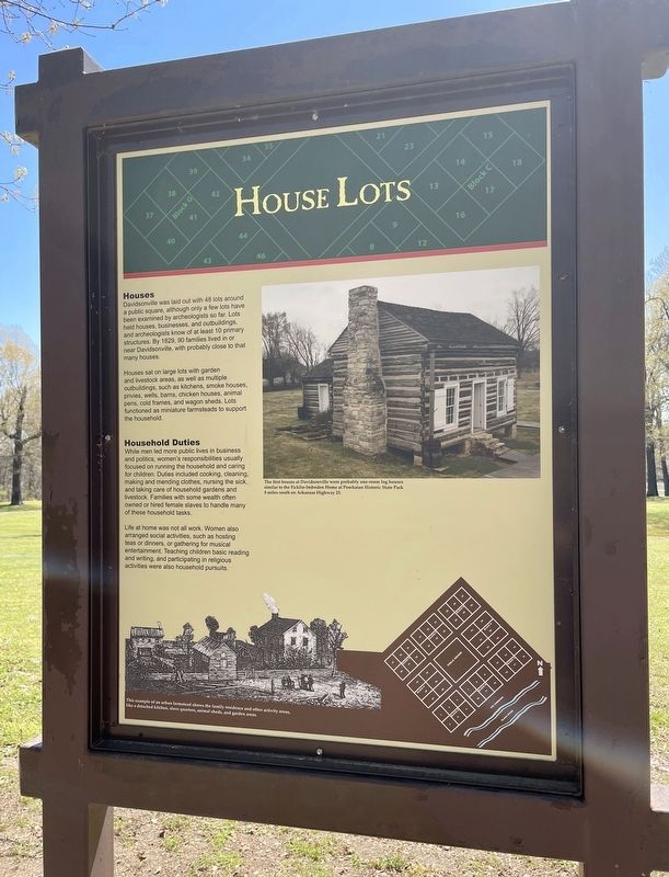
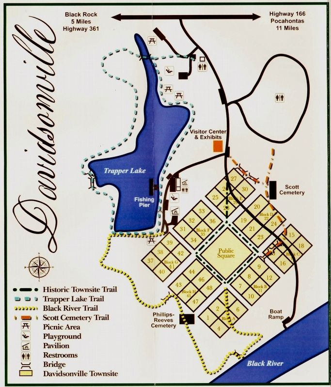
Davidsonville was laid out with 48 lots around a public square, although only a few lots have been examined by archeologists so far. Lots held houses, businesses, and outbuildings, and archeologists know of at least 10 primary structures. By 1829, 90 families lived in or near Davidsonville, with probably close to that many houses.
Houses sat on large lots with garden and livestock areas, as well as multiple outbuildings, such as kitchens, smoke houses, privies, wells, barns, chicken houses, animal pens, cold frames, and wagon sheds. Lots functioned as miniature farmsteads to support the household.
Household Duties
While men led more public lives in business
and politics, women's responsibilities usually
focused on running the household and caring
for children. Duties included cooking, cleaning,
making and mending clothes, nursing the sick,
and taking care of household gardens and
livestock. Families with some wealth often
owned or hired female slaves to handle many
of these household tasks.
Life at home was not all work. Women also arranged social activities, such as hosting teas or dinners, or gathering for musical entertainment. Teaching children basic reading and writing, and participating in religious activities were also household pursuits.
[Photo
caption]:
The first houses at Davidsonville were probably one-room log houses
similar to the Ficklin-Imboden Home at Powhatan Historic State Park
8 miles south on Arkansas Highway 25.
Erected by the State of Arkansas.
Topics. This historical marker is listed in this topic list: Settlements & Settlers. A significant historical year for this entry is 1829.
Location. 36° 9.24′ N, 91° 3.343′ W. Marker is near Black Rock, Arkansas, in Randolph County. Marker can be reached from Arkansas Route 166, 0.6 miles south of Arkansas Route 361 when traveling south. Located 11 miles south of Pocahontas and within the Davidsonville Historic State Park. Touch for map. Marker is at or near this postal address: 8047 Hwy 166 S, Pocahontas AR 72455, United States of America. Touch for directions.
Other nearby markers. At least 8 other markers are within walking distance of this marker. First Postal Stop (within shouting distance of this marker); Private Residence / Post Office (within shouting distance of this marker); Decline and Abandonment (within shouting distance of this marker); Davidsonville's Courthouse (within shouting distance of this marker); Oldest Town Site in Arkansas (within shouting distance of this marker); Courthouse Square (within shouting distance of this marker); County Seat Town (within
Credits. This page was last revised on April 13, 2021. It was originally submitted on April 13, 2021, by Mark Hilton of Montgomery, Alabama. This page has been viewed 80 times since then and 5 times this year. Photos: 1, 2, 3, 4. submitted on April 13, 2021, by Mark Hilton of Montgomery, Alabama.


