First Postal Stop
— Davidsonville Historic State Park —
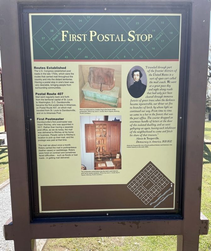
Routes Established
The U.S. Congress established post roads in the late 1700s, which were the routes that carried mail throughout the country and into the distant territories. Having a postal stop in one's town was very desirable, bringing people from surrounding communities.
Postal Route 407
Mail went regularly back and forth
from the territorial capital of St. Louis
to Washington, D.C. Davidsonville
became the first postal stop in Arkansas,
on Postal Route 407, on which mail
traveled from St. Louis to Davidsonville,
and on to Arkansas Post.
First Postmaster
Davidsonville's first postmaster was
Adam Ritchey, who was appointed in
1817. Rather than having a separate
post office, as we do today, the mail
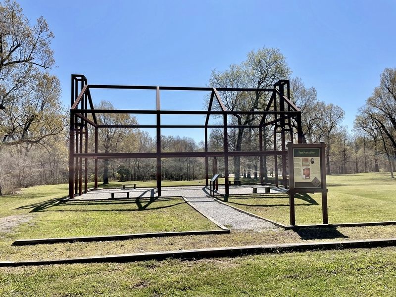
was delivered to Ritchey at his home
or business. People came to Ritchey's
location to pick up their mail, and the
postage was paid at that time.
The mail ran about once a month. Riders carried the mail in portmanteaus (leather cases) or saddlebags. Riders were hired on contract and sometimes faced difficulties - such as floods or bad roads - in getting mail delivered.
"I traveled through part
of the frontier districts of
the United States in a
sort of open cart called
the mail coach. We went
at a great pace day
and night along roads
that
had only just been
cleared through immense
forests of green trees; when the darkness
became inpenetrable, our driver set fire
to branches of larch, by whose light we
continued our way.
From time to time
we came to a hut in the forest; that was
the post office. The courier dropped an
enormous bundle of letters at the door
of this isolated dwelling, and we went
galloping on again, leaving each inhabitant
of the neighborhood to come and fetch
his share of that treasure.”
Alexis de Tocqueville,
Democracy in America, 1831-1832
[Photo captions]:
Mail was delivered in a leather bag to the house of the
postmaster. (Photo by: Joan L. Gould, Hart's Square, Hickory,
North Carolina.)
The postmaster sorted letters into the desk's mail slots for
pick up by county residents. (Photo by: Joan L. Gould, Hart's
Square, Hickory, North Carolina.)
Alexis de Tocqueville was a French political thinker and historian who
visited America in the early 1800s.
Erected by the State of Arkansas.
Topics. This historical marker is listed in this topic list: Settlements & Settlers. A significant historical year for this entry is 1817.
Location. 36° 9.252′ N, 91° 3.326′ W. Marker is near Black Rock, Arkansas, in Randolph County. Marker can be reached from
Other nearby markers. At least 8 other markers are within walking distance of this marker. Private Residence / Post Office (a few steps from this marker); Decline and Abandonment (within shouting distance of this marker); House Lots (within shouting distance of this marker); Davidsonville's Courthouse (within shouting distance of this marker); Archeology Uncovers the Past (within shouting distance of this marker); Courthouse Square (within shouting distance of this marker); Oldest Town Site in Arkansas (within shouting distance of this marker); County Seat Town (about 300 feet away, measured in a direct line). Touch for a list and map of all markers in Black Rock.
Credits. This page was last revised on April 13, 2021. It was originally submitted on April 13, 2021, by Mark Hilton of Montgomery, Alabama. This page has been viewed 83 times since then and 11 times this year. Photos: 1, 2, 3. submitted on April 13, 2021, by Mark Hilton of Montgomery, Alabama.


