Resaca in Gordon County, Georgia — The American South (South Atlantic)
Logan's XV Corps to the South
The next few rainy days were filled with marching and skirmishes all along Rocky Face Ridge, while Johnston moved troops to Resaca to take up and reinforce positions along that ridge.
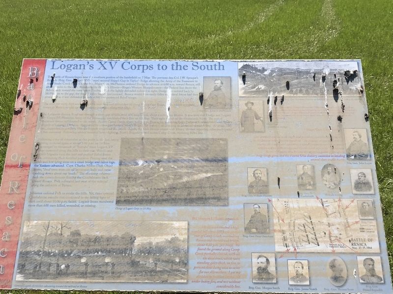
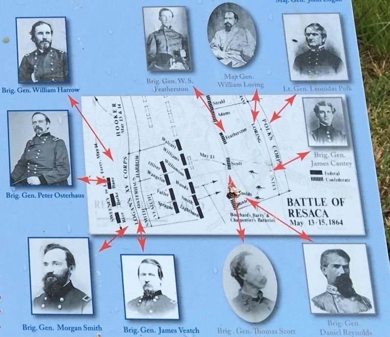
Lafayette-Resaca Road ran through a short gap of hills, west of Camp Creek, about a mile from Resaca. It was here that Dodge and Logan's XV Corps (McPherson's Army of the Tennessee) established their line on 13 May. Their sight rested on the Oostanaula River. The rest of Sherman's forces still formed to the north. Across Camp Creek, about halfway to Resaca, lay Leonidas Polk's Corps of Confederates with Scott's Brigade of Loring's Division. Supported by a two-gun battery, Scott's Brigade lay forward establishing an advanced skirmish line. At about 1:00 p.m., supported by artillery, Wood's Brigade countered the attack. Again, the 66th Illinois armed with Henry 16-shot repeating rifles participated in this easement. Following several hours of heavy fighting, Scott's Brigade retired across Camp Creek, rejoining Polk's line.
Following a day of skirmishes at this point in the line, heavy fighting occurred again at about 5:00 p.m. on 14 May. Encouraged by thousands of "hurrahs" from Logan's XV Corps stationed along the hills to their rear, Wood's and Smith's brigades took the lead and pushed Rebel forces back, overtaking their fortified position. Passing over the creek and low-lying areas on a small bridge and fallen logs, the Yankees advanced. Capt. Charles Miller (76th Ohio) wrote, "dead trees were cut off by cannon balls and came crashing down about our heads." The storming columns took the entrenchments forcing the Confederates back toward Resaca. Polk reformed just west of the railroad along the outskirts of Resaca.
Johnston ordered Polk to retake the hills. Yet, three spirited Confederate assaults that continued in the failing light of dusk until about 10.00 p.m. failed. Logan's losses numbered more than 600 men killed, wounded, or missing.
Major Gen. Grenville M. Dodge's advance on 7 May reached the "bald hill" directly in front of this position after meeting and advancing on Confederate cavalry in Snake Creek Gap. The 66th Illinois — Birge's Western Sharpshooters with 16-shot Henry repeating rifles — drove "the enemy like sheep before them" over the seven-mile advance to the vicinity of Resaca.
Major Gen. Logan wrote:
Our artillery opened with vigor and precision, and the consternation in the doomed town became apparent. The greatest commotion existed among the troops, and numerous railroad trains were seen to move southward over the bridge and trestle-work across the Oostanaula River. Of course this became the objective point of fire of our long-range guns, and the Fourth Ohio Battery succeeded in landing several shots on the trains.
BG Morgan L. Smith reported:
My division reached a high wooded hill about 400 yards on the rear of Camp Creek, overlooking Resaca and the railroad bridge, about 4:30 p.m. [13 May]. We found the ground along Camp Creek partially cleared, with all the dead trees, which were standing quite thick, on fire, to prevent their being used as cover for our skirmishers. I got my division in position on this hill under heavy fire, and not without considerable loss.Captions:
Top right (clockwise from left):
• Maj. Gen. James B. McPherson
• Position of Brig. Gen. Osterhaus' Division on Bald Hill on 14 May while shelling the railroad
• Major Gen. Grenville M. Dodge
Center: Charge of Logan's Corps on 14 May
Bottom left: General Logan's skirmishers advancing toward the railroad at Resaca
Erected by Georgia Department of Natural Resources - State Parks and Historic Sites.
Topics. This historical marker is listed in this topic list: War, US Civil. A significant historical month for this entry is May 1864.
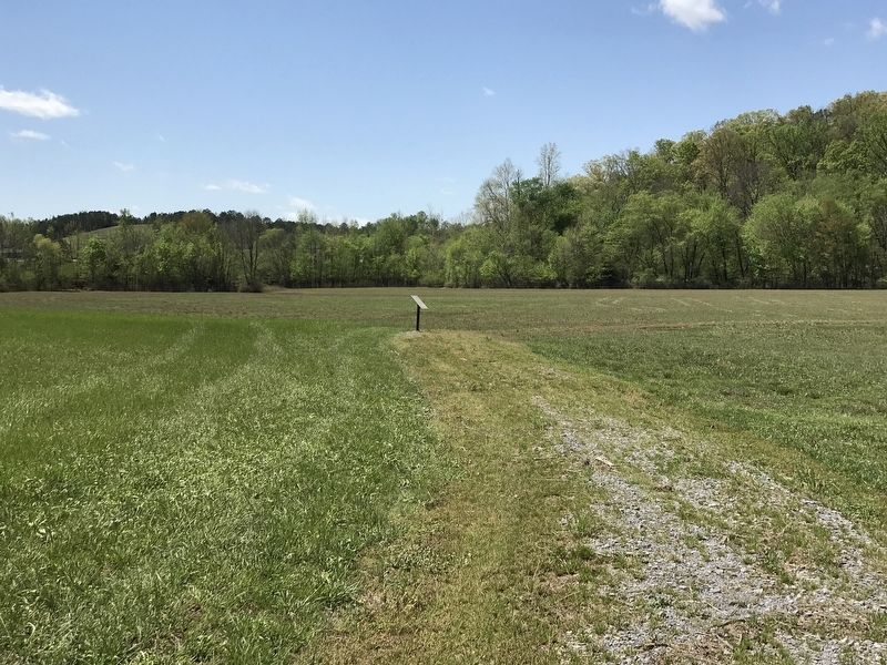
Location. 34° 34.865′ N, 84° 57.222′ W. Marker has been reported damaged. Marker is in Resaca, Georgia, in Gordon County. Marker can be reached from Resaca Lafayette Road Northwest (Georgia Route 136). Marker is on the Loop Trail on the west side of the entrance road to Resaca Battlefield State Historic Site. Touch for map. Marker is at or near this postal address: 6 GA-136, Resaca GA 30735, United States of America. Touch for directions.
Other nearby markers. At least 8 other markers are within walking distance of this location. Dancers in the Red Clay Minuet (within shouting distance of this marker); South Toward Atlanta (about 400 feet away, measured in a direct line); Resaca — A Defensible Position (approx. ¼ mile away); Crossing the Oostanaula at Lay's Ferry (approx. ¼ mile away); The Road to Resaca (approx. ¼ mile away); Battle of Resaca (approx. ¼ mile away); Resaca Battlefield State Historic Site (approx. 0.4 miles away); a different marker also named Resaca Battlefield State Historic Site (approx. 0.4 miles away). Touch for a list and map of all markers in Resaca.
Credits. This page was last revised on April 15, 2021. It was originally submitted on April 14, 2021, by Duane and Tracy Marsteller of Murfreesboro, Tennessee. This page has been viewed 207 times since then and 17 times this year. Photos: 1. submitted on April 14, 2021, by Duane and Tracy Marsteller of Murfreesboro, Tennessee. 2. submitted on April 15, 2021, by Duane and Tracy Marsteller of Murfreesboro, Tennessee. 3. submitted on April 14, 2021, by Duane and Tracy Marsteller of Murfreesboro, Tennessee.


