Near El Reno in Canadian County, Oklahoma — The American South (West South Central)
1876 Officers' Quarters
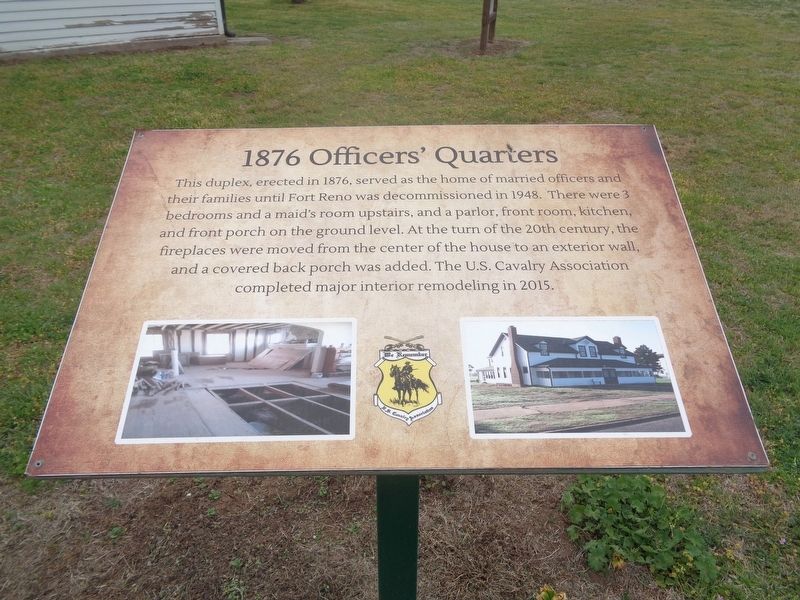
Photographed by Jason Voigt, April 9, 2021
1. 1876 Officers' Quarters Marker
Topics. This historical marker is listed in these topic lists: Architecture • Forts and Castles. A significant historical year for this entry is 1876.
Location. 35° 33.689′ N, 98° 2.013′ W. Marker is near El Reno, Oklahoma, in Canadian County. It can be reached from N Jesse Reno Street. Marker is located at Historic Fort Reno site. Touch for map. Marker is at or near this postal address: 7107 West Cheyenne Street, El Reno OK 73036, United States of America. Touch for directions.

Regionally, this marker is in Central Oklahoma—Frontier Country and in Greater Oklahoma City. It is also in the American South, specifically on the prairies, and on the Southern
this page online
Other nearby markers. At least 8 other markers are within walking distance of this marker: Fort Reno (a few steps from this marker); a different marker also named Fort Reno (within shouting distance of this marker); The Chisholm Trail and Fort Reno (within shouting distance of this marker); Commanding Officer's Quarters/BlueSTEM AgriLearning Center (within shouting distance of this marker); School and Chapel 1885 / Home of Ben & Moka Clark 1908 - 1914 (about 300 feet away, measured in a direct line); Adjutant Office (about 500 feet away); Chapel (about 500 feet away); Victorian (about 600 feet away). Touch for a list and map of all markers in El Reno.
Regarding 1876 Officers' Quarters. The Historic Fort Reno site entrance is located off the intersection of old Highway 66 and Business Route 40/OK-66, on Old Highway 66. The actual site with the structures and Visitors Center is 1.5 miles north of
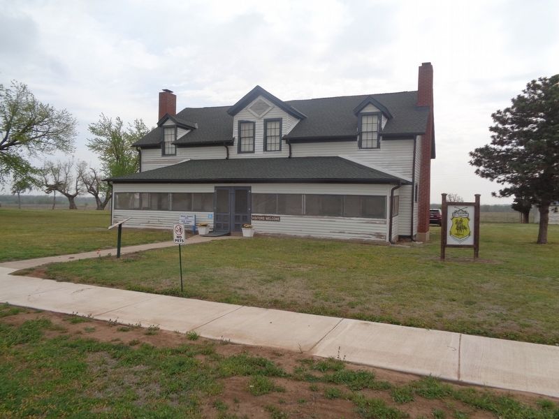
Photographed by Jason Voigt, April 9, 2021
2. 1876 Officers' Quarters Marker
Also see . . . Historic Fort Reno. Official website. Contains lots of history and photos. Fort Reno is a historic military post established in 1874 to protect the Cheyenne and Arapaho tribes. It would later become an agricultural research station, and a German prisoner of war camp during World War II. The site has a visitors center, a walking tour, cemetery, and holds events throughout the year. (Submitted on April 16, 2021, by Jason Voigt of Glen Carbon, Illinois.)
Credits. This page was last revised on November 25, 2024. It was originally submitted on April 16, 2021, by Jason Voigt of Glen Carbon, Illinois. This page has been viewed 313 times since then and 23 times this year. Photos: 1, 2. submitted on April 16, 2021, by Jason Voigt of Glen Carbon, Illinois.
