St. Matthews in Jefferson County, Kentucky — The American South (East South Central)
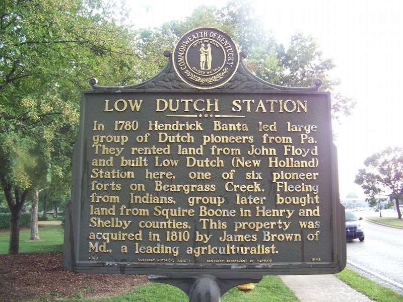
Low Dutch Station
Erected 1989 by Kentucky Historical Society and Kentucky Department of Highways. (Marker Number 1848.)
Topics and series. This historical marker is listed in this topic list: Settlements & Settlers. In addition, it is included in the Kentucky Historical Society series list. A significant historical year for this entry is 1780.
Location. Marker has been reported missing. It was located near 38° 14.423′ N, 85° 38.182′ W. Marker was in St. Matthews, Kentucky, in Jefferson County. Marker was on Kresge Way, 0.1 miles west of Browns Lane, on the right when traveling east. Touch for map. Marker was at or near this postal address: 415 Kresge Way, Louisville KY 40207, United States of America. Touch for directions.
Other nearby markers. At least 8 other markers are within 2 miles of this location, measured as the crow flies. James Brown House (approx. ¼ mile away); Lewis and Clark in Kentucky / Charles Floyd (approx. half a mile away); Floyd's Station (approx. half a mile away); John Floyd's Grave (approx. half a mile away); Beargrass Baptist Church (approx. 0.8 miles away); Bowman Field - East (approx. 1.3 miles away); Rebecca Rosenthal Judah 1866-1932 / National Council of Jewish Women (approx. 1.3 miles away); Gilman's Point / St. Matthews (approx. 1.4 miles away). Touch for a list and map of all markers in St. Matthews.
Also see . . . Low Dutch Station (Wikipedia). (Submitted on April 17, 2021, by Duane and Tracy Marsteller of Murfreesboro, Tennessee.)
Credits. This page was last revised on August 9, 2021. It was originally submitted on April 17, 2021, by Duane and Tracy Marsteller of Murfreesboro, Tennessee. This page has been viewed 237 times since then and 20 times this year. Photo 1. submitted on April 17, 2021, by Duane and Tracy Marsteller of Murfreesboro, Tennessee.
Editor’s want-list for this marker. Wide shot of marker and surrounding area in context. • Can you help?
