South Side in Houston in Harris County, Texas — The American South (West South Central)
Trinity East United Methodist Church
Photographed by James Hulse, April 16, 2021
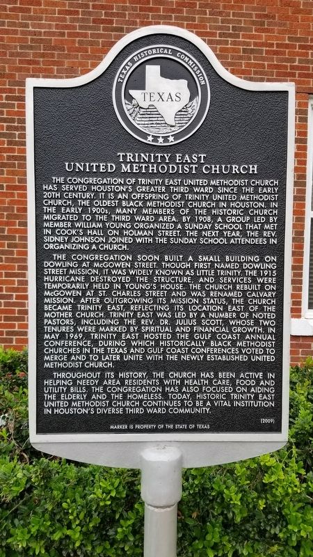
1. Trinity East United Methodist Church Marker
The congregation of Trinity East United Methodist Church has served Houston's Greater Third Ward since the early 20th century. It is an offspring of Trinity United Methodist Church, the oldest black Methodist Church in Houston. In the early 1900s, many members of the historic church migrated to the Third Ward area. By 1908, a group led by member William Young organized a Sunday school that met in Cook's hall on Holman Street. The next year, the Rev. Sidney Johnson joined with the Sunday school attendees in organizing a church.
The congregation soon built a small building on Dowling at McGowen Street. Though first named Dowling Street Mission, it was widely known as Little Trinity. The 1915 hurricane destroyed the structure, and services were temporarily held in Young's house. The church rebuilt on McGowen at St. Charles Street and was renamed Calvary Mission after outgrowing its mission status, the church became Trinity East, reflecting its location east of the mother church. Trinity East was led by a number of noted pastors, including the Rev. Dr. Julius Scott, whose two tenures were marked by spiritual and financial growth. In May 1969, Trinity East hosted the Gulf Coast Annual Conference, during which historically black Methodist churches in the Texas and Gulf Coast Conferences voted to merge and to later unite with the newly established United Methodist Church.
Throughout its history, the church has been active in helping needy area residents with health care, food and utility bills. The congregation has also focused on aiding the elderly and the homeless. Today, historic Trinity East United Methodist Church continues to be a vital institution in Houston's diverse Third Ward community.
Erected 2009 by Texas Historical Commission. (Marker Number 15796.)
Topics. This historical marker is
this page online
Location. 29° 44.251′ N, 95° 21.693′ W. Marker is in Houston, Texas, in Harris County. It is in the South Side. It is at the intersection of McGowen Street and St. Charles Street, on the left when traveling west on McGowen Street. Touch for map. Marker is at or near this postal address: 2418 McGowen Street, Houston TX 77004, United States of America. Touch for directions.

Regionally, this marker is in the American South and on the Gulf Coast. Globally, it is in North America, a Gulf of Mexico state, the Western Hemisphere, the Western World, and the Anglosphere. Historically, it finds itself in what was once New Spain, the Republic of Texas, one of the Confederate States of America, and the Antebellum South.
Other nearby markers. At least 8 other markers are within walking distance of this marker: St. John Missionary Baptist Church (about 400 feet away, measured in a direct line); Grand Court Order of Calanthe of Texas (about 400 feet away); Reverend David Elias Dibble (approx. 0.2 miles
Photographed by James Hulse, April 16, 2021
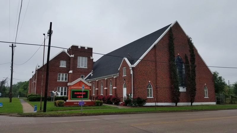
2. The view of the Trinity East United Methodist Church and Marker from across the street
Credits. This page was last revised on February 1, 2023. It was originally submitted on April 18, 2021, by James Hulse of Medina, Texas. This page has been viewed 683 times since then and 60 times this year. Photos: 1, 2. submitted on April 19, 2021, by James Hulse of Medina, Texas.
