Elizabethtown in Hardin County, Kentucky — The American South (East South Central)
Severns Valley Baptist Church
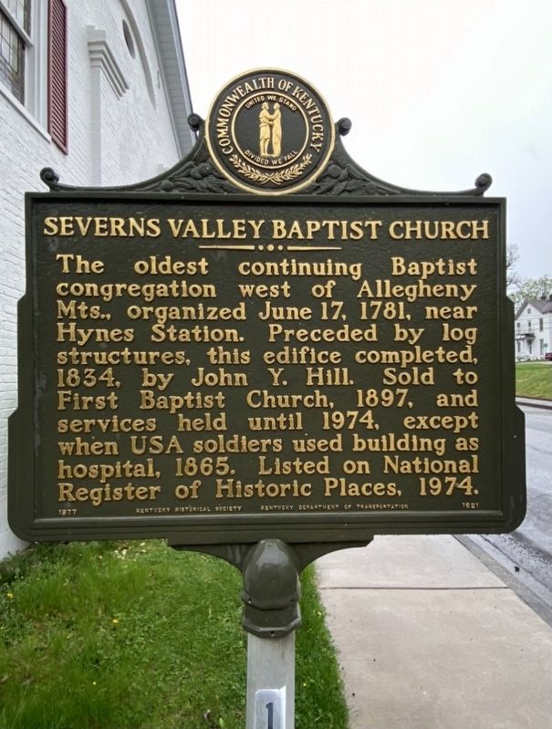
Photographed by Darren Jefferson Clay, April 10, 2021
1. Severns Valley Baptist Church Marker
Erected 1977 by Kentucky Historical Society and Kentucky Department of Highways. (Marker Number 1621.)
Topics and series. This historical marker is listed in this topic list: Religion & Religious Structures. In addition, it is included in the Kentucky Historical Society series list.
Location. 37° 41.677′ N, 85° 51.474′ W. Marker is in Elizabethtown, Kentucky, in Hardin County. It is on West Poplar Street just west of Cherry Alley, on the right when traveling east. Touch for map. Marker is at or near this postal address: 112 W Poplar St, Elizabethtown KY 42701, United States of America. Touch for directions.

Regionally, this marker is in the American South and specifically in the Upper South. Globally,
this page online
Other nearby markers. At least 8 other markers are within walking distance of this marker: Brown-Pusey House (about 300 feet away, measured in a direct line); Commodore Joshua Barney / First Brick House (about 300 feet away); Bricks and Mortar of Elizabethtown's Early Economy (about 400 feet away); Bicentennial Observance of the Birth of President Abraham Lincoln (about 400 feet away); Marriage of Thomas Lincoln (about 400 feet away); Battle of Elizabethtown (about 400 feet away); 23 Public Square (about 400 feet away); 'Ordinary' Hospitality Here (about 400 feet away). Touch for a list and map of all markers in Elizabethtown.
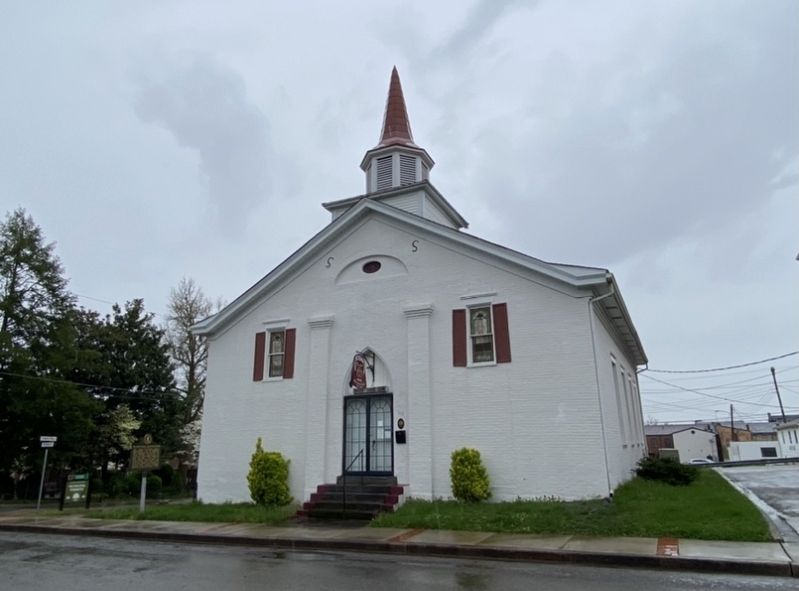
Photographed by Darren Jefferson Clay, April 10, 2021
2. Severns Valley Baptist Church Marker
Credits. This page was last revised on April 24, 2021. It was originally submitted on April 19, 2021, by Darren Jefferson Clay of Duluth, Georgia. This page has been viewed 744 times since then and 49 times this year. Photos: 1, 2. submitted on April 19, 2021, by Darren Jefferson Clay of Duluth, Georgia. • Devry Becker Jones was the editor who published this page.
