Near Corinne in Box Elder County, Utah — The American Mountains (Southwest)
Big Fill Trail

Photographed By Barry Swackhamer, August 27, 2014
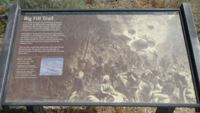
1. Big Fill Trail Marker
Before your hike
Hiking time - about 1 hour
Take drinking water.
Metal detectors, firearms, and artifact collecting are prohibited
Wear a hat; there is no shade.
Watch you step. Slopes off the grade are loose and rocky.
Prepare for mosquitoes and ticks.
Rattlesnakes have the right-of-way.
Hiking time - about 1 hour
Take drinking water.
Metal detectors, firearms, and artifact collecting are prohibited
Wear a hat; there is no shade.
Watch you step. Slopes off the grade are loose and rocky.
Prepare for mosquitoes and ticks.
Rattlesnakes have the right-of-way.
Although the Promontory Mountains don’t look as formidable as the Wasatch Front or the Sierra Nevada to modern eyes, your hike here will show you the toughest grade for a train to pull along the entire transcontinental route from Donner Pass to the Missouri River. This 1.5-mile round trip leads to the Big Fill and the Big Trestle site. The grade is easy to walk-just 1.6 percent-thanks to the limits set in the Pacific Railroad Act of 1862.
Erected by National Park Service, U.S. Department of the Interior.
Topics. This historical marker is listed in this topic list: Railroads & Streetcars. A significant historical year for this entry is 1862.
Location. Marker has been reported permanently removed. It was located near 41° 38.231′ N, 112° 29.476′ W. Marker was near Corinne, Utah, in Box Elder County. Marker could be reached from West Golden Spike Drive North, on the right when traveling west. Touch for map. Marker was in this post office area: Corinne UT 84307, United States of America.
We have been informed that this sign or monument is no longer there and will not be replaced. This page is an archival view of what was.
Other nearby markers. At least 8 other markers are within 4 miles of this location, measured as the crow flies. A different marker also named Big Fill Trail (a few steps from this marker); The “Orange Special” Wreck (about 300 feet away, measured in a direct line); Chinese Arch (approx. 0.6 miles away); The Big Trestle (approx. 0.6 miles away); The Big Fill (approx. 0.6 miles away); The Track that United the States (approx. 0.9 miles away); The Last Cut (approx. 0.9 miles away); Irish Monument (approx. 3.4 miles away). Touch for a list and map of all markers in Corinne.
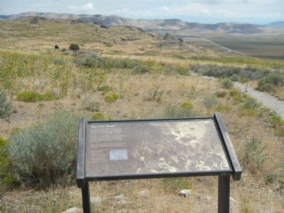
More about this marker. This marker is located at the Big Fill Trail parking lot. Pick up a guidebook at the Golden Spike National Historic Site Visitors Center.

Photographed By Harpers Illustrated
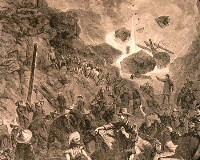
4. Background illustration on the Big Fill Trail Marker
The background illustration on this marker, taken from Harpers Illustrated, depicts an event that took place between the rival Union Pacific Central Pacific graders while they were preparing parallel tracks. As reported in the Salt Lake City Deseret Evening News on March 25, 1869:The two companies' blasters work very near each other and when Sharp & Young's men first began work, the CP would give them no warning when they fired their fuse. Jim Livingston, Sharp's able foreman, said nothing but went to work and loaded a point of rock with nitro-glycerine, and without saying anything to the CP "let her rip." The explosion was terrific. The report was heard on the Dry Tortugas, and the foreman of the CP came down to confer with Mr. Livingston about the necessity of each party notifying the other when ready for a blast. The matter was speedily arranged to the satisfaction of both parties.
Credits. This page was last revised on April 20, 2021. It was originally submitted on February 21, 2015, by Barry Swackhamer of Brentwood, California. This page has been viewed 621 times since then and 45 times this year. Last updated on April 19, 2021, by Connor Olson of Kewaskum, Wisconsin. Photos: 1, 2, 3, 4. submitted on February 21, 2015, by Barry Swackhamer of Brentwood, California. • J. Makali Bruton was the editor who published this page.

