Near Corinne in Box Elder County, Utah — The American Mountains (Southwest)
Original Rail

Photographed By Connor Olson, April 16, 2021
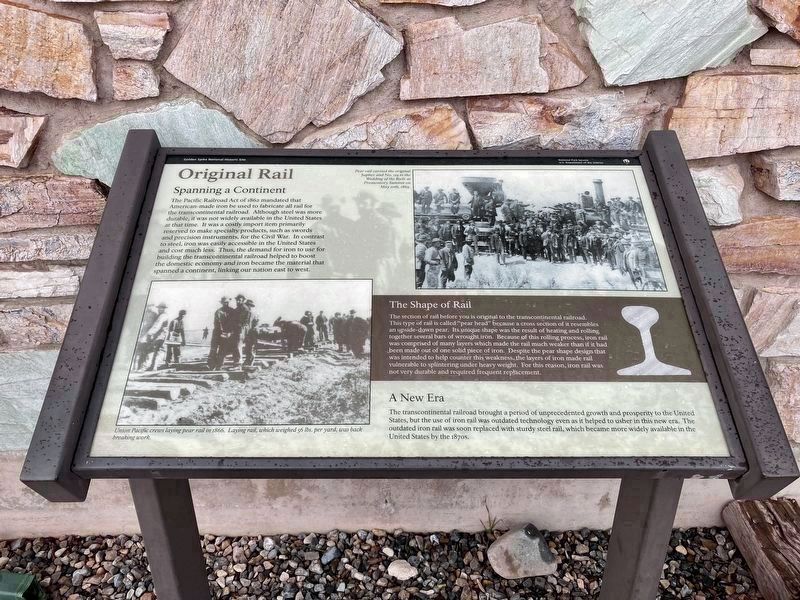
1. Original Rail Marker
Photo Captions: Pear rail carried the original Jupiter and No. 119 to the Wedding of the Rails at Promontory Summit on May 10th, 1869.
Union Pacific crews laying pear rail in 1866. Laying rail, which weighed 56 lbs. per yard, was back breaking work.
Union Pacific crews laying pear rail in 1866. Laying rail, which weighed 56 lbs. per yard, was back breaking work.
Spanning a Continent
The Pacific Railroad Act of 1862 mandated that American-made iron be used to fabricate all rail for the transcontinental railroad. Although steel was more durable, it was not widely available in the United States at that time. It was a costly import item primarily reserved to make specialty products, such as swords and precision instruments, for the Civil War. In contrast to steel, iron was easily accessible in the United States and cost much less. Thus, the demand for iron to use for building the transcontinental railroad helped to boost the domestic economy and iron became the material that spanned a continent, linking our nation east to west.
The Shape of Rail
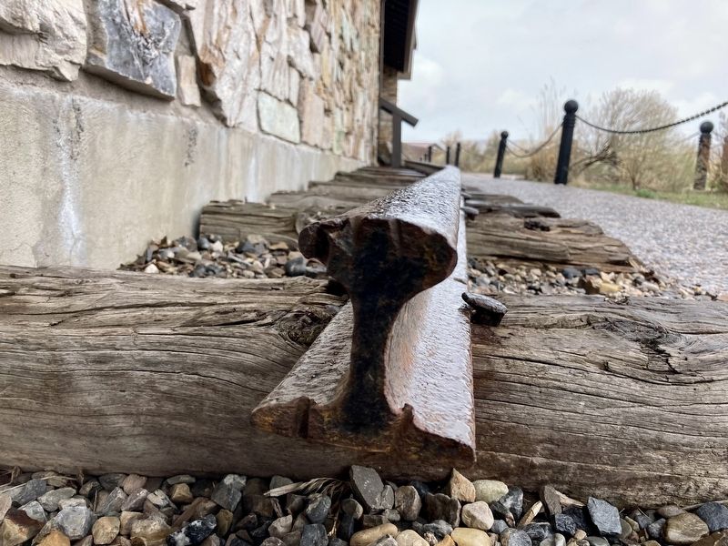
The section of rail before you is original to the transcontinental railroad.
This type of rail is called "pear head” because a cross section of it resembles
an upside-down pear. Its unique shape was the result of heating and rolling
together several bars of wrought iron. Because of this rolling process, iron rail
was comprised of many layers which made the rail much weaker than if it had
been made out of one solid piece of iron. Despite the pear shape design that
was intended to help counter this weakness, the layers of iron made rail
vulnerable to splintering under heavy weight. For this reason, iron rail was
not very durable and required frequent replacement.
A New Era
The transcontinental railroad brought a period of unprecedented growth and prosperity to the United States, but the use of iron rail was outdated technology even as it helped to usher in this new era. The outdated iron rail was soon replaced with sturdy steel rail, which became more widely available in the United States by the 1870s.
Erected by National Park Service, Department of the Interior.
Topics. This historical marker is listed in this topic list: Railroads & Streetcars. A significant historical year for this entry is 1862.
Location. 41° 37.054′ N, 112° 33.048′ W. Marker is near Corinne, Utah, in Box Elder County. Marker can be reached from North Golden Spike Drive West. Located on the north side of the visitor center. Touch for map. Marker is at or near this postal address: 6200 North 22300 West, Corinne UT 84307, United States of America. Touch for directions.
Other nearby markers. At least 8 other markers are within walking distance of this marker. Irish Monument (a few steps from this marker); Evolution of Rail (a few steps from this marker); Transforming Communication: from Coast to Coast (a few steps from this marker); Competition 1869 (a few steps from this marker); Last Spike Driven (a few steps from this marker); Golden Spike (within shouting distance of this marker); The Southern Pacific Monument (within shouting distance of this marker); Stephen Tyng Mather (within shouting distance of this marker). Touch for a list and map of all markers in Corinne.
Credits. This page was last revised on April 28, 2021. It was originally submitted on April 19, 2021, by Connor Olson of Kewaskum, Wisconsin. This page has been viewed 351 times since then and 74 times this year. Photos: 1, 2. submitted on April 19, 2021, by Connor Olson of Kewaskum, Wisconsin. • Syd Whittle was the editor who published this page.
Editor’s want-list for this marker. Wide area view of the marker and its surroundings. • Can you help?
