Coloma in El Dorado County, California — The American West (Pacific Coastal)
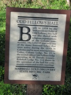
Odd Fellows Hall
Photographed by Syd Whittle, March 17, 2009
1. Odd Fellows Hall Marker
Erected by Marshall Gold Discovery State Historic Park.
Topics. This historical marker is listed in these topic lists: Fraternal or Sororal Organizations • Notable Buildings • Notable Places • Settlements & Settlers. A significant historical year for this entry is 1854.
Location. This marker has been replaced by another marker nearby. It was located near 38° 47.972′ N, 120° 53.391′ W. Marker was in Coloma, California, in El Dorado County. It was on Highway 49 (Main Street), on the left when traveling north. Marker and site are located within the boundaries of the Marshall Gold Discovery State Historic Park. Touch for map. Marker was in this post office
this page online

Regionally, it was in North America, on the Ring of Fire, on the Pacific Rim, in the Western Hemisphere, in the Western World, and in the Anglosphere. Historically, it found itself in what was once New Spain and also Mexico’s Alta California.
Other nearby markers. At least 8 other markers are within walking distance of this location: Kane House (a few steps from this marker); Site of Virginia Saloon (a few steps from this marker); Robert Bell's Store (a few steps from this marker); Coloma (a few steps from this marker); El Dorado Bath House and Shaving Saloon (within shouting distance of this marker); Papini House (within shouting distance of this marker); County Courthouse (within shouting distance of this marker); Site of the Sierra Nevada House (within shouting distance of this marker). Touch for a list and map of all markers in Coloma.
Other markers no longer nearby. Coloma’s Largest Brick Store (was a few steps from this marker but has been replaced with another marker now near it); a different marker also named Robert Bell's Store (was a few
Photographed by Syd Whittle, March 17, 2009
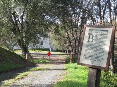
2. Odd Fellows Hall Marker
More about this marker. The marker has been removed and replaced by a different marker.
Also see . . .
1. Town Tour. An easy half mile walk along Main Street. This is the area occupied by the historic town of Coloma. There are signs at each site and structure giving a brief description and history. (Submitted on March 17, 2009, by Syd Whittle of Mesa, Arizona.)
2. Marshall Gold Discovery State Historic Park Site Map. Mapping locations of historic sites and buildings in Coloma. (Submitted on March 18, 2009, by Syd Whittle of Mesa, Arizona.)
Additional keywords. Gold Rush
Photographed by Syd Whittle, March 17, 2009
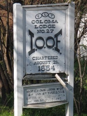
3. Odd Fellows Hall Driveway Entrance Sign
Photographed by Syd Whittle, March 17, 2009
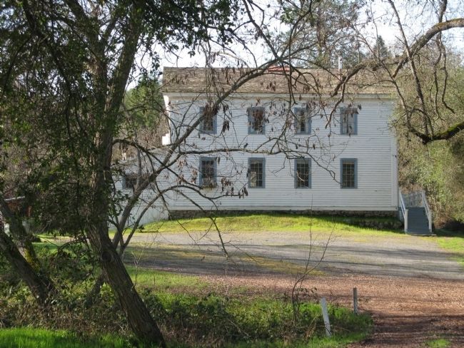
4. Odd Fellows Hall
Credits. This page was last revised on January 23, 2023. It was originally submitted on March 17, 2009, by Syd Whittle of Mesa, Arizona. This page has been viewed 1,689 times since then and 34 times this year. Photos: 1, 2, 3, 4. submitted on March 18, 2009, by Syd Whittle of Mesa, Arizona.
