Turner Park in Tulsa in Tulsa County, Oklahoma — The American South (West South Central)
The American Milkman
Route 66 Tulsa
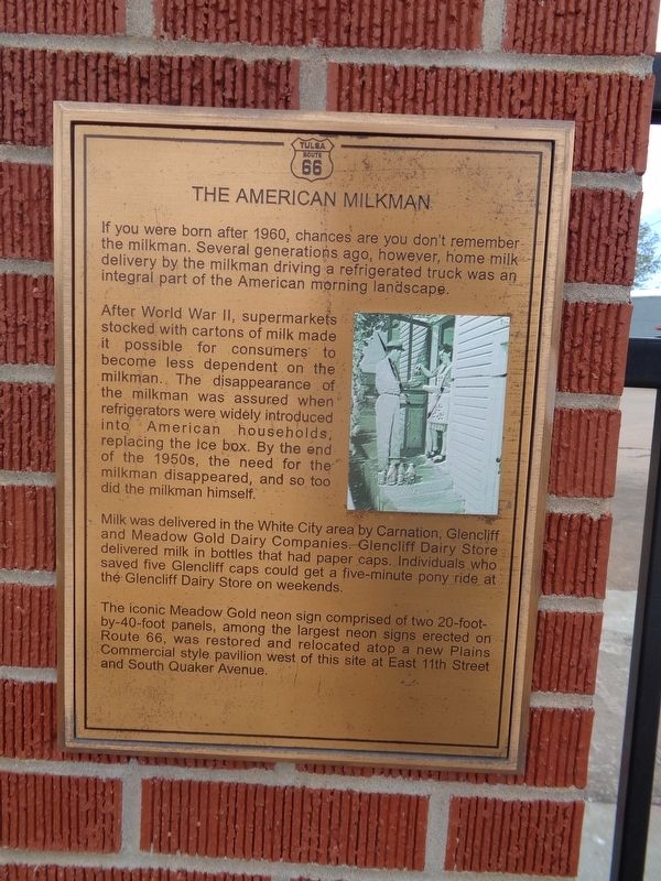
After World War II, supermarkets stocked with cartons of milk made it possible for consumers to become less dependent on the milkman. The disappearance of the milkman was assured when refrigerators were widely introduced into American households, replacing the ice box. By the end of the 1950s, the need for the milkman disappeared, and so too did the milkman himself.
Milk was delivered in the White City area by Carnation, Glencliff and Meadow Gold Dairy Companies. Glencliff Dairy Store delivered milk in bottles that had paper caps. Individuals who saved five Glencliff caps could get a five-minute pony ride at the Glencliff Dairy store on weekends.
The iconic Meadow Gold neon sign comprised of two 20-foot-by-40-foot panels, among the largest neon signs erected on Route 66, was restored and relocated atop a new Plains Commercial style pavilion west of this site at East 11th Street and South Quaker Avenue.
Erected by Vision 2025.
Topics and series. This historical marker is listed in these topic lists: Industry & Commerce • Roads & Vehicles. In addition, it is included in the U.S. Route 66 series list.
Location. 36° 8.876′ N, 95° 55.338′ W. Marker is in Tulsa, Oklahoma, in Tulsa County. It is in Turner Park. Marker is at the intersection of South Yale Avenue and East 11th Street (Old U.S. 66), on the right when traveling north on South Yale Avenue. Touch for map. Marker is at or near this postal address: 1009 S Yale Ave, Tulsa OK 74112, United States of America. Touch for directions.
Other nearby markers. At least 8 other markers are within walking distance of this marker. The Era of World War II (here, next to this marker); White City Historic District Neighborhood (here, next to this marker); The Golden Drumstick Restaurant (here, next to this marker); The Fabric of a Community (within shouting distance of this marker); Pearls Along the Route 66 Highway (within shouting distance of this marker); Expo Square (within shouting distance of this marker); Auto Dealerships (approx. 0.2 miles away); Cyrus Avery (approx. 0.9 miles away). Touch for a list and map of all markers in Tulsa.
Additional keywords. dairy industry
Credits. This page was last revised on February 16, 2023. It was originally submitted on April 20, 2021, by Jason Voigt of Glen Carbon, Illinois. This page has been viewed 375 times since then and 73 times this year. Photos: 1, 2. submitted on April 20, 2021, by Jason Voigt of Glen Carbon, Illinois.

