Marker Logo HMdb.org THE HISTORICAL
MARKER DATABASE
“Bite-Size Bits of Local, National, and Global History”
Sevierville in Sevier County, Tennessee — The American South (East South Central)
 

The McMahan Indian Mound


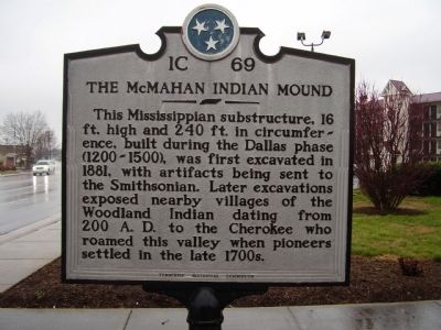
The McMahan Indian Mound Marker image. Click for full size.
Photographed By Stanley and Terrie Howard, March 14, 2009
1. The McMahan Indian Mound Marker
Inscription. This Mississippian substructure,16 ft. high and 240 ft.in circumference, built during the Dallas phase (1200-1500), was first excavated in 1881, with artifacts being sent to the Smithsonian. Later excavations exposed nearby villages of the Woodland Indian dating from 200 A.D. to the Cherokee who roamed this valley when pioneers settled in the late 1700s.
 
Erected by Tennessee Historical commission. (Marker Number 1C 69.)
 
Topics and series. This historical marker is listed in this topic list: Native Americans. In addition, it is included in the Tennessee Historical Commission series list. A significant historical year for this entry is 1881.
 
Location. 35° 51.837′ N, 83° 34.048′ W. Marker is in Sevierville, Tennessee, in Sevier County. Marker is on Chapman Hwy /The Great Smoky Mountains Hwy. (Route 441), on the right when traveling south. Touch for map. Marker is in this post office area: Sevierville TN 37862, United States of America. Touch for directions.
 
Other nearby markers. At least 8 other markers are within walking distance of this marker. Dwight and Kate Wade House (approx. 0.2 miles away); Sevierville (approx. ¼ mile away); Historic Jail Bars (approx. ¼ mile away); Sevier County Veterans (approx. ¼ mile away); a different marker also named Sevierville (approx. ¼ mile away); a different marker
Paid Advertisement
Click on the ad for more information.
Please report objectionable advertising to the Editor.
Click or scan to see
this page online
also named Sevierville (approx. ¼ mile away); a different marker also named Sevierville (approx. 0.3 miles away); a different marker also named Sevierville (approx. 0.3 miles away). Touch for a list and map of all markers in Sevierville.
 
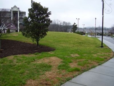
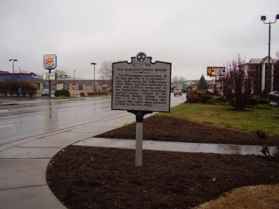
The McMahan Indian Mound Marker image. Click for full size.
Photographed By Stanley and Terrie Howard, March 14, 2009
2. The McMahan Indian Mound Marker
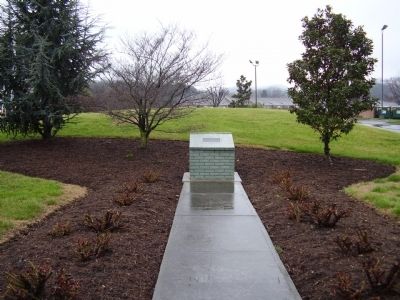
The McMahan Indian Mound Marker image. Click for full size.
Photographed By Stanley and Terrie Howard, March 14, 2009
3. The McMahan Indian Mound Marker
The McMahan Indian Mound Marker image. Click for full size.
Photographed By Stanley and Terrie Howard, March 14, 2009
4. The McMahan Indian Mound Marker
The McMahan Indian Mound Marker image. Click for full size.
Photographed By Stanley and Terrie Howard, March 4, 2009
5. The McMahan Indian Mound Marker
The McMahan Indian Mound from Rivertrail Ln. image. Click for full size.
Photographed By Lou Claudio, July 2015
6. The McMahan Indian Mound from Rivertrail Ln.
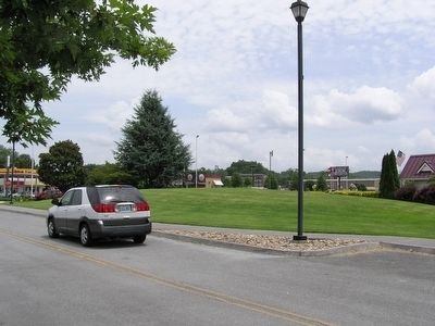
The McMahan Indian Mound image. Click for full size.
Photographed By Lou Claudio, July 2015
7. The McMahan Indian Mound
Hotel at right
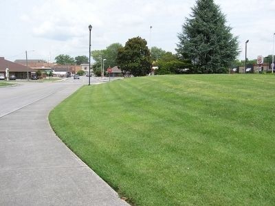
The McMahan Indian Mound; Rivertrail Ln. at left image. Click for full size.
Photographed By Lou Claudio, July 2015
8. The McMahan Indian Mound; Rivertrail Ln. at left
The McMahan Indian Mound image. Click for full size.
Photographed By Lou Claudio, July 2015
9. The McMahan Indian Mound
 
 
Credits. This page was last revised on June 16, 2016. It was originally submitted on March 19, 2009, by Stanley and Terrie Howard of Greer, South Carolina. This page has been viewed 2,443 times since then and 60 times this year. Photos:   1, 2, 3, 4, 5. submitted on March 19, 2009, by Stanley and Terrie Howard of Greer, South Carolina.   6, 7, 8, 9. submitted on August 9, 2015, by Lou Claudio of Safety Harbor, Florida. • Craig Swain was the editor who published this page.
Share this page.  
Share on Tumblr
m=17194

CeraNet Cloud Computing sponsors the Historical Marker Database.
This website earns income from purchases you make after using our links to Amazon.com. We appreciate your support.
Paid Advertisement
Apr. 26, 2024