Pioneer Pavilion
Built in 2018
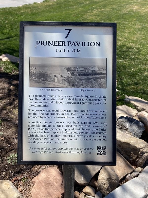
The bowery was rebuilt several times until it was replaced by the first tabernacle. In the 1860's that tabernacle was replaced by what is known today as the Mormon Tabernacle.
A replica pioneer bowery was built here in 1995, with
materials similar to those used on the first bowery of
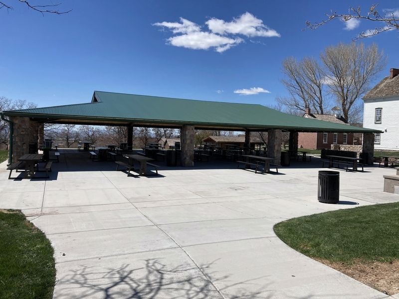
1847. Just as the pioneers replaced their bowery, the Park's
bowery has been replaced with a new pavilion, constructed
with the best of modern materials. Now guests can enjoy
the Pioneer Pavilion for family reunions, corporate parties,
wedding receptions and more.
Erected by This Is The Place Foundation. (Marker Number 7.)
Topics. This historical marker is listed in these topic lists: Religion & Religious Structures • Settlements & Settlers. A significant historical year for this entry is 1847.
Location. 40° 45.192′ N, 111° 48.976′ W. Marker is in Salt Lake City, Utah, in Salt Lake County. It is in University. It is on Main Street
this page online

Regionally, this marker is in the Wasatch Front and in Greater Salt Lake. It is also in the American Mountain West and on the Colorado Plateau. Globally, it is in North America, the Rocky Mountains, the Western Hemisphere, the Western World, and the Anglosphere. Historically, it finds itself in what was once New Spain and also Mexico’s Alta California.
Other nearby markers. At least 8 other markers are within walking distance of this marker: Smoot Hall at Brigham Young Academy (within shouting distance of this marker); Pine Valley Chapel (within shouting distance of this marker); Orson Pratt Observatory (within shouting distance of this marker); John Gardiner Cabin (within shouting distance of this marker); Sesquicentennial Mormon Trail Wagontrain (within shouting distance of this marker); Thomas Phillip White Cabin (about 300 feet away, measured in a direct line); Andrus Halfway House and Farm (about 300 feet away); Jewkes-Draper Home (about
Credits. This page was last revised on February 16, 2023. It was originally submitted on April 27, 2021, by Connor Olson of Menomonee Falls, Wisconsin. This page has been viewed 402 times since then and 35 times this year. Photos: 1, 2. submitted on April 27, 2021, by Connor Olson of Menomonee Falls, Wisconsin. • Syd Whittle was the editor who published this page.
Editor’s want-list for this marker. Wide area view of the marker and its surroundings. • Can you help?
