Salem Square
Old Salem Museums & Gardens
— 1766 —
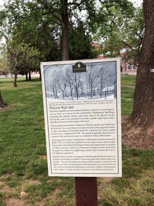
From the inception of a town plan for Salem, a square, or central green, was to serve as a focus for the community. Institutional buildings, including the church, schools, and store, were to be placed around the Square, and it was planned to be both a public open space and a significant feature in the design of the town.
During initial construction of Salem in 1766, the square was shifted one block north. Two years later, it was moved back to the original location to take advantage of elevation needs for a gravity-fed water system for the town, completed in 1778. The pump (originally placed over a cistern) at the southwest corner is a reminder of this achievement.
As planned open space, construction on the Square has been restricted. In the 1770s, a sundial on a pedestal was set in place and a stone Corpse House built. The Market-Fire Engine House (reconstructed) was added in 1803 to provide a place for community members to buy fresh meat brought in to Salem by neighboring farmers and to house the town's fire-fighting equipment.
Initially, there was only one diagonal walk through the Square; however, in a time a crosswalk was added. Fences and gates have been replaced as needed. The present landscape reflects features common to the Square over time, including early documentation for a circle of trees at the center
and perimeter plantings of sycamores, lindens, tulip poplars, and catalpas. A circle of cedars is shown in the 1840 painting above.Erected by Old Salem Museums & Gardens.
Topics. This historical marker is listed in this topic list: Settlements & Settlers. A significant historical year for this entry is 1766.
Location. 36° 5.205′ N, 80° 14.494′ W. Marker is in Winston-Salem, North Carolina, in Forsyth County. Marker is on West Street Southwest just west of Church Street South, on the right when traveling west. Touch for map. Marker is at or near this postal address: 10 West St SW, Winston Salem NC 27101, United States of America. Touch for directions.
Other nearby markers. At least 8 other markers are within walking distance of this marker. First Official 4th of July Celebration in the United States (within shouting distance of this marker); Old Salem Historic District (within shouting distance of this marker); Historic Scaffold System (about 300 feet away, measured in a direct line); Single Brothers' Diaconie (about 300 feet away); Street Grade (about 300 feet away); The Salem Campus (about 400 feet away); Commemorating the Original Krispy Kreme Doughnut Shop (about 400 feet away); Garden on the Triebel Lot (about 400 feet away). Touch for a list and map of all markers in Winston-Salem.
Credits. This page was last revised on April 27, 2021. It was originally submitted on April 27, 2021, by Devry Becker Jones of Washington, District of Columbia. This page has been viewed 144 times since then and 24 times this year. Photos: 1, 2. submitted on April 27, 2021, by Devry Becker Jones of Washington, District of Columbia.

