Tulsa in Tulsa County, Oklahoma — The American South (West South Central)
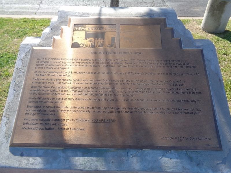
The Motoring Public 1926
At the first meeting of the U.S. Highway Association the next February (1927), Avery's proposal and motion made U.S. Route 66 "The Main Street of America".
Early vacationers and families headed east and west. Many stopped briefly at this point - the marvelous Crystal City Amusement Park - for picnics, rides on the impressive Zingo rollercoaster, and dancing at the Casa Loma Ballroom.
With the Great Depression, it became a concourse of desperation - yet hope - for Dust-Bowl-driven seekers of any new and possible opportunity. For the Great War, it became a conduit for military equipment and personnel. It welcomed home members of the Greatest Generation and carried their young families to new beginnings.
Route 66 starred in a mid-century American hit song and popular television adventure series which is still seen regularly by viewers around the world.
Ever since, it carries the fruits of American manufacturing and ingenuity, trucking goods directed by an invisible internet, and accommodates rights-of-way for fiber-optically conducting data and financial transactions alongside many other pathways for the Age of Information.
And, most recently it brought you to this place. You are here:
Welcome to Red Fork - Tulsa!
Mvskoke/Creek Nation - State of Oklahoma
Erected 2014 by Vision 2025.
Topics and series. This historical marker is listed in these topic lists: Roads & Vehicles • Settlements & Settlers. In addition, it is included in the U.S. Route 66 series list. A significant historical month for this entry is November 1926.
Location. 36° 6.119′ N, 96° 1.596′ W. Marker is in Tulsa, Oklahoma, in Tulsa County. Marker is on Southwest Boulevard north of West 43rd Place, on the right when traveling east. Located in front of the Crystal City Shopping Center. Touch for map. Marker is at or near this postal address: 4247 Southwest Blvd, Tulsa OK 74107, United States of America. Touch for directions.
Other nearby markers. At least 8 other markers are within walking distance of this marker. A New Century 1901-1926 (here, next to this marker); Transition 1866-1901 (a few steps from this marker); Settlement of the Nations 1836-1866 (a few steps from this marker); Crystal City (a few steps from this marker); First Oil Well in Tulsa County
(approx. ¼ mile away); Red Fork (approx. 0.3 miles away); Route 66 Historical Village (approx. 0.7 miles away); Clinton Heights (approx. 0.8 miles away). Touch for a list and map of all markers in Tulsa.
Credits. This page was last revised on April 28, 2021. It was originally submitted on April 28, 2021, by Jason Voigt of Glen Carbon, Illinois. This page has been viewed 167 times since then and 19 times this year. Photos: 1, 2. submitted on April 28, 2021, by Jason Voigt of Glen Carbon, Illinois.

