Roanoke Railway and Electric Company
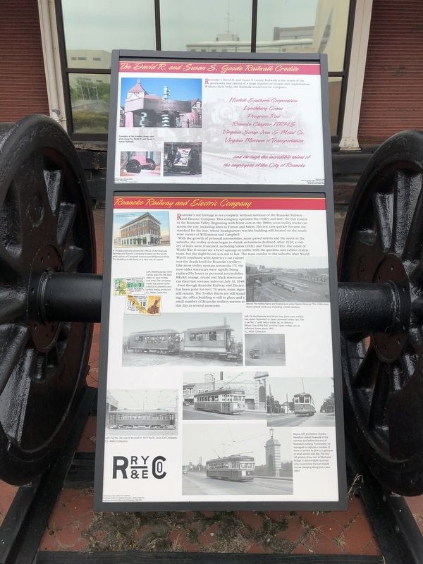
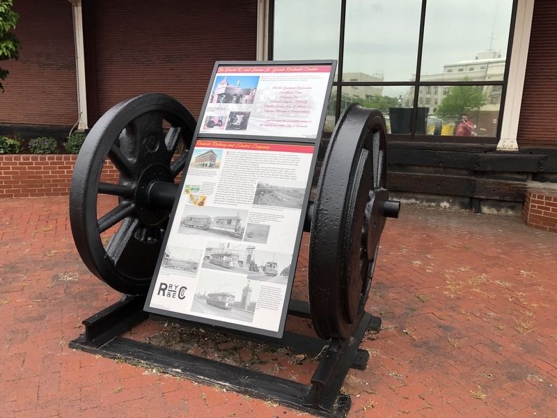
Roanoke's rail heritage is not complete without mention of the Roanoke Railway and Electric Company. This company operated the trolley and later the bus system in the Roanoke Valley. Beginning with horse cars in the 1880s, soon trolley tracks ran across the city, including lines to Vinton and Salem. Electric cars quickly became the standard for the line, whose headquarters was the building still located on the southwest corner of Williamson and Campbell.
With the growth of personal automobiles, more paved streets and the move to the suburbs, the trolley system began to shrink as business declined. After 1930, a variety of lines were truncated, including Salem (1931) and Vinton (1940). The onset of World War II would see a brief upsurge in traffic with the gasoline and rubber restrictions, but the slight boom was not to last. The mass exodus to the suburbs after World War II combined with America's car culture was the death knell for Roanoke's trolleys. Like most trolley systems across the US, the now older streetcars were rapidly being replaced by buses or personal automobiles. RRy&E orange, cream and black streetcars
this page online
Even though Roanoke Railway and Electric has been gone for over 70 years, some signs still remain. The Trolley Barns are still standing, the office building is still in place and a small number of Roanoke trolleys survive to this day in several museums.
Topics. This historical marker is listed in these topic lists: Railroads & Streetcars • Roads & Vehicles • War, World II. A significant historical date for this entry is July 31, 1948.
Location. 37° 16.37′ N, 79° 56.711′ W. Marker is in Roanoke, Virginia. It is in Downtown. It is on Salem Avenue Southwest just east of 3rd Street Southwest, on the right when traveling west. Touch for map. Marker is at or near this postal address: 215 Salem Ave SW, Roanoke VA 24016, United States of America. Touch for directions.
Regionally, this marker is in the Mountain Region and in Southwest Virginia. It is also in the American South and specifically in the Upper South. Globally, it is in North America, the Western Hemisphere, the Western World, and the Anglosphere. Historically, it finds itself in what was once the territory of the Mississippian
Other nearby markers. At least 8 other markers are within walking distance of this marker: The David R. and Susan S. Goode Railwalk (within shouting distance of this marker); Jupiter Missile (within shouting distance of this marker); Virginia Museum of Transportation / Norfolk and Western Freight Station (within shouting distance of this marker); Graham-White Manufacturing Company (within shouting distance of this marker); Norfolk & Western Safety Instruction Car #418 (within shouting distance of this marker); Locomotive Parking Brakes (within shouting distance of this marker); Norfolk & Western Freight Station (within shouting distance of this marker); Pennsylvania Railroad GE GG1 Electric #4919 (within shouting distance of this marker). Touch for a list and map of all markers in Roanoke.
Credits. This page was last revised on February 1, 2023. It was originally submitted on April 29, 2021, by Devry Becker Jones of Washington, District of Columbia. This page has been viewed 1,219 times since then and 103 times this year. Photos: 1, 2. submitted on April 29, 2021, by Devry Becker Jones of Washington, District of Columbia. 3. submitted on May 29, 2021, by Kevin W. of Stafford, Virginia.
