Near Webbtown in Clarke County, Virginia — The American South (Mid-Atlantic)
Col. Morgan's Lane
Photographed by Craig Swain, December 1, 2007
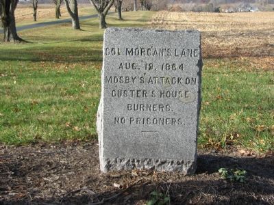
1. Col. Morgan's Lane Marker
Aug. 19, 1864
Mosby's Attack on
Custer's House
Burners.
No Prisoners
Erected by J.E.B. Stuart Chapter of the Confederate Veterans.
Topics and series. This historical marker is listed in this topic list: War, US Civil. In addition, it is included in the Sons of Confederate Veterans/United Confederate Veterans series list. A significant historical month for this entry is August 1765.
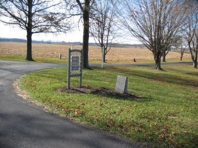
Location. 39° 7.174′ N, 77° 57.255′ W. Marker is near Webbtown, Virginia, in Clarke County. It can be reached from the intersection of Parshall Lane (County Route 608) and Hill and Dale Lane, on the right when traveling south. Located at the entrance to Hill and Dale Farms. Touch for map. Marker is at or near this postal address: 1755 Parshall Rd, Berryville VA 22611, United States of America. Touch for directions.

Regionally, this marker is in the Washington Metropolitan Area and in Northern Virginia. It is also in the American South, specifically in the Upper South, and in the Mid-Atlantic. Globally, it is in North America, the Western Hemisphere, the Western World, and the Anglosphere. Historically, it finds itself in
this page online
Other nearby markers. At least 8 other markers are within 3 miles of this marker, measured as the crow flies: Lucy Diggs Slowe (approx. 2 miles away); Milton Valley Cemetery (approx. 2 miles away); The Schools of Josephine City (approx. 2.1 miles away); Fight at Gold’s Farm (approx. 2.4 miles away); Josephine City (approx. 2.4 miles away); Berryville (approx. 2.4 miles away); Colonial Highway (approx. 2½ miles away); a different marker also named Berryville (approx. 2½ miles away).
Other markers no longer nearby. Audley (was approx. 1.9 miles away but has been reported to have been replaced with another marker now near it); a different marker also named Audley (was approx. 1.9 miles away but has been confirmed missing); a different marker also named Josephine City (was approx. 2.4 miles away but has been reported to have been replaced with another marker now near it).
More about this marker. This is one in a series of granite markers placed by the J.E.B.
Photographed by Craig Swain, December 1, 2007
2. Col. Morgan's Lane Marker
Regarding Col. Morgan's Lane. The marker references a sharp skirmish between a detachment of Mosby's Rangers under Captain William Chapman and a section of the 5th Michigan Cavalry. The Federals were detailed to burn several houses in Clarke County in response to the Ranger's operations. The "house burners" had just destroyed Colonel Morgan's home when Chapman and his band of rangers attacked, their leader ordering "no prisoners!" Records show 30 of the Federals were killed in this vicinity, including 10 who had been captured made to kneel along the farm lane where they were executed.
Photographed by Craig Swain, December 1, 2007
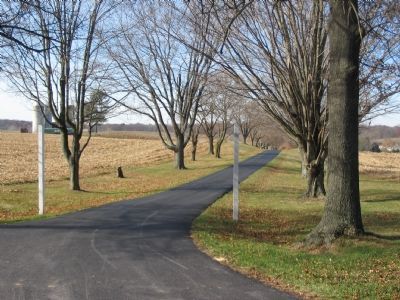
3. Colonel Morgan's Lane
At the time of the war, Colonel Benjamin Morgan operated a farm known as "Hill and Dale" here.
Credits. This page was last revised on May 3, 2021. It was originally submitted on January 6, 2008, by Craig Swain of Leesburg, Virginia. This page has been viewed 3,218 times since then and 62 times this year. Last updated on May 1, 2021, by Bradley Owen of Morgantown, West Virginia. Photos: 1, 2, 3. submitted on January 6, 2008, by Craig Swain of Leesburg, Virginia. • Bill Pfingsten was the editor who published this page.
