Columbia Forest in Arlington in Arlington County, Virginia — The American South (Mid-Atlantic)
Original Federal Boundary Stone, District of Columbia, Southwest 6
Southwest No. 6 Boundary Marker
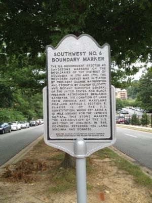
Photographed by Kevin Vincent, July 21, 2013
1. Southwest No. 6 Boundary Marker Marker
Erected 2005 by Arlington County, Virginia, paid for by Arlington County Fair.
Topics and series. This historical marker is listed in these topic lists: African Americans • Settlements & Settlers. In addition, it is included in the Daughters of the American Revolution (DAR), and the Original Federal Boundary Stones series lists. A significant historical year for this entry is 1791.
Location. 38° 51.112′ N, 77° 7.156′ W. Marker is in Arlington, Virginia, in Arlington County. It is in Columbia Forest. It is on South
this page online

Regionally, this marker is in the Washington Metropolitan Area and in Northern Virginia. It is also in the American South, specifically in the Upper South, in the Mid-Atlantic, and on the Eastern Seaboard. Globally, it is in the North Atlantic Region, North America, the Western Hemisphere, the Western World, and the Anglosphere. Historically, it finds itself in what was once the territory of the Mississippian Culture, one of the original Thirteen Colonies, one of the Confederate States of America, and the Antebellum South.
Other nearby markers. At least 8 other markers are within walking distance of this marker: Dr. Lilli Vincenz (approx. ¼ mile away); Early Engagement (approx. half a mile away); Bailey’s Crossroads (approx. 0.6 miles away); Flow Of Time (approx. 0.6 miles away); Barcroft (approx. 0.6 miles away); The Arlington Mill
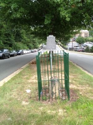
Photographed by Kevin Vincent, July 21, 2013
2. Southwest No. 6 Boundary Stone and Marker
Another marker is no longer nearby. Washington's Survey Marker (was approx. 0.7 miles away but has been confirmed missing).
More about this marker. This is not the original location of the boundary stone. It was moved from a nearby location because of street construction.
Additional keywords. Original Federal Boundary Stone SW6
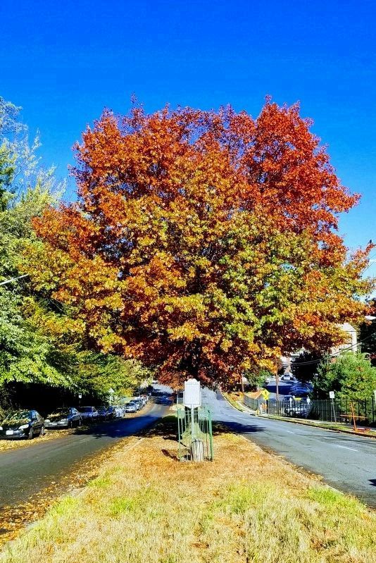
Photographed by Roberto Bernate, November 3, 2018
3. Original Federal Boundary Stone, District of Columbia, Southwest 6 Marker
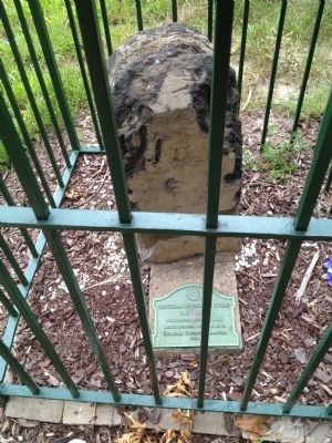
Photographed by Kevin Vincent, July 21, 2013
4. Southwest No. 6 Boundary Marker
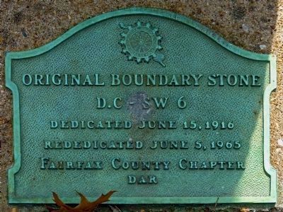
Photographed by Allen C. Browne, April 13, 2014
5. Original Boundary Stone
D.C - SW 6
Dedicated June 15, 1916
Rededicated June 5, 1965
Fairfax County Chapter
DAR
Credits. This page was last revised on February 1, 2023. It was originally submitted on July 21, 2013, by Kevin Vincent of Arlington, Virginia. This page has been viewed 1,185 times since then and 52 times this year. Last updated on May 4, 2021, by Roberto Bernate of Arlington, Virginia. Photos: 1, 2. submitted on July 21, 2013, by Kevin Vincent of Arlington, Virginia. 3. submitted on May 4, 2021, by Roberto Bernate of Arlington, Virginia. 4. submitted on July 21, 2013, by Kevin Vincent of Arlington, Virginia. 5. submitted on April 15, 2014, by Allen C. Browne of Silver Spring, Maryland. • J. Makali Bruton was the editor who published this page.
