
Medical Center in Detroit in Wayne County, Michigan — The American Midwest (Great Lakes)
Friendship Baptist Church
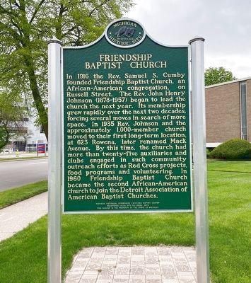
Photographed by J.T. Lambrou, May 5, 2021
1. Friendship Baptist Church Marker
Side 1
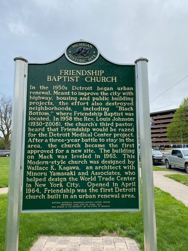
In the 1950s Detroit began urban renewal. Meant to improve the city with highway, housing and public building projects, the effort also destroyed neighborhoods, including “Black Bottom,” where Friendship Baptist was located. In 1958 the Rev. Louis Johnson (1930-2008), the church’s third pastor, heard that Friendship would be razed for the Detroit Medical Center
this page online
Erected 2018 by Michigan Historical Commission - Michigan History Center. (Marker Number L2298.)
Topics and series. This historical marker is listed in these topic lists: African Americans • Religion & Religious Structures. In addition, it is included in the Michigan Historical Commission series list. A significant historical year for this entry is 1964.
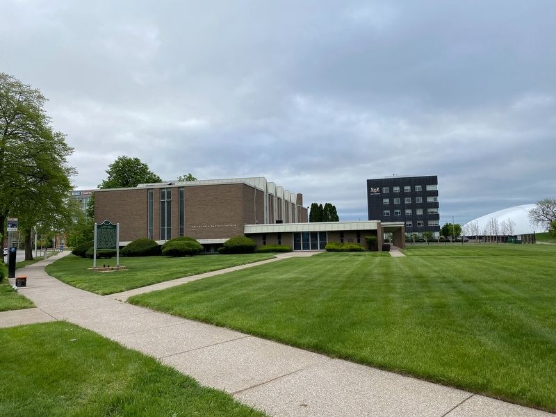
Location. 42° 21.12′ N, 83° 3.202′ W. Marker is in Detroit, Michigan, in Wayne County. It is in Medical Center. It is on Beaubien Boulevard 0.2 miles north of Mack Avenue, on the right when traveling north. Located across the street from Children's Hospital of Michigan ER. Touch for map. Marker is at or near this postal address: 3900 Beaubien Blvd, Detroit MI 48201,
Photographed by J.T. Lambrou, May 5, 2021
2. Friendship Baptist Church Marker
Side 2

Regionally, this marker is in Southeast Michigan. It is also in the American Midwest. Globally, it is in North America, on the Great Lakes, in the Western Hemisphere, in the Western World, and in the Anglosphere. Historically, it finds itself in what was once the Viceroyalty of New France and also the Northwest Territory.
Other nearby markers. At least 8 other markers are within walking distance of this marker: Recreation Park (about 600 feet away, measured in a direct line); American Academy of Pediatrics (approx. 0.2 miles away); Brewster Homes (approx. ¼ mile away); Alpha House (approx. ¼ mile away); Detroit Urban League (approx. ¼ mile away); Greater Shiloh Baptist Church (approx. ¼ mile away); St. Josaphat Roman Catholic Church Complex (approx. 0.3 miles away); The Detroit Medical College (approx. 0.3 miles away). Touch for a list and map of all markers in Detroit.
Photographed by J.T. Lambrou, May 5, 2021
3. Friendship Baptist Church Marker
Credits. This page was last revised on February 12, 2023. It was originally submitted on May 6, 2021, by J.T. Lambrou of New Boston, Michigan. This page has been viewed 1,470 times since then and 85 times this year. Photos: 1, 2, 3. submitted on May 6, 2021, by J.T. Lambrou of New Boston, Michigan. • Mark Hilton was the editor who published this page.
