Poolesville in Montgomery County, Maryland — The American Northeast (Mid-Atlantic)
Poolesville
Warm Reception
— Antietam Campaign 1862 —

Photographed By Devry Becker Jones (CC0), December 10, 2023
1. Poolesville Marker
Unfortunately, the marker has weathered. However, it remains legible.
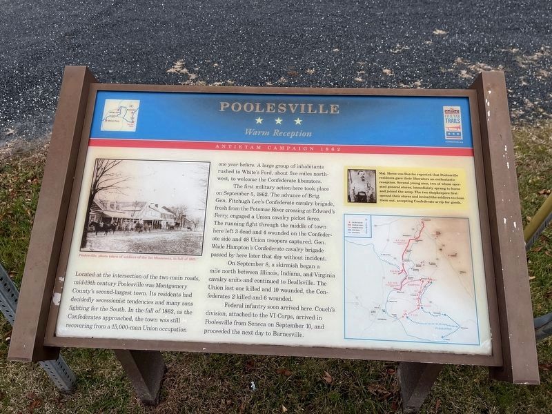
Located at the intersection of the two main roads, mid-19th century Poolesville was Montgomery County’s second-largest town. Its residents had decidedly secessionist tendencies and many sons fighting for the South. In the fall of 1862, as the Confederates approached, the town was still recovering from a 15,000-man Union occupation one year before. A large group of inhabitants rushed to White’s Ford, about five miles northwest, to welcome the Confederate liberators.
The first military action here took place on September 5, 1862. The advance of Brig. Gen. Fitzhugh Lee's Confederate cavalry brigade, fresh from the Potomac River crossing at Edward’s Ferry, engaged a Union cavalry picket force. The running fight through the middle of town here left 43 dead and 4 wounded on the Confederate side and 48 Union troopers captured. Gen. Wade Hampton’s Confederate cavalry brigade passed by here later that day without incident.
On September 8, a skirmish began a mile north between Illinois, Indiana, and Virginia cavalry units and continued to Beallsville. The Union lost one killed and 10 wounded, the Confederates 2 killed and 6 wounded.
Federal infantry soon arrived here. Couch’s division, attached to the VI Corps, arrived in Poolesville from Seneca on September 10, and proceeded the next day to Barnesville.
(Sidebar)
Maj. Heros von Borcke reported that Poolesville residents gave their liberators an enthusiastic reception. Several young men, two of whom operated general stores, immediately sprang to horse and joined the army. The two shopkeepers first opened their stores and invited the soldiers to clean them out, accepting Confederate scrip for goods.
Erected by Maryland Civil War Trails.
Topics and series. This historical marker is listed in this topic list: War, US Civil. In addition, it is included in the Maryland Civil War Trails series list. A significant historical date for this entry is September 5, 1862.
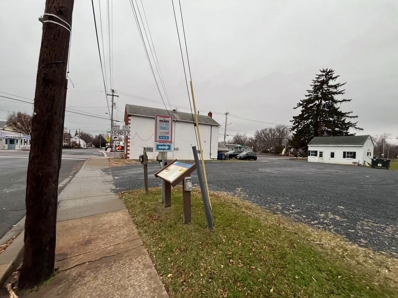
Location. 39° 8.766′ N, 77° 24.991′ W. Marker is in Poolesville, Maryland, in Montgomery County. Marker is at the intersection of Fisher Avenue / Whites Ferry Road (Maryland Route 107) and Elgin Road / Beallsville Road (Route 109), on the right on Fisher Avenue / Whites Ferry Road. Located in a parking lot one building east of the intersection. Touch for map. Marker is in this post office area: Poolesville MD 20837, United States of America. Touch for directions.
Other nearby markers. At least 8 other markers are within walking distance of this marker. Welcome to Poolesville (within shouting distance of this marker); The Old Bank Building (within shouting distance of this marker); Lynching of George W. Peck / Lynching in Maryland (within shouting distance of this marker); a different marker also named
Poolesville (within shouting distance of this marker); The Civil War at Poolesville (about 400 feet away, measured in a direct line); Historic Poolesville (about 600 feet away); St. Peter's Church (about 800 feet away); 20101 Fisher Avenue (approx. 0.2 miles away). Touch for a list and map of all markers in Poolesville.
More about this marker. The marker displays a picture of Poolesville taken by a soldier of the 1st Minnesota Infantry in the fall of 1861. The sidebar contains a portrait of Maj. Heros von Borcke. A map follows the movements through the early phases of the Antietam campaign.
Regarding Poolesville. Although none of the buildings along Fisher Avenue date to the war, Poolesville features several buildings dating to the early 20th century.
Also see . . . Poolesville Historic District. (Submitted on June 27, 2019, by Allen C. Browne of Silver Spring, Maryland.)
Credits. This page was last revised on December 10, 2023. It was originally submitted on July 15, 2007, by Craig Swain of Leesburg, Virginia. This page has been viewed 2,202 times since then and 35 times this year. Photos: 1. submitted on December 10, 2023, by Devry Becker Jones of Washington, District of Columbia. 2. submitted on July 15, 2007, by Craig Swain of Leesburg, Virginia. 3. submitted on December 10, 2023, by Devry Becker Jones of Washington, District of Columbia. • J. J. Prats was the editor who published this page.

