The Woolen Mills
👮🏼♂️ 🐑 ⛪
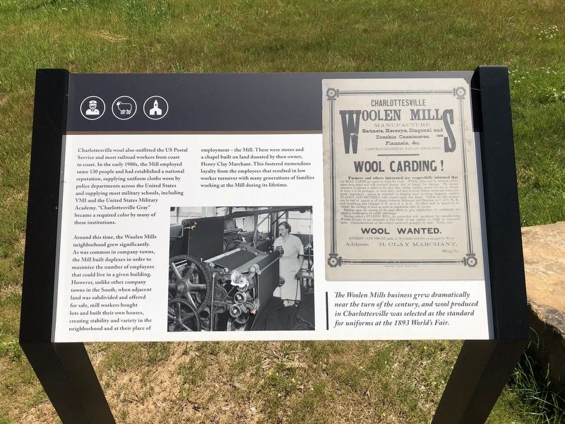
Charlottesville wool also outfitted the US Postal Service and most railroad workers from coast to coast. In the early 1900s, the Mill employed some 130 people and had established a national reputation, supplying uniform cloths worn by police departments across the United States and supplying most military schools, including VMI and the United States Military Academy. "Charlottesville Gray" became a require color by many of these institutions.
Around this time, the Woolen Mills neighborhood grew significantly. As was common in company towns, the Mill built duplexes in order to maximize the number of employees that could live in a given building. However, unlike other company towns in the South, when adjacent land was subdivided and offered for sale, mill workers bought lots and built their own houses, creating stability and variety in the neighborhood and ath their place of employment — the Mill. There were stores and chapel built on land donated by then owner, Henry Clay Marchant. This fostered tremendous loyalty from the employees that resulted in low worker turnover with many generations of families working at the Mill during its lifetime.
The Woolen Mills business grew dramatically near the turn of the century, and wool produced in Charlottesville was selected as the standard for uniforms at the 1893 World's
Fair.
Topics. This historical marker is listed in these topic lists: Industry & Commerce • Settlements & Settlers. A significant historical year for this entry is 1893.
Location. 38° 1.161′ N, 78° 27.357′ W. Marker is near Charlottesville, Virginia, in Albemarle County. Marker is on East Market Street (County Road 1105) 0.3 miles south of Riverside Drive, on the right when traveling east. Touch for map. Marker is at or near this postal address: 1835 Broadway St, Charlottesville VA 22902, United States of America. Touch for directions.
Other nearby markers. At least 8 other markers are within walking distance of this marker. A different marker also named The Woolen Mills (within shouting distance of this marker); a different marker also named The Woolen Mills (within shouting distance of this marker); Charlottesville Woolen Mills (approx. 0.2 miles away); Riverview Park (approx. 0.3 miles away); Woolen Mills Village Historic District (approx. 0.3 miles away); North Terrace Wing (approx. 0.6 miles away); Barrier (approx. 0.6 miles away); Ice House (approx. 0.6 miles away). Touch for a list and map of all markers in Charlottesville.
Credits. This page was last revised on February 2, 2023. It was originally submitted on May 10, 2021, by Devry Becker Jones of Washington, District of Columbia. This page has been viewed 246 times since then and 45 times this year. Photos: 1, 2. submitted on May 10, 2021, by Devry Becker Jones of Washington, District of Columbia.

