The Woolen Mills
💵 👔 🧱
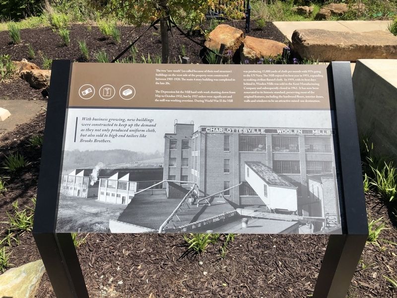
With business growing, new buildings were constructed to keep up the demand as they not only produced uniform cloth, but also sold to high end tailors like Brooks Brothers.
The two "saw-tooth" (so-called because of their roof structure) buildings on the west side of the property were constructed between 1905-1920. The main 4 story building was completed in the late 20s.
The Depression hit the Mill hard with work shutting down from May to October 1932, but by 1937 orders were significant and the mill was working overtime. During World War II the Mill was producing 15,000 yards of cloth per month with 95% going to the US Navy. The Mill enjoyed its best year in 1951, expanding to make civilian flannel cloth. In 1959, with its best days behind it, the Woolen Mills was sold to the Kent Manufacturing Company and subsequently closed in 1962. It has now been renovated to its historic standard, preserving most of the original features, including the hardwood floors, interior doors, walls and windows to be an attractive mixed-use destination.
Topics. This historical marker is listed in this topic list: Industry & Commerce. A significant historical month for this entry is October 1932.
Location. 38° 1.136′ N, 78° 27.382′ W. Marker is near Charlottesville, Virginia, in Albemarle County. Marker is on
Other nearby markers. At least 8 other markers are within walking distance of this marker. A different marker also named The Woolen Mills (within shouting distance of this marker); a different marker also named The Woolen Mills (about 400 feet away, measured in a direct line); Charlottesville Woolen Mills (approx. 0.2 miles away); Riverview Park (approx. 0.3 miles away); Woolen Mills Village Historic District (approx. 0.4 miles away); North Terrace Wing (approx. 0.6 miles away); Barrier (approx. 0.6 miles away); North Pavilion (approx. 0.6 miles away). Touch for a list and map of all markers in Charlottesville.
Credits. This page was last revised on February 2, 2023. It was originally submitted on May 10, 2021, by Devry Becker Jones of Washington, District of Columbia. This page has been viewed 253 times since then and 56 times this year. Photos: 1, 2. submitted on May 10, 2021, by Devry Becker Jones of Washington, District of Columbia.

