Providence Township near Grand Rapids in Lucas County, Ohio — The American Midwest (Great Lakes)
Tough Times On The Towpath
Photographed by Craig Doda, June 16, 2019
1. Tough Times On The Towpath Marker
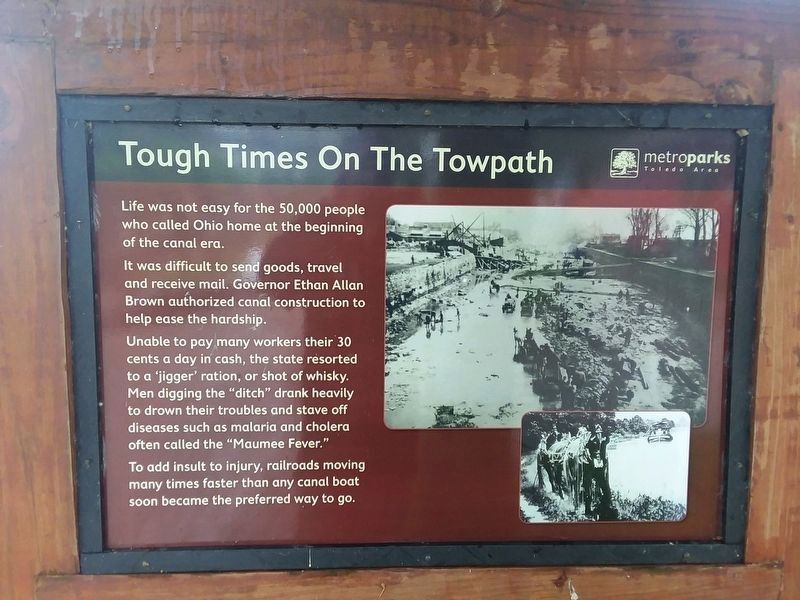
Life was not easy for the 50,000 people who called Ohio home at the beginning of the canal era.
It was difficult to send goods, travel and receive mail. Governor Ethan Allan Brown authorized canal construction to help ease the hardship.
Unable to pay many workers their 30 cents a day in cash, the state resorted to a 'jigger' ration, or shot of whisky. Men digging the "ditch” drank heavily to drown their troubles and stave off diseases such as malaria and cholera often called the "Maumee Fever."
To add insult to injury, railroads moving many times faster than any canal boat soon became the preferred way to go.
Erected by Toledo Area MetroParks.
Topics and series. This historical marker is listed in these topic lists: Industry & Commerce • Railroads & Streetcars • Waterways & Vessels. In addition, it is included in the The Miami & Erie Canal series list.
Location. 41° 24.932′ N, 83° 51.691′ W. Marker is near Grand Rapids, Ohio, in Lucas County. It is in Providence Township. It is on South River Road (U.S. 24) 0.1 miles west of Grand
this page online

Regionally, this marker is on the Lake Erie Shore and in the Toledo Metropolitan Area. It is also in the American Midwest and in the Corn Belt. Globally, it is in North America, on the Great Lakes, in the Western Hemisphere, in the Western World, and in the Anglosphere. Historically, it finds itself in what was once the Viceroyalty of New France, the Haudenosaunee (Iroquois) Confederacy, the territory of the Mississippian Culture, and the Northwest Territory.
Other nearby markers. At least 8 other markers are within walking distance of this marker: Whalers And Wickets Of Lock 44 (here, next to this marker); The Towpath Trail (within shouting distance of this marker); Water Power: Turbines and Races (within shouting distance of this marker); Isaac Ludwig Historic Mill (within shouting distance of this marker); A Dam With A View (about 300 feet away, measured in a direct line); Next Stop: Bankruptcy! (about
Photographed by Craig Doda, June 16, 2019
2. Tough Times On The Towpath Marker
Credits. This page was last revised on February 6, 2023. It was originally submitted on May 13, 2021, by Craig Doda of Napoleon, Ohio. This page has been viewed 315 times since then and 23 times this year. Photos: 1, 2. submitted on May 13, 2021, by Craig Doda of Napoleon, Ohio. • Devry Becker Jones was the editor who published this page.
