Byron in Contra Costa County, California — The American West (Pacific Coastal)
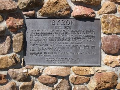
Byron
Est. 1878
This township was famous for shipping more hay than any other station in California at the turn of the century.
Dedicated to the early pioneers and settlers of this community.
Dedicated September 19, 1987
Joaquin Murrieta Chapter 13
E Clampus Vitus
Erected 1987 by Joaquin Murrieta Chapter 13, E Clampus Vitus.
Topics and series. This historical marker is listed in these topic lists: Notable Places • Railroads & Streetcars. In addition, it is included in the E Clampus Vitus series list. A significant historical date for this entry is September 19, 1913.
Location. 37° 52.189′ N, 121° 38.478′ W. Marker is in Byron, California, in Contra Costa County. Marker is on Main Street near Holway Drive, on the right when traveling north. Touch for map. Marker is in this post office area: Byron CA 94514, United States of America. Touch for directions.
Other nearby markers. At least 8 other markers are within 10 miles of this marker, measured as the crow flies. John and Abby Marsh (approx. 4.6 miles away); Marsh-Kellogg Creek Watershed Project (approx. 4.6 miles away); Site of Historic Brentwood Hotel (approx. 5.2 miles away); Round Valley Regional Preserve (approx. 6 miles away); Bryer/Nail House (approx. 6 miles away); Byer/Nail House (approx. 6 miles away); Mountain House School (approx. 6.7 miles away); Brushy Peak Regional Preserve (approx. 9.3 miles away).
Photographed By Andrew Ruppenstein, March 22, 2009
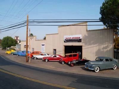
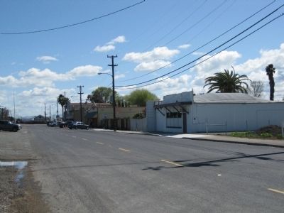
3. Main Street (Looking South -Southeast)
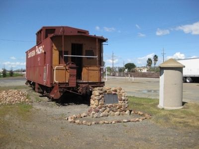
Although no longer visible (now parking), the Byron depot was roughly where the caboose (previous picture) is now, with the hay and oil loading platforms a bit further south (this picture, on the left, about where the truck is parked).
In 2000, Byron had 916 people according to the US Census.
In 2000, Byron had 916 people according to the US Census.
Credits. This page was last revised on June 16, 2016. It was originally submitted on March 25, 2009, by Andrew Ruppenstein of Lamorinda, California. This page has been viewed 1,846 times since then and 86 times this year. Photos: 1, 2, 3. submitted on March 25, 2009, by Andrew Ruppenstein of Lamorinda, California. 4, 5. submitted on December 31, 2009, by Pamela Munkelt of Byron, California. • Kevin W. was the editor who published this page.
