Oregon in Lucas County, Ohio — The American Midwest (Great Lakes)
A Sticky Situation
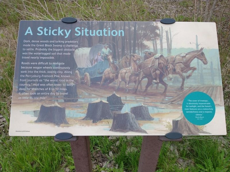
Dark, dense woods and lurking predators made the Great Black Swamp a challenge to settle. Probably the biggest obstacle was the waterlogged soil that made travel nearly impossible.
Roads were difficult to navigate because wagon wheels continuously sank into the thick, oozing clay. Along the Perrysburg-Fremont Pike, known from journals as "the worst road in the country,” mud was often knee- to belly-deep for stretches of 8 to 10 miles. It often took an entire day to travel as little as one mile!
"The cover of treetops… is absolutely impenetrable for sunlight, and the forest's main features are a melancholy semidarkness and a majestic silence."
Moritz Busch
1851-1852
Topics. This historical marker is listed in these topic lists: Roads & Vehicles • Settlements & Settlers.
Location. 41° 38.959′ N, 83° 25.905′ W. Marker is in Oregon, Ohio, in Lucas County. Marker can be reached from Seaman Road, 0.1 miles west of South Wynn Road, on the right when traveling east. Touch for map. Marker is at or near this postal address: 130 Seaman Rd, Oregon OH 43616, United States of America. Touch for directions.
Other nearby markers. At least 8 other markers are within 4 miles of this marker, measured as the crow flies. Natural Mosquito Repellent (about 300 feet away, measured in a direct line); CCC Builds A Park (approx. 0.6 miles away); United Hebrew Benevolent Cemetery Veterans Memorial (approx. 2.2 miles away); Veterans Of Foreign Wars Post No. 9816 Veterans Memorial (approx. 2.9 miles away); Old Street Lamp (approx. 3.2 miles away); Brandville School (approx. 3.2 miles away); a different marker also named Old Street Lamp (approx. 3.2 miles away); Birmingham - Ironville (approx. 3˝ miles away). Touch for a list and map of all markers in Oregon.
Credits. This page was last revised on May 18, 2021. It was originally submitted on May 18, 2021, by Craig Doda of Napoleon, Ohio. This page has been viewed 113 times since then and 13 times this year. Photos: 1, 2, 3, 4. submitted on May 18, 2021, by Craig Doda of Napoleon, Ohio. • Devry Becker Jones was the editor who published this page.


