Winder in Barrow County, Georgia — The American South (South Atlantic)
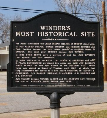
Winder's Most Historical Site
In 1793 ALONZO DRAPER, HOMER JACKSON and HERMAN SCUPEEN and their families became the first white people to establish homes in SNODON. This same year SNODON became JUG TAVERN.
In 1862, BRYD BETTS gave a portion of land for JUG TAVERN’S first church, the First Methodist.
In 1880 HILLMAN D. JACKSON, DR. JAMES M. SAUNDERS and REV. D. FRANK RUTHERFORD purchased 11 1/2 acres and built JUG TAVERN`S FIRST SCHOOL on this spot known as the ACADEMY LOT. These three men served as Board of Trustees until 1887, at which time they transferred the school to a new board consisting of: ROBERT L. CARITHERS, C.W. HARRIS, HILLMAN D. JACKSON, J.H. KILGORE and Z.F. STANTON.
JUG TAVERN became WINDER in 1893 and the ACADEMY LOT remained the site of WINDER'S Public School until 1938.
Erected 1979 by Descendants of Dr. James M. Saunders and Hillman D. Jackson.
Topics. This historical marker is listed in these topic lists: Churches & Religion • Education • Industry & Commerce • Native Americans • Settlements & Settlers. A significant historical year for this entry is 1793.
Location. 33° 59.664′ N, 83° 43.506′ W. Marker is in Winder, Georgia, in Barrow County. Marker is at the intersection of West Athens Street (Georgia Route 211) and Church Street, on the left when traveling east on West Athens Street. Touch for map. Marker is in this post office area: Winder GA 30680, United States of America. Touch for directions.
Other nearby markers. At least 8 other markers are within walking distance of this marker. Concord Methodist Cemetery (about 300 feet away, measured in a direct line); Historic Barrow County Jail (approx. 0.2 miles away); Builder of the Nation (approx. ¼ mile away); Winder Railroad Depot (approx. ¼ mile away); Barrow County Courthouse (approx. ¼ mile away); Barrow County War Memorial (approx. ¼ mile away); The Stoneman Raid Battle of King's Tanyard (approx. ¼ mile away); Barrow County (approx. ¼ mile away). Touch for a list and map of all markers in Winder.
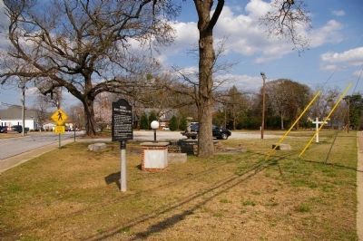
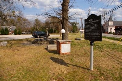
Regarding Winder's Most Historical Site. The "Most Historical Site" is now an empty lot.
Credits. This page was last revised on January 26, 2020. It was originally submitted on March 26, 2009, by David Seibert of Sandy Springs, Georgia. This page has been viewed 4,799 times since then and 311 times this year. Photos: 1, 2, 3. submitted on March 26, 2009, by David Seibert of Sandy Springs, Georgia. • Craig Swain was the editor who published this page.


