Cumberland Township near Gettysburg in Adams County, Pennsylvania — The American Northeast (Mid-Atlantic)
Second Division
Third Corps
— Army of the Potomac —
Inscription.
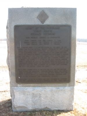
Third Corps
Second Division
Brig. General Andrew A. Humphreys
First Brigade Brig. Gen. Joseph B. Carr
Second Brigade Col. William R. Brewster
Third Brigade Col. George C. Burling
July 2. Arrived about 1 a.m. and bivouacked for the night. In the morning took position between Birney's Division on the left and the Second Corps facing Emmitsburg Road. Between 2 and 3 p.m. advanced to the Emmitsburg Road. Carr's Brigade in line along the road. Brewster's Brigade in reserve. Burling's Brigade at first in reserve and then except the 5th New Jersey sent to Gen. Birney. The Division was attacked by McLaws's and Anderson's Division and by sunset was compelled to retire to the first position occupied where it reformed on the left of Second Corps and drove back the Confederate forces beyond the Emmitsburg Road and recovered the Artillery that had been abandoned and captured many prisoners and held the position during the night.
July 3. About sunrise moved to the rear and left and was supplied with rations and ammunition. Burling's Brigade joined the Division moved to different points in rear of the First, Second, Fifth, and Sixth Corps in support of threatened positions. Suffered some loss in the afternoon from Confederate Artillery.
Casualties. Killed 28 officers 286 men. Wounded 140 officers 1422 men. Captured or missing 2 officers 214 men. Total 2092.
Erected 1910 by Gettysburg National Military Park Commission.
Topics. This historical marker is listed in this topic list: War, US Civil. A significant historical month for this entry is July 1958.
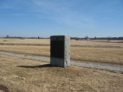
Location. 39° 48.434′ N, 77° 14.67′ W. Marker is near Gettysburg, Pennsylvania, in Adams County. It is in Cumberland Township. Marker is on Sickels Avenue, on the right when traveling north. Located near the Klingle House in Gettysburg National Military Park. Touch for map. Marker is in this post office area: Gettysburg PA 17325, United States of America. Touch for directions.
Other nearby markers. At least 8 other markers are within walking distance of this marker. Batteries F & K, Third U.S. Artillery (within shouting distance of this marker); First Brigade (within shouting distance of this marker); 5th New Jersey Volunteers (within shouting distance of this marker); 3rd Brigade (within shouting distance of this marker); 16th Massachusetts Volunteers (within shouting distance of this marker); Wisconsin Sharpshooters (about 300 feet away, measured in a direct line); 11th Massachusetts Infantry (about 300 feet away); Andrew Atkinson Humphreys (about 400 feet away). Touch for a list and map of all markers in Gettysburg.
Also see . . . Report of Brig. Gen. Andrew A. Humphreys. General Humphreys offered a detailed report of the July 2 fighting:
About 4 p.m., in compliance with General Sickles' orders, I moved my division forward, so that the first line ran along the Emmitsburg road a short distance behind the crest upon which that road lies. At the same time I ordered Lieutenant Seeley to place his battery in position on the right of the log house. As the division moved forward in two lines, as heretofore described, the enemy opened with artillery, which enfiladed us from the left, and subsequently with artillery on our front, both with but little effect. In reply to my inquiry whether I should attack, I was directed to remain reposition. Lieutenant Seeley's battery was transferred to the left of the log house, and soon silenced the battery in our front....
The division on my left was now engaged with the enemy's infantry, which in my front merely made demonstrations, but did not drive in my pickets....
My infantry now engaged the enemy's, but my left was in air (although I extended it as far as possible with my Second Brigade), and, being the only troops on the field, the enemy's whole attention was directed to my division, which was forced back slowly, firing as they receded. (Submitted on March 26, 2009, by Craig Swain of Leesburg, Virginia.)

Photographed By Craig Swain
3. Humphrey's Division Position
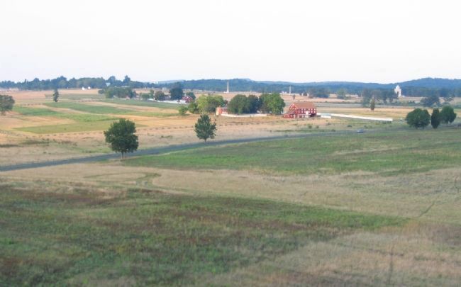
Looking from the Longstreet Observation Tower to the east. The Peach Orchard, and the tablet location, is just out of frame to the right. The red barn in the center right is the Sherfy Farm. Running behind the barn is the Emmitsburg Road. Further to the north along the road is the Klingle Farm. The Millersburg Road runs from the lower left toward the Emmitsburg Road, crossing near the Peach Orchard. When first deployed, Humphreys posted Brewster's Brigade just north (left) of the Sherfy Farm. Carr's Brigade extended the line along the Emmitsburg Road beyond that to the north, about where the last stand of trees appears along the road. Graham's Brigade, of First Division, III Corps, was posted between the Sherfy Farm and the Peach Orchard. The Confederate brigades of Barksdale and Wofford advanced across the open fields in the foreground to assault the Peach Orchard salient.
Credits. This page was last revised on February 7, 2023. It was originally submitted on March 26, 2009, by Craig Swain of Leesburg, Virginia. This page has been viewed 734 times since then and 9 times this year. Photos: 1, 2. submitted on March 26, 2009, by Craig Swain of Leesburg, Virginia. 3. submitted on October 26, 2008, by Craig Swain of Leesburg, Virginia.

