El Oro de Hidalgo, Mexico State, Mexico — The Central Highlands (North America)
Tiro Norte
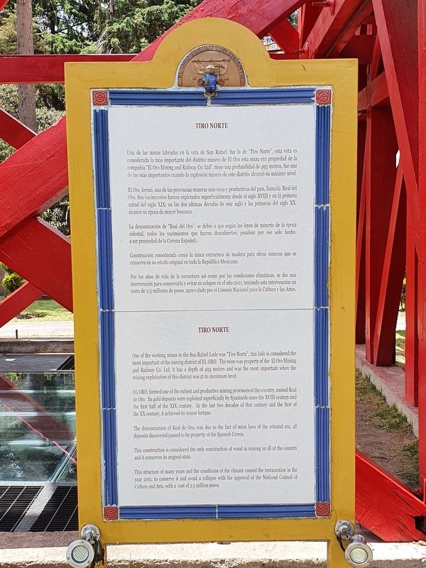
Una de las minas labradas en la veta de San Rafael, fue la de “Tiro Norte”, esta veta es considerada la más importante del distrito minero de El Oro esta mina en propiedad de la compañia “El Oro Mining and Railway Co, Ltd”, tiene una profundidad de 493 metros, fue una de las más importantes cuando la explosión minera de este distrito alcanzó su máximo nivel.
El Oro, formó, una de las provincias mineras más ricas y productivas del pais, llamado Real del Oro. Sus yacimientos fueron explotados superficialmente desde el siglo XVIII y en la primera mitad del siglo XIX; en las dos ultimas décadas de este siglo y las primeras del siglo XX alcanzó su época de mayor bonanza.
La denominacion de “Real del Oro”, se debió a que según las leyes de minera de la época colonial, todos los yacimientos que fuera descubiertos, pasaban por ese sólo hecho, a ser propiedad de la Corona Española.
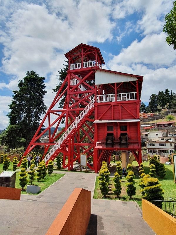
Construcción considerada como la única estructura de madera para obras mineras que se conserva en su estado original en toda la República Mexicana. Por lo de vida de la estructura así como por las condicions climáticas, se dio una intervención para conservar y evitar su colapso en el año 2011, teniendo esta intervención un costo de 2.5 millones de pesos, apoyo dado por el Consejo Nacional para la Cultura y las Artes.
Tiro Norte
One of the working mines in the San Rafael Lode was “Tiro Norte”, this lode is considered the most important of the mining district of El Oro. The mine was property of the El Oro Mining and Railway Co. Ltd; it has a depth of 493 meters and was the most important when the mining exploitation of this district was at its maximum level.
El Oro formed one of the richest and productive mining provinces of the country, named Real de Oro. Its gold deposits were exploited superficially by Spaniards since the XVIII century and the first half of the XIX century. In the last two decades of that century and the first of the XX century, it achieved its mayor fortune.
The denomination of Real de Oro, was due to the fact of mine laws of the colonial era, all deposits discovered passed to be property of the Spanish Crown.
This construction is considered the only construction of wood in mining in all of the country and it conserves its original state.
This structure of many years and the conditions of the climate caused the restauration in the year 2011, to conserve it and avoid a
collapse with the approval of the National Council of Culture and Arts, with a cost of 2.5 million pesos.
Topics. This historical marker is listed in this topic list: Industry & Commerce. A significant historical year for this entry is 2011.
Location. 19° 48.048′ N, 100° 8.068′ W. Marker is in El Oro de Hidalgo, Estado de Mexico (Mexico State). Marker can be reached from Tiro Norte just west of Avenida Independencia, on the left when traveling west. Touch for map. Marker is in this post office area: El Oro de Hidalgo MEX 50600, Mexico. Touch for directions.
Other nearby markers. At least 8 other markers are within walking distance of this marker. Velia Marmolejo Fat (within shouting distance of this marker); María Luisa Ocampo Heredia (within shouting distance of this marker); Commercial Activity in El Oro (about 180 meters away, measured in a direct line); Authorization of the Railroad in El Oro (about 180 meters away); El Oro Mining and Railway (about 210 meters away); El Oro Historical Monuments Area (about 210 meters away); Inauguration of the Railroad in El Oro (about 210 meters away); Old Railway Station (about 210 meters away). Touch for a list and map of all markers in El Oro de Hidalgo.
Additional keywords. placa histórica
Credits. This page was last revised on May 27, 2021. It was originally submitted on May 23, 2021, by J. Makali Bruton of Accra, Ghana. This page has been viewed 141 times since then and 39 times this year. Photos: 1, 2, 3, 4. submitted on May 23, 2021, by J. Makali Bruton of Accra, Ghana.


