
Ida Lousiana
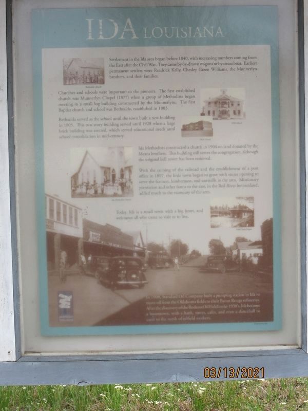
Churches and schools were important to the pioneers. The first established church was Munnerlyn Chapel (1877) when a group of Methodists began meeting in a small log building constructed by the Munnerlyns. The first Baptist church and school was Bethsaida, established in 1883.
Bethsaida served as the school until the town built a new building in 1905. This two-story building served until 1928 when a large brick building was erected, which served educational needs until school consolidation in mid century. Ida Methodists constructed a church in 1904 on land donated by the Means brothers. This building still serves the congregation, although the original bell tower has been removed.
With the coming of the railroad and the establishment of a post office in 1897, the little town began to grow with stores opening to serve the farmers, lumbermen, and
this page online
In 1909, Standard Oil Company built a pumping station in Ida to move oil from the Oklahoma fields to their Baton Rouge refineries. After the discovery of the Rodessa Oil Field in the 1930's Ida became a boomtown, with a bank, stores, cafes, and even a dancehall to cater to the needs of oilfield workers.
Topics. This historical marker is listed in these topic lists: Industry & Commerce • Religion & Religious Structures • Settlements & Settlers. A significant historical year for this entry is 1840.
Location. 33° 0.235′ N, 93° 53.648′ W. Marker is in Ida, Louisiana, in Caddo Parish. It is on East Magnolia Lane near U.S. 71, on the right when traveling east. Touch for map. Marker is at or near this postal address: 6999 E Magnolia Ln, Ida LA 71044, United States of America. Touch for directions.
Regionally, this marker is in North Louisiana. It is also in the American South, specifically in the
Other nearby markers. At least 8 other markers are within 9 miles of this marker, measured as the crow flies: Ida Post Office Building (here, next to this marker); History of The Spring Bank Ferry (approx. 6 miles away in Arkansas); The Spring Bank Ferry (approx. 6.2 miles away in Arkansas); Frog Level (approx. 6.3 miles away); Discovery-Rodessa Oil Field (approx. 6.3 miles away); Hosston Methodist Church (approx. 7.9 miles away); The Adams-Fuller House (approx. 8.1 miles away); Hosston Post Office (approx. 8.2 miles away).
Credits. This page was last revised on May 24, 2021. It was originally submitted on May 24, 2021, by Jason Armstrong of Talihina, Oklahoma. This page has been viewed 1,743 times since then and 134 times this year. Photo 1. submitted on May 24, 2021, by Jason Armstrong of Talihina, Oklahoma. • Mark Hilton was the editor who published this page.
Editor’s want-list for this marker. A wide shot of the marker and its surroundings. • Can you help?
