Morgantown in Monongalia County, West Virginia — The American South (Appalachia)
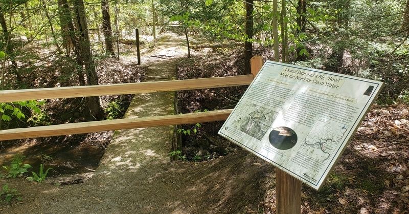
A Small Dam and a Big "Bowl" Meet the Need for Clean Water
Interpreting History
Inscription.
The Ideal Spot for a Reservoir
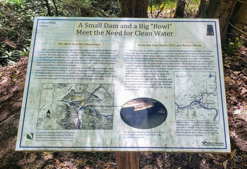
When nearby land was no longer able to supply an adequate amount of water to town, the Union Improvement Company (UIC) searched for a site to build a reservoir. The land you see here was ideal – Tibbs Run water could be captured in a natural “bowl.” In addition, Tibbs Run's upper watershed had remained largely undeveloped, preserving the clean mountain water. When reservoir construction began in early 1911, the land was still heavily forested. Some of the old growth timber found then is still standing today.
The Union Utilities Company, a successor to the UIC, acquired water rights within the watershed leading to (but not adjoining) the reservoir in early 1912. The landowners promised not to pollute the waters as part of the agreement. These water rights transferred through subsequent deeds, and some of that land. is now protected as part of the Snake Hill Wildlife Management Area.
Diversion Dam Meets 1912 and Future Needs
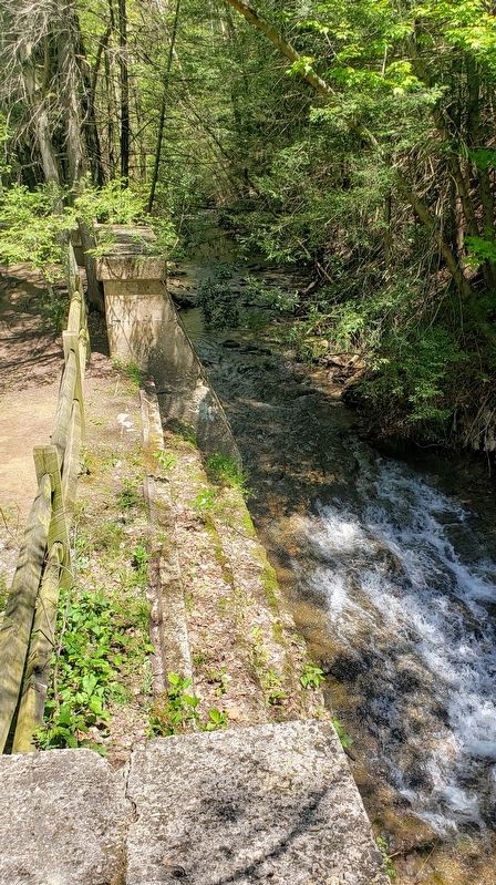
The first steps in reservoir construction entailed diverting the flow of Tibbs Run water so a small diversion dam was built. This structure was about 8 feet high by 30 feet wide. During reservoir construction, water pooled behind this dam in the natural stream channel and was diverted to the pipeline leading to town. After construction, water behind the dam was routed west into the reservoir basin through a 24-inch-diameter terra-cotta pipe. Nearing the reservoir, the pipe crossed Jones Run inside a short concrete aqueduct, seen to your left, before ending at the basin. This "off-stream reservoir” design was unique for the time period. This method was most likely chosen because it allowed the clean Tibbs Run water to enter the reservoir without mixing with the more polluted Jones Run, which was then kept outside the reservoir. In 1948, a small wooden weir, pipe into the reservoir, and control box were built to allow Jones Run to act as a súpplemental water supply. The concrete control box with a steel plate on it can be seen along the trail.
[Captions:]
Aerial photo showing Tibbs Run Reservoir location and features, including Tibbs Run díversion dam and Jones Run wooden weir. Original map source: U.S. Dept. of Agriculture, 1938.
Remains of the diversion dam can still be seen a short walk from here on the Forest Trail. Photo by George Longenecker.
Map showing the route of water pipelínes leading to Morgantown. In general, the pipes took the same path as natural water flow, following Tibbs Run and Deckers Creek to the pump station on the Monongahela River. Map source: 1932 tax record, courtesy of Morgantown Utility Board.
Erected
2014 by West Virginia Botanic Garden and West Virginia Humanities Council.
Topics. This historical marker is listed in these topic lists: Charity & Public Work • Environment • Industry & Commerce.
Location. 39° 37.692′ N, 79° 51.916′ W. Marker is in Morgantown, West Virginia, in Monongalia County. Marker can be reached from Tyrone Road (County Road 75) 0.1 miles south of Quartz Drive, on the right when traveling east. The marker is located on the Reservoir Loop Trail at the West Virginia Botanic Garden. Touch for map. Marker is at or near this postal address: 1061 Tyrone Road, Morgantown WV 26508, United States of America. Touch for directions.
Other nearby markers. At least 8 other markers are within walking distance of this marker. Prehistoric Garden (within shouting distance of this marker); Strong Men and Horses Build the Basin (about 400 feet away, measured in a direct line); Clean Water Comes To Morgantown (about 400 feet away); Who Wants Clean Water? (about 500 feet away); Remnants of the Past: The Dam and Outlet Tower (approx. 0.2 miles away); The Tibbs Run Reservoir: Then a Water Source, Now a Local Treasure (approx. 0.2 miles away); "Clean Mountain Water" Not So Clean (approx. ¼ mile away); Ralph Lemley: Resourceful Caretaker (approx. 0.3 miles away). Touch for a list and map of all markers in Morgantown.
Credits. This page was last revised on May 27, 2021. It was originally submitted on May 24, 2021, by Bradley Owen of Morgantown, West Virginia. This page has been viewed 129 times since then and 15 times this year. Photos: 1, 2, 3. submitted on May 24, 2021, by Bradley Owen of Morgantown, West Virginia. • Devry Becker Jones was the editor who published this page.


